Ænes
| Ænes | |
|---|---|
| Village | |
|
View of the village church | |
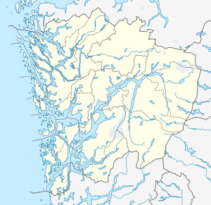 Ænes  Ænes Location in Hordaland county | |
| Coordinates: 60°05′25″N 06°06′33″E / 60.09028°N 6.10917°ECoordinates: 60°05′25″N 06°06′33″E / 60.09028°N 6.10917°E | |
| Country | Norway |
| Region | Western Norway |
| County | Hordaland |
| District | Sunnhordland |
| Municipality | Kvinnherad |
| Elevation[1] | 8 m (26 ft) |
| Time zone | CET (UTC+01:00) |
| • Summer (DST) | CEST (UTC+02:00) |
| Post Code | 5475 Ænes |
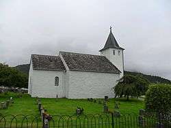
Ænes is a village in Kvinnherad municipality in Hordaland county, Norway. The village is located on the southeastern shore of the Hardangerfjorden at the mouth of the Maurangsfjorden. Ænes Church is located in the village. There has been a church located here since the Middle Ages.[2]
The village sits at the northern end of the small Ænesdalen valley, through which the river Æneselva runs. The border for Folgefonna National Park lies at the southern end of the valley, just a few kilometers south of Ænes.[2]
References
- ↑ "Ænes, Kvinnherad (Hordaland)" (in Norwegian). yr.no. Retrieved 2015-03-19.
- 1 2 Store norske leksikon. "Ænes" (in Norwegian). Retrieved 2015-03-19.
This article is issued from Wikipedia - version of the 8/4/2016. The text is available under the Creative Commons Attribution/Share Alike but additional terms may apply for the media files.