Écardenville-sur-Eure
| Écardenville-sur-Eure | ||
|---|---|---|
|
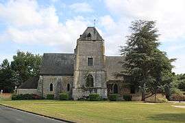
St. Germanus' Church | ||
| ||
 Écardenville-sur-Eure | ||
|
Location within Normandy region  Écardenville-sur-Eure | ||
| Coordinates: 49°06′09″N 1°15′53″E / 49.1025°N 1.2647°ECoordinates: 49°06′09″N 1°15′53″E / 49.1025°N 1.2647°E | ||
| Country | France | |
| Region | Normandy | |
| Department | Eure | |
| Arrondissement | Les Andelys | |
| Canton | Gaillon | |
| Intercommunality | Eure Madrie Seine | |
| Government | ||
| • Mayor (2008–2014) | Litertario Calvario | |
| Area1 | 6.67 km2 (2.58 sq mi) | |
| Population (2008)2 | 528 | |
| • Density | 79/km2 (210/sq mi) | |
| Time zone | CET (UTC+1) | |
| • Summer (DST) | CEST (UTC+2) | |
| INSEE/Postal code | 27211 / 27490 | |
| Elevation |
26–145 m (85–476 ft) (avg. 35 m or 115 ft) | |
|
1 French Land Register data, which excludes lakes, ponds, glaciers > 1 km² (0.386 sq mi or 247 acres) and river estuaries. 2 Population without double counting: residents of multiple communes (e.g., students and military personnel) only counted once. | ||

Écardenville-sur-Eure is a former commune in the Eure department in northern France. On 1 January 2016, it was merged into the new commune of Clef-Vallée-d'Eure.[1]
Population
| Historical population | ||
|---|---|---|
| Year | Pop. | ±% |
| 1962 | 226 | — |
| 1968 | 253 | +11.9% |
| 1975 | 284 | +12.3% |
| 1982 | 399 | +40.5% |
| 1990 | 501 | +25.6% |
| 1999 | 544 | +8.6% |
| 2008 | 528 | −2.9% |
See also
References
- ↑ Arrêté préfectoral 4 December 2015 (French)
| Wikimedia Commons has media related to Écardenville-sur-Eure. |
This article is issued from Wikipedia - version of the 3/24/2016. The text is available under the Creative Commons Attribution/Share Alike but additional terms may apply for the media files.