't Woud
Not to be confused with 't Woudt.
| 't Woud | |
|---|---|
| Village | |
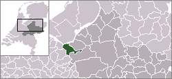 | |
 The village (dark red) and the statistical district (light green) of 't Woud in the municipality of Nijkerk. | |
| Coordinates: 52°12′N 5°33′E / 52.200°N 5.550°ECoordinates: 52°12′N 5°33′E / 52.200°N 5.550°E | |
| Country | Netherlands |
| Province | Gelderland |
| Municipality | Nijkerk |
| Population | |
| • Total | 1,700 |
| Time zone | CET (UTC+1) |
| • Summer (DST) | CEST (UTC+2) |
't Woud is a village in the Dutch province of Gelderland. It is a part of the municipality of Nijkerk, and lies about 12 km east of Amersfoort.
't Woud was founded by farmers at the beginning of the 20th century. After they had made the soil ready for farming they expanded their operations for decades. Nowadays only a few large farming companies are left. The other inhabitants are merely people who love living on the countryside.
The statistical area "'t Woud", which also can include the surrounding countryside, has a population of around 1790.[1]
References
- ↑ Statistics Netherlands (CBS), Statline: Kerncijfers wijken en buurten 2003-2005. As of 1 January 2005. Archived July 24, 2006, at WebCite
This article is issued from Wikipedia - version of the 11/19/2016. The text is available under the Creative Commons Attribution/Share Alike but additional terms may apply for the media files.