1867 Manhattan, Kansas earthquake
 Manhattan | |
| Date | April 24, 1867 |
|---|---|
| Origin time | 20:22 UTC [1] |
| Magnitude | 5.1 Mfa [1] |
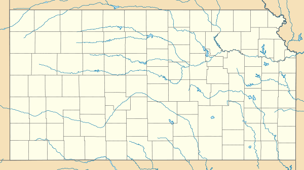
| Epicenter | 39°12′N 96°18′W / 39.2°N 96.3°WCoordinates: 39°12′N 96°18′W / 39.2°N 96.3°W [1] |
| Type | Unknown |
| Areas affected |
Kansas United States |
| Max. intensity | VII (Very strong) [1] |
| Casualties | Several injured |
The 1867 Manhattan earthquake struck Riley County, Kansas on April 24 at 14:22 local time. It measured 5.1 on a seismic scale that is based on an isoseismal map or the event's felt area. The earthquake's epicenter was by the town of Manhattan and is the strongest earthquake to originate in the state.
The earthquake had an intensity of VII (Very strong) on the Mercalli intensity scale, and was felt over an area of roughly 193,051 square miles (500,000 km2). It caused largely minor damage, reports of which were confined to Kansas, Iowa, and Missouri, according to the United States Geological Survey.
Manhattan is near the Nemaha Ridge, a long structure that is bounded by several faults. The nearby Humboldt Fault Zone in particular poses a threat to the city; though Kansas is not known for earthquake activity, an earthquake could occur at any time.
Background and geography
The earthquake's epicenter lay near Manhattan, Kansas, a town just off the connection of the Kansas River and the Big Blue River.[2] Nearby is the anticline Nemaha Ridge, which has been associated with at least a few earthquakes of Kansas. A 300‑million-year-old Precambrian granite range bounded by faults, it hosts the Humboldt Fault Zone, which, in addition to serving as the range's easternmost boundary, has produced a large portion of the state's earthquakes. Each year, it is responsible for at least several small tremors less than magnitude 2.7.[2] It cuts through Permian rock, and according to the Geological Society of America, may actually be a complex fault. Previously, it was believed to be a simple, Precambrian structure.[3]
The Nemaha Range lies roughly 50 miles (80 km) east of the Midcontinent rift, which forms a layer of basaltic rock around 1.1 billion years old. This rift extends northward to Lake Superior and the surrounding area and southward to Kansas, then stops abruptly.[4] Also present in the state is the Central Kansas Uplift, the faults of which produced several small earthquakes during the late 1980s. According to United States Geological Survey geophysicist Don Steeples, earthquakes at the Humboldt Zone have decreased and activity at the Uplift has increased.[5]
Felt over an area of 193,051 square miles (500,000 km2), the earthquake followed the Midcontinent seismic trend:[6] unlike earthquakes on the Western Coast of the US, events in the central and east-central sectors of the country are spread out over extensive areas; for example, the 1968 Illinois earthquake also followed this trend.
The 1867 Manhattan earthquake remains the only notable earthquake to originate in the state,[7] though 25 in total have taken place since.[2] According to a report in the Bulletin of the Seismological Society of America, the frequency between earthquakes is between 40 and 45 years.[8]
Damage and casualties
Originating at 20:22 UTC, or around 2:30 local time,[9] the earthquake was assigned a maximum intensity of VII. Minor damage occurred throughout the geographical region. Injuries were reported as well. The earthquake fractured walls, downed chimneys, and interfered with the stability of structures, even loosening stones. In Louisville and Leavenworth, chimneys fell; in Paola, the earthquake destroyed one wall of a large post office building. Waves were observed on the Kansas River, 2 feet (1 m) in height. Isolated reports from Iowa and Missouri, describing fallen and cracked plaster in Dubuque and Chillicothe, compliment additional reports of fallen plaster and roof shingles, damaged wells, and cracked walls.[6]
A series of articles were published by the Chicago Tribune describing the extent of the damage throughout the state of Kansas. "At Kansas City" details that the earthquake jolted homes with a sudden burst, giving off a resonating roar like thunder.[9] The earthquake also extended into Indiana and Illinois, according to the United States Geological Survey.[6]
Reaction
The Chicago Tribune observed in its article "At Leavenworth, Kansas" that the earthquake was completely unexpected, describing the event as "[...] sudden in its coming and departure." It confirms that earthquakes were not common in earlier time and states that "all were more or less startled, and, indeed, frightened."[10]
The earthquake renewed geological interest of the state, and scientists began to analyze faults and earthquakes. One study found that between December 1977 and June 1989, more than 200 earthquakes were recognized by a seismograph network. All were between 4 and .8 on the Richter magnitude scale.[11]
Future threat
Despite the fact that Kansas is not seismically active, a strong earthquake could pose significant threats to the state. If an earthquake were to occur, it would likely be along the Nemaha Ridge, which is still active.[8] The Humboldt Fault Zone, a fault just off the Ridge, lies just 12 miles (19 km) eastward of the Tuttle Creek Reservoir near Manhattan. If an earthquake were to occur here, it would likely destroy the dam, releasing 300,000 feet (91,440 m) of water per second and flooding the nearby area, also threatening roughly 13,000 people and 5,900 homes. A moderate earthquake "between 5.7 to 6.6 would cause sand underneath the dam to liquefy into quicksand, causing the dam to spread out and the top to drop up to three feet."[2] A large earthquake would spawn gaps, forcing water to leak and eventually cause the dam to collapse. Any earthquake that could pose a threat occurs on a cycle of roughly 1,800 years, according to the United States Army Corps of Engineers, who studied the area first in 1980.[2]
To counter this threat, the group has galvanized an effort to strengthen the dam. Replacing the sand, which could shift during an earthquake, with more than 350 walls, the group has equipped the dam with sensors. Alarms are connected to these sensors, which would alert nearby citizens to the earthquake.[2]
See also
References
- 1 2 3 4 Stover, C. W.; Coffman, J. L. (1993), Seismicity of the United States, 1568–1989 (Revised), U.S. Geological Survey Professional Paper 1527, United States Government Printing Office, pp. 3, 236
- 1 2 3 4 5 6 Metz, Christine (May 2, 2008). "Earthquakes in Kansas a real threat". Lawrence Journal-World. Retrieved February 11, 2010.
- ↑ Steeples, Don W.; DuBois, Susan M. & Wilson, Frank W. (March 1979). "Seismicity, faulting, and geophysical anomalies in Nemaha County, Kansas: Relationship to regional structures". Geological Society of America. pp. 134–138. Retrieved February 20, 2010.
- ↑ "Earthquakes in Kansas". Kansas Geological Survey. July 1996. Retrieved February 17, 2010.
- ↑ "Small Kansas earthquakes shift westward". March 2, 1867. Retrieved February 25, 2010.
- 1 2 3 "Historic Earthquakes: Manhattan, Riley County, Kansas". United States Geological Survey. October 26, 2009. Retrieved February 10, 2010.
- ↑ "Historic United States Earthquakes". United States Geological Survey. November 23, 2009. Retrieved February 10, 2010.
- 1 2 Merriam, Daniel F. (April 1956). "History of earthquakes in Kansas". Bulletin of the Seismological Society of America. Seismological Society of America. 46 (2): 87.
- 1 2 "At Kansas City". Tribune Company. April 30, 1867.
- ↑ "At Leavenworth, Kansas". Chicago Tribune. Tribune Company. April 30, 1867.
- ↑ "Recording Earthquakes in Kansas". Kansas Geological Survey. July 1996. Retrieved February 17, 2010.