1872 Lone Pine earthquake
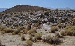 Lone Pine fault scarp | |
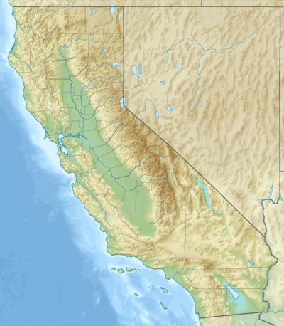 San Diego Sacramento Lone Pine | |
| Date | March 26, 1872 |
|---|---|
| Origin time | 10:30 UTC, 02:30 PST [1] |
| Magnitude | 7.4–7.9 Mw [2] |
| Epicenter | 36°42′N 118°06′W / 36.7°N 118.1°WCoordinates: 36°42′N 118°06′W / 36.7°N 118.1°W [1] |
| Type | Oblique-slip [2] |
| Areas affected |
Eastern California United States |
| Total damage | $250,000 [1] |
| Max. intensity | X (Extreme) [1] |
| Casualties | |
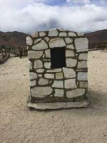
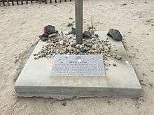
| Official name | Grave of 1872 Earthquake Victims[5] |
| Reference no. | 507 |
The 1872 Lone Pine earthquake struck on March 26 at 10:30 UTC with an estimated moment magnitude of 7.4 to 7.9 and a maximum Mercalli Intensity of X (Extreme). Its epicenter was near Lone Pine, California in Owens Valley. Historical evidence detailing the damage it caused in settlements, fault scarps, and the geographic extent to which noticeable movement was felt led researchers to the high magnitude estimate. It was one of the largest earthquakes to hit California in recorded history and was similar in size to the 1906 San Francisco earthquake.
Tectonic setting
The earthquake resulted from sudden vertical movement of 15–20 feet (4.5–6m) and right-lateral movement of 35–40 feet (10.6–12m) on the Lone Pine Fault and part of the Owens Valley Fault. These faults are part of a twin system of normal faults that run along the base of two parallel mountain ranges; the Sierra Nevada on the west and Inyo Mountains on the east flank of Owens Valley. This particular event created fault scarps from north of Big Pine, California, 55 mi (89 km) north of Lone Pine, to Haiwee Reservoir (30 mi (48 km)) south of Lone Pine.
Earthquake
The earthquake occurred on a Tuesday morning and leveled almost all the buildings in Lone Pine and nearby settlements.[3] Of the estimated 250–300 inhabitants of Lone Pine, 27 are known to have perished and 52 of the 59 houses were destroyed. One report states that the main buildings were thrown down in almost every town in Inyo County. About 130 kilometers (81 mi) south of Lone Pine, at Indian Wells, Kern County, California, adobe houses sustained cracks. Property loss has been estimated at $250,000 (1872 dollars), or about $30,000,000 in 2016 dollars. As in many earthquakes, adobe, stone and masonry structures fared worse than wooden ones which prompted the closing of nearby Camp Independence which was an adobe structure destroyed in the quake.
The quake was felt strongly as far away as Sacramento, where citizens were startled out of bed and into the streets. Giant rockslides in what is now Yosemite National Park woke naturalist John Muir, then living in Yosemite Valley, who reportedly ran out of his cabin shouting, "A noble earthquake!" and promptly made a moonlit survey of the fresh talus piles. This earthquake stopped clocks and awakened people in San Diego, California, to the south, Red Bluff, California, to the north, and Elko, Nevada, to the east. The shock was felt over most of California and much of Nevada. Thousands of aftershocks occurred, some severe.
Aftermath
Researchers later estimated that similar earthquakes occur on the Lone Pine fault every 3,000–4,000 years. However, the Lone Pine fault is only one of many faults on two parallel systems.
This earthquake also formed a small graben that later was filled by water, creating 86-acre (350,000 m2) Diaz Lake.[6]
Many geoscientists who have studied the area theorize that quakes similar to the 1872 Lone Pine event are responsible for creating Owens Valley.
The common grave of the earthquake's victims is now registered as California Historical Landmark #507.[5]
See also
- Inyo County, California
- List of earthquakes in California
- List of earthquakes in the United States
- List of historical earthquakes
References
- 1 2 3 4 5 Stover, C. W.; Coffman, J. L. (1993), Seismicity of the United States, 1568–1989 (Revised), U.S. Geological Survey Professional Paper 1527, United States Government Printing Office, pp. 73, 105
- 1 2 Hough, S. E.; Hutton, K. (2008), "Revisiting the 1872 Owens Valley, California, Earthquake", Bulletin of the Seismological Society of America, Seismological Society of America, 98 (2): 931, 932, doi:10.1785/0120070186
- 1 2 "State's Biggest Quake Struck 100 Years Ago". Los Angeles Times. Mar 26, 1972.
- ↑ National Geophysical Data Center / World Data Service (NGDC/WDS), Significant Earthquake Database, National Geophysical Data Center, NOAA, doi:10.7289/V5TD9V7K
- 1 2 "Grave of 1872 Earthquake Victims". Office of Historic Preservation, California State Parks. Retrieved 2012-10-07.
- ↑ Hall, Jr., C. A. (2007). Introduction to the geology of southern California and its native plants. University of California Press. p. 231. ISBN 978-0-520-24932-5.
- Bibliography
- Amos, C. B.; Lutz, A. T.; Jayko, A. S.; Mahan, S. A.; Fisher, G. Burch; Unruh, J. R. (2013), "Refining the Southern Extent of the 1872 Owens Valley Earthquake Rupture through Paleoseismic Investigations in the Haiwee Area, Southeastern California", Bulletin of the Seismological Society of America, Seismological Society of America, 103 (2A): 1022–1037, doi:10.1785/0120120024
- Sharp, R. P.; Glazner, A. F. (1997). Geology Underfoot in Death Valley and Owens Valley (First ed.). Mountain Press Publishing Company. ISBN 0-87842-362-1.