1931 Zangezur earthquake
 | |
| Date | April 27, 1931 |
|---|---|
| Origin time | 16:50:45 UTC [1] |
| Magnitude | 6.5 Mw [1] |
| Depth | 15 km (9.3 mi) [1] |
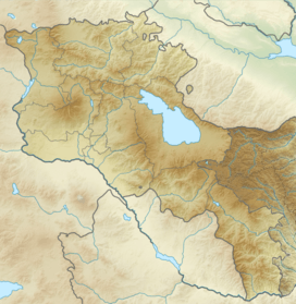
| Epicenter | 39°17′N 45°57′E / 39.29°N 45.95°ECoordinates: 39°17′N 45°57′E / 39.29°N 45.95°E [1] |
| Areas affected |
Armenia Azerbaijan |
| Max. intensity | IX (Destructive) |
| Casualties | 390–2,890 deaths [2] |
The 1931 Zangezur earthquake occurred on April 27 at 20:50:45 local time with a moment magnitude of 6.5. The earthquake was located in the Zangezur Mountains near the boundary between southwestern Armenia and Azerbaijan's exclave, the Nakhichivan Autonomous Republic. Both territories were part of the Soviet Union at that time.[3]
The earthquake was located near the border between the Syunik Province of Armenia (Zangezur is an alternative name for the region of Syunik Province) and the Nakhichivan Autonomous Republic of Azerbaijan. Up to 2,890 were reported dead.[3] In Armenia, 57 villages were destroyed or heavily damaged in the Sisian-Goris area and in Azerbaijan, 46 villages were destroyed or seriously damaged in the Ordubad area.[4] In another source it was reported that the earthquake destroyed 254 villages.[5] In southeastern Armenia, the historical Tatev Monastery was damaged. The intensities reached MSK-64 IX in Shamb and MSK-64 VIII in Jougha.[6] The Museum of History in Sisian has some photos taken after the town was hit by the earthquake.[7]
The Pambak-Sevan-Sunik Fault extends in the NW-SE direction. The fault can be traced continuously for 400 km and consists of four major segments. The 1931 Zangezur earthquake was located in the area of the Sunik-Zanghezour segment, which is about 120 km long.[8]
There was a period of increased earthquake activity in Armenia and its neighboring republics between 1911 and 1956 and the 1931 event was one of the strongest. It released about half of the total energy of all the earthquakes occurring in the Caucasus region near the Caspian Sea in that period.[9]
See also
References
- 1 2 3 4 ISC (2015), ISC-GEM Global Instrumental Earthquake Catalogue (1900–2009), Version 2.0, International Seismological Centre
- ↑ USGS (September 4, 2009), PAGER-CAT Earthquake Catalog, Version 2008_06.1, United States Geological Survey
- 1 2 National Geophysical Data Center / World Data Service (NGDC/WDS) Significant Earthquake Database, Boulder, CO, USA. (Available at http://www.ngdc.noaa.gov/nndc/struts/form?t=101650&s=1&d=1)
- ↑ http://earthquake.usgs.gov/learn/today/index.php?month=4&day=27&submit=View+Date
- ↑ http://gsi.ir/General/Lang_en/Page_29/TypeId_/DataId_128/Action_Pn4/WebsiteId_13/Twentieth.Century.Seismicity.of.Maku.Region. (1900.1977).html
- ↑ "Evidence of historical seismicity and volcanism in the Armenian Highland (from Armenian and other sources)" by A. Karakhanian and Y. Abgaryan
- ↑ "Georgia, Armenia & Azerbaijan" by J. Noble, M. Kohn, and D. Systermans. Lonely Planet. 2008.
- ↑ Philip, Hervé; Avagyana, Ara; Karakhanian, Arcadi; Ritz, Jean-François; Rebai, Samira (2001). "Estimating slip rate and recurrence intervals for strong earthquakes along an intracontinental fault: example of the Pambak-Sevan-Sunik fault (Armenia)". Tectonophysics. Elsevier. 343 (3-4): 206–232. Bibcode:2001Tectp.343..205P. doi:10.1016/S0040-1951(01)00258-X.
- ↑ "ON THE PERIODICITY OF SEISMIC ACTIVITY DURING THE LAST ONE AND A HALF TO TWO THOUSAND YEARS (BASED ON THE EXAMPLE OF ARMENIA)" by G. P. Tamrazyan