1965 Rat Islands earthquake
 | |
| Date | February 4, 1965 UTC |
|---|---|
| Magnitude | 8.7 Mw |
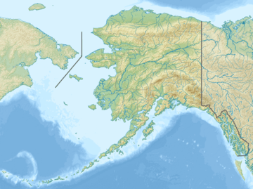
| Epicenter | 51°17′N 178°33′E / 51.29°N 178.55°ECoordinates: 51°17′N 178°33′E / 51.29°N 178.55°E |
| Areas affected | United States (Alaska) |
| Max. intensity | VI (Strong) |
| Tsunami | 10.7 m (35 ft) |
The 1965 Rat Islands earthquake occurred at 05:01 UTC, on 4 February (19:01, 3 February local time[1]). It had a magnitude of 8.7 and triggered a tsunami of over 10 m on Shemya Island,[2] but caused very little damage.
Tectonic setting
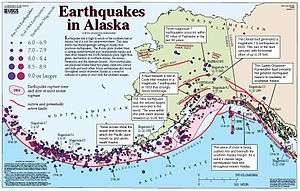
The Rat Islands form part of the Aleutian Islands, a chain of volcanic islands forming an island arc, that results from the subduction of the Pacific Plate beneath the North American Plate. This plate boundary, the Alaska-Aleutian megathrust, has been the location of many megathrust earthquakes.
Characteristics
Earthquake
The earthquake was associated with a 600 km long rupture along the plate boundary, based on the distribution of aftershocks.[3] The pattern of energy release suggest the presence of three asperities along the plate interface, each causing a pulse of moment release. Modelling of the tsunami supports the idea that the earthquake consisted of three sub-events, related to three structural 'blocks' within the overriding plate.[4]
The main shock was followed by an earthquake of magnitude 7.6 nearly two months later, that triggered a small tsunami.[1] This was not an aftershock, but a normal fault event within the outer rise of the subducting plate, triggered by the earlier event.[5]
Tsunami
The tsunami had a maximum run-up height of 10.7 m on Shemya Island, 2.0 m at Amchitka Island, 1.6 m at Attu Island and 1.1 m in northern Kauai, Hawaii. It was also observed in Peru, Ecuador, Mexico, California, Japan and eastern Russia.[1]
Damage
Flooding from the tsunami caused $10,000 worth of damage on Amchitka Island.[2] Minor damage from the earthquake was recorded on both Attu and Shemya islands in the form of cracks in runways.
See also
References
- 1 2 3 NGDC. "Search result for 1965 Alaska earthquakes". Retrieved 8 March 2010.
- 1 2 USGS (26 October 2009). "Historic Earthquakes Rat Islands, Alaska". Retrieved 8 March 2010.
- ↑ Beck, S.L.; Christensen D.H. (1991). "Rupture Process of the February 4, 1965, Rat Islands Earthquake". Journal of Geophysical Research. 96 (B"): 2205–2221. Bibcode:1991JGR....96.2205B. doi:10.1029/90JB02092. Retrieved 2010-03-08.
- ↑ Johnson, J.M. (1999). "Heterogeneous coupling along Alaska-Aleutians as inferred from Tsunami, Seismic and Geodetic Inversions". In Dmowska R. & Saltzman B. Tsunamigenic Earthquakes and Their Consequences. Advances in Geophysics. 39. pp. 28–55. ISBN 978-0-12-018839-0. Retrieved 2010-03-08.
- ↑ Abe, K. (1972). "Lithospheric normal faulting beneath the Aleutian trench". Physics of the Earth and Planetary Interiors. 5: 109–198. Bibcode:1972PEPI....5..190A. doi:10.1016/0031-9201(72)90091-X.