A4146 road
| |
|---|---|
 | |
| Major junctions | |
| From: | Hemel Hempstead |
|
| |
| To: | Milton Keynes |
| Location | |
| Primary destinations: | Leighton Buzzard |
| Road network | |
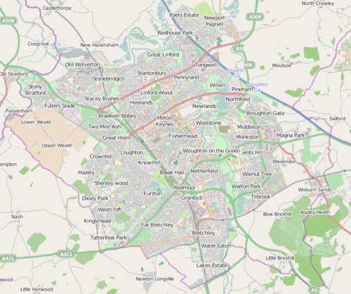
The A4146 is an A-class road running through south-central England from M1 junction 14 at Milton Keynes, around Linslade and Leighton Buzzard (as a new dual carriageway bypass), and via Dagnall to Hemel Hempstead, where it terminates at a roundabout with the A4251.
In Milton Keynes, the road briefly follows the H6 Childs Way from Junction 14 of the M1 Motorway before turning south onto the V11 Tongwell Street, west again onto the H10 Bletcham Way and once more to the south where it joins with the A5. It then separates again, continuing as the Milton Keynes southern bypass south of Fenny Stratford and Bletchley. At the end of the single carriageway bypass the road used to turn left and head south through the village of Stoke Hammond. However it now continues west onto a short stretch of dual carriageway bypass which was built in 2004.
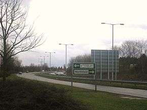
From a point just south of Water Eaton, Milton Keynes, a brand new alignment has been built for the road, forming the Stoke Hammond and Linslade western bypass. The dual carriageway road hugs the route of the West Coast Main Line for most of the way south towards Leighton Buzzard. This route opened on 14 September 2007. The route is planned to tie in with a proposed A418 Wing bypass. The new road features five new roundabouts, including one on the 2004 section, four overbridges and three underpasses.The bypass was the focus on an anti-road protest. During the protest two women chained themselves to a digger. They were arrested and charged, but later acquitted.[1]
After the end of the new bypass at its meeting with the A418, the A4146 takes over the former route of the A505 road around the south of Leighton Buzzard. This stretch is partly a three-lane single carriageway and partly a very wide two-lane single carriageway. It turns right off this route onto its old alignment immediately south of the town, with the A505 continuing forward towards Dunstable. After turning south the A4146 stops being a primary route and loses its green road signs. It passes through the village of Northall and past the larger village of Edlesborough before crossing the B489 route near Ivinghoe. After arriving into Hemel Hempstead the road turns right at the town's magic roundabout before ending at a junction with the A4251.
References
- ↑ "Road Block press release". Retrieved 2008-01-13.
External links
Coordinates: 51°55′N 0°42′W / 51.91°N 0.70°W
| Road |
| ||||||||||||||||||
|---|---|---|---|---|---|---|---|---|---|---|---|---|---|---|---|---|---|---|---|
| Rail |
| ||||||||||||||||||
| Air | |||||||||||||||||||
| Waterways |
| ||||||||||||||||||
| Footpaths | |||||||||||||||||||
| Cycle Paths | |||||||||||||||||||
| Related articles | |||||||||||||||||||