Achtkarspelen
| Achtkarspelen | |||
|---|---|---|---|
| Municipality | |||
|
Road into Surhuizum | |||
| |||
.svg.png) Location in Friesland | |||
| Coordinates: 53°15′N 6°9′E / 53.250°N 6.150°ECoordinates: 53°15′N 6°9′E / 53.250°N 6.150°E | |||
| Country | Netherlands | ||
| Province | Friesland | ||
| Government[1] | |||
| • Body | Municipal council | ||
| • Mayor | Gerben Gerbrandy | ||
| Area[2] | |||
| • Total | 103.98 km2 (40.15 sq mi) | ||
| • Land | 102.40 km2 (39.54 sq mi) | ||
| • Water | 1.58 km2 (0.61 sq mi) | ||
| Elevation[3] | 2 m (7 ft) | ||
| Population (May 2014)[4] | |||
| • Total | 27,938 | ||
| • Density | 273/km2 (710/sq mi) | ||
| Time zone | CET (UTC+1) | ||
| • Summer (DST) | CEST (UTC+2) | ||
| Postcode | Parts of 9000 range | ||
| Area code | 0511, 0512 | ||
| Website |
www | ||


Topographic map of Achtkarspelen, June 2015
Achtkarspelen (Dutch pronunciation: [ɑxtˈkɑrspələ(n)]) is a municipality in Friesland in the northern Netherlands.
History
The name Achtkarspelen is derived from the original eight kerspelen within the grietenij, namely: Augustinusga, Buitenpost(Capital), Drogeham, De Kooten, Kortwoude, Lutkepost, Surhuizum and Twijzel. Achtkarspelen held a separate status within Friesland for many years. In the Middle Ages Achtkarspelen fell under the Bishopric of Münster, meanwhile the rest of Friesland was a part of the Bishopric of Utrecht. The grietenij Achtkarspelen became a Municipality in 1851 after the gemeentewet (Municipality law) of Johan Rudolf Thorbecke.
Population centres
The administrative centre in the municipality is Buitenpost.
| Official name | West Frisian name | Population |
|---|---|---|
| Augustinusga | Stynsgea | 1332 |
| Boelenslaan | Boelensloane | 1145 |
| Buitenpost | Bûtenpost | 5785 |
| Drogeham | Droegeham | 1751 |
| Gerkesklooster-Stroobos | Gerkeskleaster-Strobos | 1140 |
| Harkema | De Harkema | 4235 |
| Kootstertille | Koatstertille | 2595 |
| Surhuisterveen | Surhústerfean | 5810 |
| Surhuizum | Surhuzem | 1371 |
| Twijzel | Twizel | 1093 |
| Twijzelerheide | Twizelerheide | 1889 |
References
- ↑ "Burgemeester Gerben Gerbrandy" [Mayor Gerben Gerbrandy] (in Dutch). Gemeente Achtkarspelen. Retrieved 6 September 2013.
- ↑ "Kerncijfers wijken en buurten" [Key figures for neighbourhoods]. CBS Statline (in Dutch). CBS. 2 July 2013. Retrieved 12 March 2014.
- ↑ "Postcodetool for 9285NH". Actueel Hoogtebestand Nederland (in Dutch). Het Waterschapshuis. Retrieved 6 September 2013.
- ↑ "Bevolkingsontwikkeling; regio per maand" [Population growth; regions per month]. CBS Statline (in Dutch). CBS. 26 June 2014. Retrieved 24 July 2014.
External links
| Wikimedia Commons has media related to Achtkarspelen. |
 |
Dantumadiel | Kollumerland en Nieuwkruisland | | |
| Tytsjerksteradiel | |
Grootegast (GR) | ||
| ||||
| | ||||
| Smallingerland |
| Administrative centre | 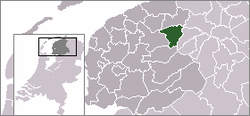 | |
|---|---|---|
| Villages | ||
| Hamlets |
| |
| Landmarks |
| |

This article is issued from Wikipedia - version of the 7/21/2015. The text is available under the Creative Commons Attribution/Share Alike but additional terms may apply for the media files.