Aden Country Park
Aden Country Park is located in Mintlaw, Aberdeenshire, Scotland. The park has a caravan area with camping, a small shop, a small cafe near the agricultural museum, a play area, a nature garden and a barbecue area. Aden Park can be accessed from Mintlaw by Station Road or Nether Aden Road.
It is home to the Aberdeenshire Farming Museum, forest walks and a ruined country house. Every year it hosts a pipe band contest which attracts bag pipe bands from around Scotland.
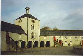
Aberdeenshire Farming Museum
The Aberdeenshire Farming Museum comprises two main features. The early 19th century semi-circular Home Farm steading features interpretations of 20th century Aden Estate through costumed guides, and the "Weel Vrocht Grun" (well worked ground) contains displays about regional farming history and innovations in agriculture over the last two centuries.[1]
The Hareshowe Working Farm was moved to Aden Country Park in the early 1990s. The farmhouse has been restored to a 1950s appearance and guided tours provide demonstrations of cooking and farm activities.[2]
Ruined house
The country mansion house belonging to the Russell family is said to have been beautiful before it was ruined.[3] During World War II it was used as an army barracks and it is said that the inside decoration was damaged and had lost its lustre once the army were finished with it. After the war the owners moved away from Scotland and left the house to ruin. At the time a tax had to be paid on any building with a roof, so the roof was removed so they didn't have to pay the tax on a house they didn't live in. The house is made of grey granite.
References
- ↑ "Aberdeenshire Farming Museum". Aberdeenshire Council. Archived from the original on 28 October 2010. Retrieved 15 January 2010.
- ↑ "Aberdeenshire Farming Museum". Gazetteer for Scotland. Retrieved 16 February 2013.
- ↑ John Bernard Burke (1847). A Genealogical and Heraldic History of the Landed Gentry of Great Britain & Ireland Vol. II. London: Henry Colburn. Retrieved 2009-08-30.
External links
- Aden Country Park Website
- Aberdeenshire Council Website - Aden Country Park
- Aberdeenshire Farming Museum Website
- Aberdeenshire Council Website - Aberdeenshire Farming Museum
- Local Information on the Park
Settlements and places of interest in Buchan, Aberdeenshire | ||
|---|---|---|
| Primary settlements | 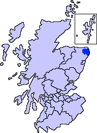 | |
| Other settlements | ||
| Places of interest | ||
Coordinates: 57°31′19″N 2°1′47″W / 57.52194°N 2.02972°W