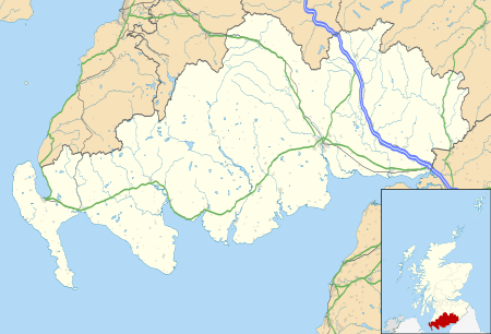
Ae, Dumfries and Galloway
| Ae | |
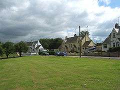 The village of Ae |
|
 Ae |
|
| Population | 200 (approx) |
|---|---|
| OS grid reference | NX983891 |
| – Edinburgh | 70 mi (110 km) NE |
| – London | 340 mi (550 km) SE |
| Council area | Dumfries and Galloway |
| Lieutenancy area | Dumfries |
| Country | Scotland |
| Sovereign state | United Kingdom |
| Post town | DUMFRIES |
| Postcode district | DG1 |
| Dialling code | 01387 |
| Police | Scottish |
| Fire | Scottish |
| Ambulance | Scottish |
| EU Parliament | Scotland |
| UK Parliament | Dumfries and Galloway |
| Scottish Parliament | Dumfriesshire |
Coordinates: 55°11′10″N 3°35′49″W / 55.186°N 3.597°W
Ae (pronounced /eɪ/) is a village in Dumfries and Galloway, south west Scotland.[1] The village is located within a conifer forest of more than 15,000 acres (61 km2), and is approximately 9 miles (14 km) north of Dumfries.[1]
History
Robert Chambers wrote of the Ae area in 1826, describing it as a moor with a glen (known as Glenae),[2] whose inhabitants were "long famed for broils, battles, and feats of activity".[3] Chambers wrote that most men in the area were employed in farming and transporting goods on horseback between the village and Glasgow, as well as the cities of Carlisle and Manchester.[3] These "lads of Ae" had a reputation that preceded them, being famous for "cudgel-playing [and] boxing" at every fair and wedding the area held.[3]
The village of Ae is one of the youngest villages in Britain, having been founded in 1947 by the Forestry Commission.[1]
Geography
The village is situated between the Water of Ae and the Goukstane Burn after they have flowed out of the Forest of Ae. The population is approximately 200, with 50 dwellings. Facilities in the village include a public house (formerly the post office), a school and community hall.[1]
Experiments at Ae include successful afforestation of former peat bogs, formerly thought to be unplantable. Plantation has also been established at a height of 1,750 feet (530 m). The forest consists mainly of Sitka spruce,[4] but there are also larch, Scots pine, and Norway spruce. There is much wildlife, including deer, fox, hare, weasel, woodpigeon, yellowhammer, sparrowhawk, jay, pheasant, partridge and red squirrel.
Toponymy
In 1787, the area's name was written with the ligature Æ.[5] By 1826 the name was written as Ae which, by repute, is the shortest place name in the United Kingdom.[1] However the Scottish Gaelic name of the island of Iona comprises a single letter, Ì.
Mountain biking trails
Close to the village is the local area headquarters of the Forestry Commission. The commission has been instrumental in developing a mountain biking centre, which provides access to cycle trails of various difficulty. To cater for visitors, there is a small café and a bike shop.
See also
Footnotes
- 1 2 3 4 5 Reader's Digest Association (1990, p. 16)
- ↑ Chambers (1826, p. 111)
- 1 2 3 Chambers (1826, p. 112)
- ↑ Pye & Croft (2004, p. 274)
- ↑ Great Britain House of Lords (1787, p. 201)
Sources
- Reader's Digest Association (1990), Book of British Villages, London: Reader's Digest, ISBN 0-276-42018-7, OCLC 35330841
- Chambers, Robert (1826), The Popular Rhymes of Scotland, W. Hunte
- Great Britain House of Lords (1787), Journals of the House of Lords / Great Britain, Parliament, House of Lords, 38, HMSO
- Pye, Kenneth; Croft, Debra (2004), Forensic geoscience: principles, techniques and applications, London: Geological Society, ISBN 1-86239-161-0
| Wikimedia Commons has media related to Ae, Dumfries and Galloway. |