Ahlsburg
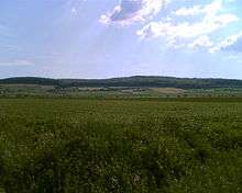
The Ahlsburg is a range of hills, relatively small in area and up to 411.4 m above sea level (NN), in the southern part of Lower Saxony (Germany).
Geography
The Ahlsburg hills run in a northwest to southeast direction and are around 10 km long and up to about 3 km wide. They are heavily wooded and belong to the Leine Uplands. They are located in the district of Northeim southeast of Dassel, east of the Solling, south of Einbeck and the valley of the Ilme, west of Northeim and the Leine valley and north of Moringen and northeast of Fredelsloh.
Hills
The following hills and elevations belong to the Ahlsburg ridge – with their heights in metres above sea level (Normalnull or NN):
|
|
Streams
The following streams flow in and around the Ahlsburg (all in the catchment area of the Leine):
- Bölle (rises on the southern edge of the ridge, passes its southern foothills and is a western tributary of the Leine)
- Dieße (rises on the eastern edge of the Solling, passes the western slopes of the ridge and is a south-southwestern tributary of the Ilme)
- Ilme (passes the ridge some way to the north and is a western tributary of the Leine)
- Leine (passes the ridge some way to the east and is a southern tributary of the Aller)
- Rebbe (rises in the central part of the ridge and is a southern tributary of the Ilme)
- Rotte (rises north of the ridge and is a southern tributary of the Ilme)
- Hane (rises in the central part of the ridge and is a southern tributary of the Dieße)
Places of interest
Places of interest in and on the Ahlsburg ridge – with heights in metres above sea level ( NN) - include:
- Grubenhagen Castle (298.0 m)
- Fredelsloh (ca. 270 m; art and pottery village)
- Kaisereiche (ca. 240 m)
- Quastbuche (331 m)
- Stahlbuche (ca. 310 m)
- Bengerode ruined village (ca. 265 m; medieval pottery settlement)
Coordinates: 51°45′N 9°49.5′E / 51.750°N 9.8250°E