Aiguille du Belvédère
| Aiguille du Belvédère | |
|---|---|
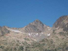 Aiguille du Belbédère from Lognan | |
| Highest point | |
| Elevation | 2,965 m (9,728 ft) |
| Prominence | 505 m (1,657 ft) [1] |
| Listing | Alpine mountains 2500-2999 m |
| Coordinates | 45°59′15″N 06°52′24″E / 45.98750°N 6.87333°ECoordinates: 45°59′15″N 06°52′24″E / 45.98750°N 6.87333°E |
| Geography | |
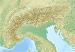 Aiguille du Belvédère Location in the Alps | |
| Location | Haute-Savoie, France |
| Parent range | Aiguilles Rouges |
Aiguille du Belvédère is a mountain of Haute-Savoie, France. It lies in the Aiguilles Rouges range of the French Prealps and has an altitude of 2,965 metres (9,728 ft) above sea level.
References
- ↑ "Aiguille du Belvédère - peakbagger". peakbagger.com. Retrieved 5 February 2015.
This article is issued from Wikipedia - version of the 12/4/2015. The text is available under the Creative Commons Attribution/Share Alike but additional terms may apply for the media files.