Alberto Carnevalli Airport
| Alberto Carnevalli Airport Aeropuerto Alberto Carnevalli | |||||||||||
|---|---|---|---|---|---|---|---|---|---|---|---|
 | |||||||||||
| IATA: MRD – ICAO: SVMD | |||||||||||
| Summary | |||||||||||
| Airport type | Public | ||||||||||
| Owner/Operator | SAPAM | ||||||||||
| Serves | Mérida, Venezuela | ||||||||||
| Elevation AMSL | 5,007 ft / 1,526 m | ||||||||||
| Coordinates | 08°34′56″N 071°09′40″W / 8.58222°N 71.16111°WCoordinates: 08°34′56″N 071°09′40″W / 8.58222°N 71.16111°W | ||||||||||
| Map | |||||||||||
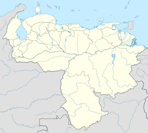 MRD Location of the airport in Venezuela | |||||||||||
| Runways | |||||||||||
| |||||||||||
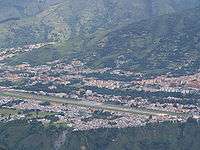
Alberto Carnevalli Airport (IATA: MRD, ICAO: SVMD) is an airport located 3 km southwest of downtown Mérida, the capital of Mérida State in Venezuela, at an elevation of 1,526 m MSL. Its runway is 1,630 m long. It is situated in the Chama River valley in the Andean mountains, surrounded by higher terrain in all quadrants. Night operations are prohibited. Commercial service resumed to Caracas on 2 August 2014, after being suspended for 5 years[4] due to the crash of Santa Bárbara Airlines Flight 518.
Accidents and incidents
On 21 February 2008, Santa Bárbara Airlines Flight 518, an ATR 42-300 twin-turboprop en route to Caracas, crashed shortly after takeoff from Carnevalli, killing all 46 persons on board. The cause of the accident was pilot error caused by disorientation and rushed procedures.
Airline and destination
| Airlines | Destinations |
|---|---|
| Avior Airlines | Caracas |
See also
 Venezuela portal
 Aviation portal
- Transport in Venezuela
- List of airports in Venezuela
References
- ↑ World Aero Data
- ↑ Airport information for MRD at Great Circle Mapper.
- ↑ Google Maps - Mérida
- ↑ Airport reopened
External links
- OurAirports - Mérida
- SkyVector - Mérida
- OpenStreetMaps - Mérida
- airlinecodes.co.uk entry
- airportlist.com entry
- Reuters article about Flight 518 accident