Alur, Osmanabad
| Alur Aloor | |
|---|---|
| village | |
 Alur  Alur Location in Maharashtra, India | |
| Coordinates: 17°41′51″N 076°25′31″E / 17.69750°N 76.42528°ECoordinates: 17°41′51″N 076°25′31″E / 17.69750°N 76.42528°E | |
| Country |
|
| State | Maharashtra |
| District | Osmanabad |
| Tahsil | Omerga |
| Government | |
| • Body | Village panchayat |
| Area | |
| • Total | 35.64 km2 (13.76 sq mi) |
| Elevation | 458 m (1,503 ft) |
| Population (2011) | |
| • Total | 7,931 |
| • Density | 220/km2 (580/sq mi) |
| Languages | |
| • Official | Marathi,Kannada |
| Time zone | IST (UTC+5:30) |
| PIN | 413605 |
| Lok Sabha constituency | Osmanabad |
| Vidhan Sabha constituency | Umarga[1] |
| Website |
maharashtra |
Alur is a panchayat village[2] in the state of Maharashtra, India.[3][4] Administratively, Alur is under Umarga Tahsil of Osmanabad District in Maharashtra.[4] There is only the single village of Alur in the Alur gram panchayat.[4] The village of Alur is 31 km by road southeast of the town of Naldurg and 52 km by road southwest of the town of Umarga, but only 13 km by road northeast of Wagdari, in Solapur District.
Alur is situated 17 km from NH-9 on the Akkalkot–Omerga road. It was formerly a border village of Hyderabad. Under the Nizam, it had a naka to collect taxes.
Demographics
In the 2001 census, the village of Alur had 6,948 inhabitants, with 3,591 males (51.7%) and 3,357 females (48.3%), for a gender ratio of 935 females per thousand males.[5]
In the 2011 census, the village of Alur had 7,931 inhabitants.[6]
Due to formerly being a village in Hyderabad State and to the nearness of the Karnataka border most of the population is can speak Kannada and Where as Marathi language is used as official work.
Temples and culture
This village has ancient temples of Lord Siva. Shanteshwar Temple, Sangameshwar Temple and Someshwar Temple , Narasimha Temple are some of these. this village has ancient masjid, 1 Jama Masjid. 2 Rahemaniya Masjid. 3 Momin Masjid and Madarsa maheraj Ululum Alur ,
Infrastructure
Education: Kannada and Marathi Zila Parishad High School til 10th Standard.
Alur has a "Center of Sanskrit Education and Examination" affiliated with Bharatiya Vidya Bhavan, Mumbai. This center was started by the late Sri. Shantappa Birajdar – Guruji, hundreds of students have successfully completed various level of Sanskrit courses, it has benefited young students in learning about Indic cultural and the mother language of Hindi.
Health Care: The government hospital, with more than 100 beds, is the medical center for nearby villages as well.
Financial Alur has one bank, the 'Maharashtra Grameen Bank' which was formerly known as 'Marathwada Grameen Bank'.
Transportation Alur has government buses running to Umarga and Akkalkot. Apart from government buses, private vehicles are also available for hire.
Industry Agriculture is the major industry in the surrounding area, and the village has typical small industries that support agricultural activities. There are several mills, the Khyade Flour mill being one of the oldest. Agriculture based machinery like tractors, harvesting machines, oil explorers, rice mill hullers are serviced and leased.
Notes
- ↑ "Assembly Constituencies-Post delimitation: Maharashtra: Osmanabad District" (PDF). National Informatics Centre, Government of India.
- ↑ 2011 Village Panchayat Code for Alur = 186024, "Reports of National Panchayat Directory: Village Panchayat Names of Omerga, Osmanabad, Maharashtra". Ministry of Panchayati Raj, Government of India.
- ↑ 2001 Census Village code for Alur = 03659400, "2001 Census of India: List of Villages by Tehsil: Maharashtra" (PDF). Registrar General & Census Commissioner, India. p. 710. Archived (PDF) from the original on 13 November 2012.
- 1 2 3 2011 Census Village code for Alur = 561769, "Reports of National Panchayat Directory: List of Census Villages mapped for: Alur Gram Panchayat, Omerga, Osmanabad, Maharashtra". Ministry of Panchayati Raj, Government of India.
- ↑ "Census 2001 Population Finder: Maharashtra: Osmanabad: Umarga: Alur". Office of The Registrar General & Census Commissioner, Ministry of Home Affairs, Government of India.
- ↑ "NPR Report: Maharashtra: Osmanabad: Umarga". National Population Register, Ministry of Home Affairs, Government of India. 2011.
External links
Osmanabad district topics | ||
|---|---|---|
| History | 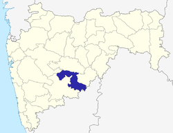 | |
| Cities and towns | ||
| Monuments | ||
| Lok Sabha constituencies | ||
| Vidhan Sabha constituencies | ||