Alvøy
Not to be confused with Alvøen.
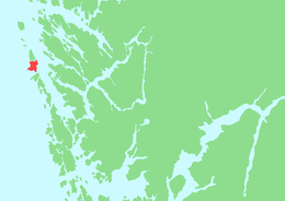 Location in Hordaland county | |
| Geography | |
|---|---|
| Location | Hordaland, Norway |
| Coordinates | 60°36′29″N 4°49′37″E / 60.6080°N 4.8270°ECoordinates: 60°36′29″N 4°49′37″E / 60.6080°N 4.8270°E |
| Area | 12 km2 (4.6 sq mi) |
| Length | 5.7 km (3.54 mi) |
| Width | 3.7 km (2.3 mi) |
| Highest elevation | 39 m (128 ft) |
| Highest point | Sjonarhøyen |
| Administration | |
| County | Hordaland |
| Municipality | Øygarden |
| Demographics | |
| Population | 760 (2001) |
Alvøyna or Alvøy is an island in Øygarden municipality in Hordaland county, Norway. The 12-square-kilometre (4.6 sq mi) island is located west of the Hjeltefjorden and it had a population of 760 inhabitants in 2001. It sits just north of the island of Ona and just south of the island of Seløyna. The Sture Terminal, endpoint of the Oseberg Transport System, was established here in 1988.[1] The village of Alveim is located on the west side of the island and the village of Tjeldstø lies on the eastern shore.
References
- ↑ Godal, Anne Marit (ed.). "Alvøy". Store norske leksikon (in Norwegian). Oslo: Norsk nettleksikon. Retrieved 9 April 2014.
This article is issued from Wikipedia - version of the 11/10/2016. The text is available under the Creative Commons Attribution/Share Alike but additional terms may apply for the media files.