Kato Achaia
| Kato Achaia Κάτω Αχαΐα | |
|---|---|
|
Kato Achaia train station | |
 Kato Achaia | |
| Coordinates: 38°9′N 21°33′E / 38.150°N 21.550°ECoordinates: 38°9′N 21°33′E / 38.150°N 21.550°E | |
| Country | Greece |
| Administrative region | West Greece |
| Regional unit | Achaea |
| Municipality | West Achaea |
| Municipal unit | Dymi |
| Community[1] | |
| • Population | 6,880 (2011) |
| Time zone | EET (UTC+2) |
| • Summer (DST) | EEST (UTC+3) |
| Vehicle registration | AX |
Kato Achaia (Greek: Κάτω Αχαΐα) is a town and a community in Achaea, West Greece, Greece. Since the 2011 local government reform it is part of the municipality West Achaea, of which it is the seat of administration.[2] The community Kato Achaia consists of the town Kato Achaia and the villages Alykes, Manetaiikia, Paralia Kato Achaias and Piso Sykea.
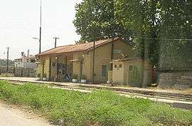
Kato Achaia is located 1 km south of the Gulf of Patras and 20 km southwest of Patras. The villages Alykes and Paralia Kato Achaias are on the coast. The Greek National Road 9 (Patras - Pyrgos) passes outside the town. Kato Achaia had a train station on the currently unexploited Patras–Pyrgos railway.
Population history
| Year | Kato Achaia Town | Community |
|---|---|---|
| 1981 | 5,185 | - |
| 1991 | 4,947 | - |
| 2001 | 5,518 | 6,027 |
| 2011 | 6,618 | 6,880 |
Gallery
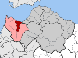 Dymi (Kato Achaia) municipal unit
 Kato Achaia beach
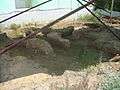 Roman archaeological findings in kato Achaia
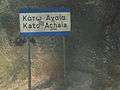 Kato Achaia
References
- ↑ "Απογραφή Πληθυσμού - Κατοικιών 2011. ΜΟΝΙΜΟΣ Πληθυσμός" (in Greek). Hellenic Statistical Authority.
- ↑ Kallikratis law Greece Ministry of Interior (Greek)
This article is issued from Wikipedia - version of the 10/15/2016. The text is available under the Creative Commons Attribution/Share Alike but additional terms may apply for the media files.