Doem Bang Nang Buat District
| Doem Bang Nang Buat เดิมบางนางบวช | |
|---|---|
| Amphoe | |
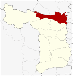 Amphoe location in Suphanburi Province | |
| Coordinates: 14°51′13″N 100°5′52″E / 14.85361°N 100.09778°ECoordinates: 14°51′13″N 100°5′52″E / 14.85361°N 100.09778°E | |
| Country |
|
| Province | Suphanburi |
| Seat | Khao Phra |
| Area | |
| • Total | 552.3 km2 (213.2 sq mi) |
| Population (2013) | |
| • Total | 73,741 |
| • Density | 135.1/km2 (350/sq mi) |
| Time zone | THA (UTC+7) |
| Postal code | 72120 |
| Geocode | 7202 |
Doem Bang Nang Buat (Thai: เดิมบางนางบวช; IPA: [dɤ̄ːm bāːŋ nāːŋ bùat]) is a district (Amphoe) in the northern part of Suphanburi Province, central Thailand.
History
In the past, Nang Buat district covered a large area. Prince Damrong Rajanubhab and the governor of Suphanburi agreed to separate the northernmost part and then created a new district named Doem Bang on May 16, 1911. They also added two tambons of Hankha district, Chainat Province and two tambons of Bang Rachan district, Sing Buri Province.[1] In 1939 the government changed the district name of Nang Buat district to Sam Chuk, they decided to put the word Nang Buat after Doem Bang, so since that year the district is named Doem Bang Nang Buat.[2]
The present district office is located on Chainat-Suphanburi Road, Tambon Khao Phra since 1995.
Geography
Neighboring districts are (from the north clockwise) Noen Kham, Hankha and Sankhaburi of Chainat Province, Bang Rachan and Khai Bang Rachan of Sing Buri Province, Sawaeng Ha of Ang Thong Province, and Sam Chuk, Nong Ya Sai and Dan Chang of Suphanburi Province.
The main water resource of Doem Bang Nang Buat is the Tha Chin river or Suphan river.
Administration
Central administration
The district Doem Bang Nang Buat is subdivided into 14 subdistrict (Tambon), which are further subdivided into 121 administrative villages (Muban).
| No. | Name | Thai | Villages | Pop.[3] |
|---|---|---|---|---|
| 1. | Khao Phra | เขาพระ | 11 | 8,610 |
| 2. | Doem Bang | เดิมบาง | 11 | 7,630 |
| 3. | Nang Buat | นางบวช | 10 | 7,852 |
| 4. | Khao Din | เขาดิน | 12 | 6,071 |
| 5. | Pak Nam | ปากน้ำ | 7 | 4,724 |
| 6. | Thung Khli | ทุ่งคลี | 8 | 5,563 |
| 7. | Khok Chang | โคกช้าง | 10 | 4,641 |
| 8. | Hua Khao | หัวเขา | 12 | 6,922 |
| 9. | Hua Na | หัวนา | 7 | 4,359 |
| 10. | Bo Kru | บ่อกรุ | 7 | 4,247 |
| 11. | Wang Si Rat | วังศรีราช | 4 | 594 |
| 12. | Pa Sakae | ป่าสะแก | 6 | 2,704 |
| 13. | Yang Non | ยางนอน | 7 | 4,952 |
| 14. | Nong Krathum | หนองกระทุ่ม | 9 | 4,872 |
Local administration
There are 8 subdistrict municipalities (Thesaban Tambon) in the district:
- Pak Nam (Thai: เทศบาลตำบลปากน้ำ) consisting of the complete subdistrict Pak Nam.
- Thung Khli (Thai: เทศบาลตำบลทุ่งคลี) consisting of the complete subdistrict Thung Khli.
- Nong Krathum (Thai: เทศบาลตำบลหนองกระทุ่ม) consisting of the complete subdistrict Nong Krathum.
- Khao Phra (Thai: เทศบาลตำบลเขาพระ) consisting of parts of the subdistricts Khao Phra, Doem Bang.
- Nang Buat (Thai: เทศบาลตำบลนางบวช) consisting of parts of the subdistrict Nang Buat.
- Bo Kru (Thai: เทศบาลตำบลบ่อกรุ) consisting of parts of the subdistrict Bo Kru.
- Khao Din (Thai: เทศบาลตำบลเขาดิน) consisting of the complete subdistrict Khao Din.
- Doem Bang (Thai: เทศบาลตำบลเดิมบาง) consisting of parts of the subdistrict Doem Bang.
There are 8 subdistrict administrative organizations (SAO) in the district:
- Khao Phra (Thai: องค์การบริหารส่วนตำบลเขาพระ) consisting of parts of the subdistrict Khao Phra.
- Nang Buat (Thai: องค์การบริหารส่วนตำบลนางบวช) consisting of parts of the subdistrict Nang Buat.
- Khok Chang (Thai: องค์การบริหารส่วนตำบลโคกช้าง) consisting of the complete subdistrict Khok Chang.
- Hua Khao (Thai: องค์การบริหารส่วนตำบลหัวเขา) consisting of the complete subdistrict Hua Khao.
- Hua Na (Thai: องค์การบริหารส่วนตำบลหัวนา) consisting of the complete subdistrict Hua Na.
- Bo Kru (Thai: องค์การบริหารส่วนตำบลบ่อกรุ) consisting of parts of the subdistrict Bo Kru.
- Pa Sakae (Thai: องค์การบริหารส่วนตำบลป่าสะแก) consisting of the complete subdistrict Wang Si Rat, Pa Sakae.
- Yang Non (Thai: องค์การบริหารส่วนตำบลยางนอน) consisting of the complete subdistrict Yang Non.
References
- ↑ ประกาศกระทรวงมหาดไทย ประกาศตั้งอำเภอเดิมบางและเปลี่ยนชื่ออำเภอเดิมบางเก่าเป็นอำเภอบ้านเชียน (PDF). Royal Gazette (in Thai). 28 (0 ง): 299–300. May 21, 1911.
- ↑ พระราชกฤษฎีกาเปลี่ยนนามอำเภอ กิ่งอำเภอ และตำบลบางแห่ง พุทธศักราช ๒๔๘๒ (PDF). Royal Gazette (in Thai). 56 (0 ก): 354–364. April 17, 1939.
- ↑ "Population statistics 2013" (in Thai). Department of Provincial Administration. Retrieved 2014-10-04.