Pa Sang District
| Pa Sang ป่าซาง | |
|---|---|
| Amphoe | |
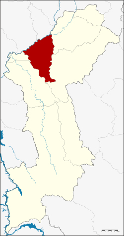 Amphoe location in Lamphun Province | |
| Coordinates: 18°31′33″N 98°56′21″E / 18.52583°N 98.93917°ECoordinates: 18°31′33″N 98°56′21″E / 18.52583°N 98.93917°E | |
| Country |
|
| Province | Lamphun |
| Seat | Pa Sang |
| Area | |
| • Total | 299.9 km2 (115.8 sq mi) |
| Population (2015) | |
| • Total | 55,824 |
| • Density | 195.5/km2 (506/sq mi) |
| Time zone | THA (UTC+7) |
| Postal code | 51120 |
| Geocode | 5106 |
Pa Sang (Thai: ป่าซาง; IPA: [pàː sāːŋ]) is a district (amphoe) of Lamphun Province, northern Thailand.
Geography
Neighboring districts are (from the east clockwise) Mueang Lamphun, Mae Tha, Ban Hong and Wiang Nong Long of Lamphun Province, Doi Lo and San Pa Tong of Chiang Mai Province.
History
Originally named Pak Bong after its central subdistrict, the district was renamed to Pa Sang in 1953.[1]
Administration
Central administration
The district Pa Sang is subdivided into 9 subdistricts (Tambon), which are further subdivided into 90 administrative villages (Muban).
| No. | Name | Thai | Villages | Pop.[2] |
|---|---|---|---|---|
| 1. | Pak Bong | ปากบ่อง | 5 | 3,415 |
| 2. | Pa Sang | ป่าซาง | 5 | 5,450 |
| 3. | Mae Raeng | แม่แรง | 11 | 7,368 |
| 4. | Muang Noi | ม่วงน้อย | 8 | 4,466 |
| 5. | Ban Ruean | บ้านเรือน | 8 | 4,059 |
| 6. | Makok | มะกอก | 9 | 5,361 |
| 7. | Tha Tum | ท่าตุ้ม | 14 | 7,345 |
| 8. | Nam Dip | น้ำดิบ | 17 | 9,592 |
| 11. | Nakhon Chedi | นครเจดีย์ | 13 | 8,768 |
Missing numbers are tambon which now form Wiang Nong Long district.
Local administration
There are 4 subdistrict municipalities (Thesaban Tambon) in the district:
- Pa Sang (Thai: เทศบาลตำบลป่าซาง) consisting of the complete subdistrict Pak Bong, Pa Sang.
- Muang Noi (Thai: เทศบาลตำบลม่วงน้อย) consisting of the complete subdistrict Muang Noi.
- Mae Raeng (Thai: เทศบาลตำบลแม่แรง) consisting of the complete subdistrict Mae Raeng.
- Makok (Thai: เทศบาลตำบลมะกอก) consisting of the complete subdistrict Makok.
There are 4 subdistrict administrative organizations (SAO) in the district:
- Ban Ruean (Thai: องค์การบริหารส่วนตำบลบ้านเรือน) consisting of the complete subdistrict Ban Ruean.
- Tha Tum (Thai: องค์การบริหารส่วนตำบลท่าตุ้ม) consisting of the complete subdistrict Tha Tum.
- Nam Dip (Thai: องค์การบริหารส่วนตำบลน้ำดิบ) consisting of the complete subdistrict Nam Dip.
- Nakhon Chedi (Thai: องค์การบริหารส่วนตำบลนครเจดีย์) consisting of the complete subdistrict Nakhon Chedi.
References
- ↑ พระราชกฤษฎีกาเปลี่ยนชื่ออำเภอและตำบลบางแห่ง พ.ศ. ๒๔๙๖ (PDF). Royal Gazette (in Thai). 70 (25 ก): 492. April 14, 1953.
- ↑ "Population statistics 2015" (in Thai). Department of Provincial Administration. Retrieved 2016-04-21.
External links
- amphoe.com (Thai)
This article is issued from Wikipedia - version of the 4/21/2016. The text is available under the Creative Commons Attribution/Share Alike but additional terms may apply for the media files.