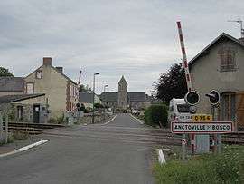
Anctoville-sur-Boscq
| Anctoville-sur-Boscq | |
|---|---|
 | |
 Anctoville-sur-Boscq | |
|
Location within Normandy region  Anctoville-sur-Boscq | |
| Coordinates: 48°50′41″N 1°31′52″W / 48.8447°N 1.5311°WCoordinates: 48°50′41″N 1°31′52″W / 48.8447°N 1.5311°W | |
| Country | France |
| Region | Normandy |
| Department | Manche |
| Arrondissement | Coutances |
| Canton | Bréhal |
| Intercommunality | Pays granvillais |
| Government | |
| • Mayor (2008–2014) | Sylvain Lebreton |
| Area1 | 2.15 km2 (0.83 sq mi) |
| Population (2009)2 | 518 |
| • Density | 240/km2 (620/sq mi) |
| Time zone | CET (UTC+1) |
| • Summer (DST) | CEST (UTC+2) |
| INSEE/Postal code | 50008 / 50400 |
| Elevation |
22–69 m (72–226 ft) (avg. 49 m or 161 ft) |
|
1 French Land Register data, which excludes lakes, ponds, glaciers > 1 km² (0.386 sq mi or 247 acres) and river estuaries. 2 Population without double counting: residents of multiple communes (e.g., students and military personnel) only counted once. | |
Anctoville-sur-Boscq is a commune in the Manche department in the Basse-Normandie region in northwestern France.
Population
| Historical population | ||
|---|---|---|
| Year | Pop. | ±% |
| 1793 | 259 | — |
| 1800 | 219 | −15.4% |
| 1806 | 232 | +5.9% |
| 1821 | 243 | +4.7% |
| 1831 | 219 | −9.9% |
| 1836 | 208 | −5.0% |
| 1841 | 219 | +5.3% |
| 1846 | 227 | +3.7% |
| 1851 | 211 | −7.0% |
| 1856 | 199 | −5.7% |
| 1861 | 206 | +3.5% |
| 1866 | 212 | +2.9% |
| 1872 | 202 | −4.7% |
| 1876 | 199 | −1.5% |
| 1881 | 170 | −14.6% |
| 1886 | 169 | −0.6% |
| 1891 | 135 | −20.1% |
| 1896 | 138 | +2.2% |
| 1901 | 146 | +5.8% |
| 1906 | 140 | −4.1% |
| 1911 | 132 | −5.7% |
| 1921 | 118 | −10.6% |
| 1926 | 129 | +9.3% |
| 1931 | 125 | −3.1% |
| 1936 | 103 | −17.6% |
| 1946 | 112 | +8.7% |
| 1954 | 119 | +6.2% |
| 1962 | 110 | −7.6% |
| 1968 | 98 | −10.9% |
| 1975 | 111 | +13.3% |
| 1982 | 178 | +60.4% |
| 1990 | 285 | +60.1% |
| 1999 | 418 | +46.7% |
| 2006 | 498 | +19.1% |
| 2009 | 518 | +4.0% |
See also
References
| Wikimedia Commons has media related to Anctoville-sur-Boscq. |
This article is issued from Wikipedia - version of the 2/11/2016. The text is available under the Creative Commons Attribution/Share Alike but additional terms may apply for the media files.