Andoversford
| Andoversford | |
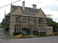 Former Police station |
|
 Andoversford |
|
| Population | 555 (2011 census) |
|---|---|
| OS grid reference | SP0219 |
| District | Cotswold |
| Shire county | Gloucestershire |
| Region | South West |
| Country | England |
| Sovereign state | United Kingdom |
| Post town | Cheltenham |
| Postcode district | GL54 |
| Police | Gloucestershire |
| Fire | Gloucestershire |
| Ambulance | South Western |
| EU Parliament | South West England |
| UK Parliament | The Cotswolds |
|
|
Coordinates: 51°52′N 1°58′W / 51.86°N 01.97°W
Andoversford is a village and civil parish in the Cotswold district of Gloucestershire, England, about six miles east of Cheltenham. The parish had a population of 668 according to the 2001 census, reducing to 555 at the 2011 census.[1]
The village runs parallel to the A40 and is on the River Coln. Amenities include a post office, two community or village halls, a primary school, pubs called the Royal Oak and the Kilkeney Inn, a shop and disused animal stock market currently being developed into a small housing estate.
In addition to its own primary school, the village was in the catchment area for several schools. These used to include the Charlton Kings Schools, Balcarras (located in Charlton Kings) but is now only in the priority catchment area for Cotswold School. Andoversford is located on the bus routes for the Balcarras, Cotswold and St Edward's (private) schools. A variety of private schools are also within reach.The village used to have a doctor's surgery, which was a branch of the Sixway's clinic and which is now closed.
The village has a community atmosphere and several meeting areas (pubs, schools, church, social club, play ground, etc) as well as annual events. These include point to point events on the point to point course, an annual pig roast,and a music festival (Andoverfest). The village also supports a football team, a cricket team and has Cubs and Scout groups as well as social events.
Andoversford has three nearby golf courses.
Cheltenham town is five minutes by car; Gloucester is 25 minutes.
Governance
The village is part of 'Sandywell' electoral ward. This ward starts at Andoversford in the east and stretches to Notgrove in the west. The total ward population taken at the 2011 census was 1,829.[2]
See also
References
External links
| Wikimedia Commons has media related to Andoversford. |
SCHOOLS
- Andoversford Primary School
- Cotswold school
- Balcarras Senior School
- Charlton Kings Junior School
- St Edwards school
- Rendcomb College
DINING and DRINKING
- The Kilkenny Inn or find them on Facebook
- The Frogmill
- The Seven Tuns pub
- Farm Shop
SPORT, LEISURE and HEALTH
- Point to Point
- Andoversford football club
- Ian Coley shooting
- Lilley Brook golf club
- Shipton golf course
- Spa, Pool and Gym
- Cotswold Water Park
- Doctor's Surgery