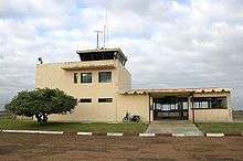
Artigas Airport
| Artigas International Airport Aeropuerto Internacional de Artigas | |||||||||||||||
|---|---|---|---|---|---|---|---|---|---|---|---|---|---|---|---|
 | |||||||||||||||
| IATA: ATI – ICAO: SUAG | |||||||||||||||
| Summary | |||||||||||||||
| Airport type | Public | ||||||||||||||
| Serves | Artigas | ||||||||||||||
| Elevation AMSL | 125 m / 410 ft | ||||||||||||||
| Coordinates | 30°24′03″S 056°30′28″W / 30.40083°S 56.50778°WCoordinates: 30°24′03″S 056°30′28″W / 30.40083°S 56.50778°W | ||||||||||||||
| Map | |||||||||||||||
 ATI Location in Uruguay | |||||||||||||||
| Runways | |||||||||||||||
| |||||||||||||||
|
Sources: Great Circle Mapper[1] | |||||||||||||||
Artigas International Airport (IATA: ATI, ICAO: SUAG) is the airport serving Artigas, Uruguay.
History
The airport was opened in November 1973. It is situated close to Uruguay's border with Brazil.
Airlines and destinations
Currently no scheduled flights operate at this airport.
Accidents and incidents
- 10 February 1978: a TAMU Douglas C-47A 75-DL registration CX-BJH/T511 flying from Artigas to Montevideo crashed shortly after take-off from Artigas on a domestic scheduled passenger flight. All 44 people on board, comprising 38 passengers and 6 crew, were killed, making this the second-worst crash involving a DC-3 (or derivative), and the worst aviation accident in Uruguay at the time.[2] The airframe in question had first flown in 1943, and was damaged beyond repair in the accident.
Access
The airport is located 3 km (2 mi) from downtown Artigas.
References
- ↑ Airport Information on Great Circle Mapper
- ↑ "Accident description CX-BJH/T511". Aviation Safety Network. Retrieved 1 August 2010.
External links
- Airport information for SUAG at World Aero Data. Data current as of October 2006.Source: DAFIF.
- Airport information for SUAG at Great Circle Mapper. Source: DAFIF (effective October 2006).
- Current weather for SUAG at NOAA/NWS
- Accident history for ATI at Aviation Safety Network
- Artigas Airport Photo Archive at airliners.net
This article is issued from Wikipedia - version of the 6/23/2015. The text is available under the Creative Commons Attribution/Share Alike but additional terms may apply for the media files.