Arzberger Site
|
Arzberger Site | |
|
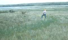
Countryside at the site | |
| Nearest city | Pierre, South Dakota |
|---|---|
| NRHP Reference # | 66000715 |
| Significant dates | |
| Added to NRHP | October 15, 1966[1] |
| Designated NHL | July 19, 1964[2] |
Arzberger Site, also known as 39HU6 is an archaeological site in Hughes County, South Dakota, near Pierre, South Dakota. It was declared a National Historic Landmark in 1964.[2][3]
At the time of the designation in 1964, it was stated:
The northernmost outpost of the Central Plains Tradition (c. 1500 AD), this is the site of an extraordinarily large fortified village atop a low mesa overlooking the Missouri River. The site covers some 70n(sic) acres with 24 bastions. Forty-four circular house rings have been noted. The village likely represents the Arikara Indians at the time they were differentiating from the Pawnee.[2]
References
- ↑ National Park Service (2008-04-15). "National Register Information System". National Register of Historic Places. National Park Service.
- 1 2 3 "Arzberger Site". National Historic Landmark summary listing. National Park Service. Retrieved 2008-06-14.
- ↑ Note: A National Register of Historic Places Inventory-Nomination document should be available upon request from the National Park Service for this site, but it appears not to be available on-line from the NPS Focus search site.
External links
| Topics | |
|---|---|
| Lists by states |
|
| Lists by insular areas | |
| Lists by associated states | |
| Other areas | |
| |
This article is issued from Wikipedia - version of the 6/26/2016. The text is available under the Creative Commons Attribution/Share Alike but additional terms may apply for the media files.