Asalatganj
| Asalat Ganj | |
|---|---|
| town | |
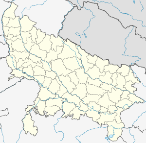 Asalat Ganj Location in Uttar Pradesh, India | |
| Coordinates: 26°41′0″N 79°51′0″E / 26.68333°N 79.85000°ECoordinates: 26°41′0″N 79°51′0″E / 26.68333°N 79.85000°E | |
| Country | India |
| State | Uttar Pradesh |
| District | Kanpur Dehat |
| Government | |
| • Body | Akabarpur |
| Elevation | 130 m (430 ft) |
| Population | |
| • Total | 10,000 |
| Languages | |
| • Official | Hindi |
| Time zone | IST (UTC+5:30) |
| PIN | 209306 |
| Telephone code | 05114 |
| Vehicle registration | UP-77 |
| Coastline | 0 kilometres (0 mi) |
| Nearest city | Kanpur Nagar |
| Literacy | 80%% |
| Lok Sabha constituency | Kannauj |
| Civic agency | Akabarpur |
| Avg. summer temperature | 47 °C (117 °F) |
| Avg. winter temperature | 6 °C (43 °F) |
Asalatganj is a town in Kanpur Dehat district in the state of Uttar Pradesh, India.
History
This is one of the Older villages of Kanpur Dehat. Earlier it was known as asalat Ganj(office for revenue collection in the period of British. It owns the biggest market(two times in a week) in whole district. Gandhi Faz-e AAm Technical Inter College and Janta Inter College are famous colleges for secondary education. The first school in Asalat Ganj was established by Maulvi Chhedi Khan in 1930. It is well connected by rail and road. Population of this town is about 10000. The main occupation of the people of town is agriculture.
Education
- Maulana Abul Kalam Azad Mahavidyalaya
- Gandi Faiz-e Aam Inter College
- Madarsa Arebia for Arebic Languages
- Janta Inter College
- Mini I T I Asalat Ganj
- R D N Mahavidyalaya
Geography
Asalatganj is located at 26°41′0″N 79°51′0″E / 26.68333°N 79.85000°E. It has an average elevation of 130 metres (429 feet).