Showak
| Showak الشواك (Arabic) | |
|---|---|
| Town | |
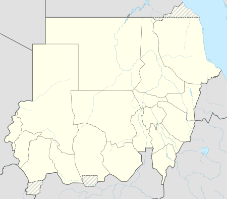 Showak Location in Sudan | |
| Coordinates: 14°23′N 35°52′E / 14.383°N 35.867°ECoordinates: 14°23′N 35°52′E / 14.383°N 35.867°E | |
| Country |
|
| State | Al Qadarif |
| Elevation | 516 m (1,693 ft) |
| Time zone | EAT (UTC+3) |
Showak (also Ash Showak or el Showak[1]) (Arabic: االشواك A'shou-wāk), is a town on the Atbarah River[2] in eastern Gedarif State, Sudan, at an altitude of 516 meters (1,693 feet) above sea level. It lies at a distance of 381 kilometres (237 mi) to the northeast of Khartoum. Showak is a major transport hub between Gedaref, the state capital and Kassala city.
The national highway linking Khartoum and the rest of the country with Port Sudan, as well as the railway line parallel to it passes through Showak. Showak has the largest cattle market in the State and contains a special clinic, affiliated with Khartoum University, which treats camels.[3] It also hosts a large UN Refugees camp in its vicinity known as the Shagarab Refugees camp and is home to the Sudanese headquarters of the United Nations High Commission for Refuge.[4][5] There is one hospital in the town, Ash Showak Rural Hospital, and a branch of the Agricultural Bank of Sudan, located in the town's main market.
Climate
| Climate data for Showak (1961–1990) | |||||||||||||
|---|---|---|---|---|---|---|---|---|---|---|---|---|---|
| Month | Jan | Feb | Mar | Apr | May | Jun | Jul | Aug | Sep | Oct | Nov | Dec | Year |
| Record high °C (°F) | 40.3 (104.5) |
43.6 (110.5) |
45.2 (113.4) |
46.0 (114.8) |
45.7 (114.3) |
44.5 (112.1) |
40.8 (105.4) |
40.7 (105.3) |
41.0 (105.8) |
41.5 (106.7) |
41.0 (105.8) |
40.1 (104.2) |
46.0 (114.8) |
| Average high °C (°F) | 34.5 (94.1) |
36.6 (97.9) |
39.3 (102.7) |
41.5 (106.7) |
41.1 (106) |
38.7 (101.7) |
34.9 (94.8) |
33.9 (93) |
35.5 (95.9) |
37.9 (100.2) |
37.4 (99.3) |
35.3 (95.5) |
37.2 (99) |
| Daily mean °C (°F) | 24.8 (76.6) |
26.5 (79.7) |
29.5 (85.1) |
31.8 (89.2) |
33.1 (91.6) |
31.4 (88.5) |
28.6 (83.5) |
27.9 (82.2) |
28.8 (83.8) |
29.9 (85.8) |
28.3 (82.9) |
26.0 (78.8) |
28.9 (84) |
| Average low °C (°F) | 15.1 (59.2) |
16.5 (61.7) |
19.7 (67.5) |
22.1 (71.8) |
25.1 (77.2) |
24.1 (75.4) |
22.3 (72.1) |
21.9 (71.4) |
22.1 (71.8) |
22.0 (71.6) |
19.3 (66.7) |
16.7 (62.1) |
20.6 (69.1) |
| Record low °C (°F) | 8.3 (46.9) |
8.2 (46.8) |
9.0 (48.2) |
12.6 (54.7) |
17.0 (62.6) |
17.7 (63.9) |
18.3 (64.9) |
13.7 (56.7) |
17.5 (63.5) |
14.4 (57.9) |
10.8 (51.4) |
7.8 (46) |
7.8 (46) |
| Average precipitation mm (inches) | 0.5 (0.02) |
0.0 (0) |
0.9 (0.035) |
3.2 (0.126) |
18.8 (0.74) |
70.8 (2.787) |
166.2 (6.543) |
148.1 (5.831) |
70.1 (2.76) |
21.9 (0.862) |
1.4 (0.055) |
0.0 (0) |
501.9 (19.76) |
| Average precipitation days (≥ 0.1 mm) | 0.0 | 0.0 | 0.1 | 0.8 | 3.9 | 8.0 | 11.1 | 11.2 | 7.1 | 2.6 | 0.3 | 0.0 | 45.1 |
| Average relative humidity (%) | 35 | 29 | 24 | 22 | 29 | 40 | 56 | 61 | 55 | 41 | 33 | 34 | 38.2 |
| Mean monthly sunshine hours | 313.1 | 282.8 | 303.8 | 315.0 | 300.7 | 285.0 | 251.1 | 238.7 | 267.0 | 291.4 | 306.0 | 310.0 | 3,464.6 |
| Percent possible sunshine | 89 | 87 | 81 | 83 | 75 | 69 | 62 | 61 | 73 | 80 | 83 | 89 | 78 |
| Source: NOAA[6] | |||||||||||||
References
- ↑ Dirani, Omar Hassan El; Jabbar, Mohammad Abdul; Babiker, Idris Babiker (2009). Constraints in the Market Chains for Export of Sudanese Sheep and Sheep Meat to the Middle East. ILRI (aka ILCA and ILRAD). p. 27. ISBN 978-92-9146-195-0.
- ↑ Hurst, Harold Edwin; Phillips, P.; Black, R. P. (1950). The Nile Basin. Government Press. p. 122.
- ↑ Masood, Ehsan; Schaffer, Daniel (2006). Dry: Life Without Water. Harvard University Press. p. 18. ISBN 978-0-674-02224-9.
- ↑ Shepherd, Andrew; Norris, Malcolm; Watson, John R. (1987). Water planning in arid Sudan. Published for the Development Administration Group, Institute of Local Government Studies, University of Birmingham, by Ithaca Press. p. 36. ISBN 978-0-86372-072-7.
- ↑ "Refuggees and Asylum Seekers in Sudan" (PDF). UNHCR. Retrieved 10 December 2013.
- ↑ "El Showak Climate Normals 1961–1990". National Oceanic and Atmospheric Administration. Retrieved January 18, 2016.