Audnedalen
| Audnedalen | |
|---|---|
|
View of the Audnedalen valley from Gampeheia | |
 Audnedalen  Audnedalen Location of the valley | |
| Location | Vest-Agder, Norway |
| Long-axis direction | North-South |
| Long-axis length | 50 kilometres (31 mi) |
| Geology | |
| Type | River valley |
| Geography | |
| Coordinates | 58°13′07″N 07°21′09″E / 58.21861°N 7.35250°ECoordinates: 58°13′07″N 07°21′09″E / 58.21861°N 7.35250°E |
| Population centers | Vigeland, Konsmo, Byremo |
| Watercourses | Audna |
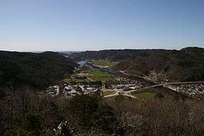
Audnedalen is the shortest of the six main north-south valleys in Vest-Agder county, Norway. The 50-kilometre (31 mi) long river valley runs through the municipalities of Audnedal and Lindesnes. The river Audna runs through the valley, ending in Snigsfjorden in the south. The valley floor is flat and the sides are relatively steep. Since it is a rather short valley, it does not reach into the high moorland like other such valleys in the county.[1]
References
- ↑ Henriksen, Petter, ed. (2007). "Audna". Store norske leksikon (in Norwegian). Oslo: Kunnskapsforlaget. Retrieved 17 May 2009.
This article is issued from Wikipedia - version of the 11/17/2016. The text is available under the Creative Commons Attribution/Share Alike but additional terms may apply for the media files.