Aughrim, County Galway
| Aughrim Eachroim | |
|---|---|
| Town | |
 Aughrim Location in Ireland | |
| Coordinates: 53°18′15″N 8°19′00″W / 53.304167°N 8.316667°WCoordinates: 53°18′15″N 8°19′00″W / 53.304167°N 8.316667°W | |
| Country | Ireland |
| Province | Connacht |
| County | County Galway |
| Elevation | 115 m (377 ft) |
| Population (2002) | |
| • Urban | 546 |
| • Rural | 546 |
| Time zone | WET (UTC+0) |
| • Summer (DST) | IST (WEST) (UTC-1) |
| Irish Grid Reference | M785281 |
| Website |
www |
Aughrim (Irish: Eachroim, meaning "horse ridge") is a small village in County Galway, Ireland. It is located between the towns of Loughrea and Ballinasloe, along the old N6 national primary road, now listed as R446 regional road that used to be the main road between Galway and Dublin.
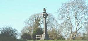
Its place in history is assured as it was here that the Marquis de St Ruth prepared the Irish troops for the Battle of Aughrim which was fought, during the Williamite war in Ireland, on 12 July 1691.
According to the Irish census of 2002, the village had a population of 546 [1]
Chernobyl Appeal
Aughrim is the base for the charitable organisation Sunflowers Chernobyl Appeal which carry out voluntary work in areas in Belarus affected by the Chernobyl nuclear disaster.
Abbots and Bishops of Aughrim
- c.500 - Connell of Aughrim, Bishop and founder.
- 736 - Flann Aighle, Bishop.
- 746 - Maelimarchair, Bishop.
- 782 - Rechtabhra mac Dubbchomar, Abbot.
- 809 - Maelduin of Aughrim, Bishop and Airchinneach (Erenagh)
People
- John Doogan, recipient of the Victoria Cross
- William MacCnaimhín, Republican negotiator during the 1798 Rising
Holy Trinity Church
Holy Trinity Church is the Church of Ireland parish church for Aughrim. It was built in 1819 and consecrated on Trinity Sunday 1819 and it was therefore called Holy Trinity. It is cruciform in shape and is still in use as a parish church [2]
Rectors of Holy Trinity Church
- Rev. Henry Martin (1819 - 1845)
- The Very Rev. John Fiennes Twisleton Crampton (1845 - 1888) [3]
References
- Illustrated road book of Ireland, Second Edition, Automobile Association, London (1970)
- ↑ http://www.cso.ie/en/media/csoie/census/documents/vol1_entire.pdf page 102 Table 6 Ballinasloe No. 1 Rural Area
- ↑ Aughrim Union of Parishes
- ↑ Kriste Family Tree