Bad Laer
| Bad Laer | ||
|---|---|---|
| ||
 Bad Laer | ||
Location of Bad Laer within Osnabrück district 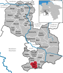
 | ||
| Coordinates: 52°06′11″N 08°05′21″E / 52.10306°N 8.08917°ECoordinates: 52°06′11″N 08°05′21″E / 52.10306°N 8.08917°E | ||
| Country | Germany | |
| State | Lower Saxony | |
| District | Osnabrück | |
| Government | ||
| • Mayor | Franz Vollmer | |
| Area | ||
| • Total | 46.85 km2 (18.09 sq mi) | |
| Population (2015-12-31)[1] | ||
| • Total | 9,268 | |
| • Density | 200/km2 (510/sq mi) | |
| Time zone | CET/CEST (UTC+1/+2) | |
| Postal codes | 49196 | |
| Dialling codes | 05424 | |
| Vehicle registration | OS | |
| Website | www.bad-laer.de | |


St. Marien
Bad Laer is a municipality and health resort in the district of Osnabrück, in Lower Saxony, Germany. It is situated in the Teutoburg Forest, approx. 20 km south of Osnabrück.
The municipality includes Bad Laer and five outlying districts Remsede, Müschen, Hardensetten, Westerwiede and Winkelsetten.
References
This article is issued from Wikipedia - version of the 6/7/2015. The text is available under the Creative Commons Attribution/Share Alike but additional terms may apply for the media files.