Baker Brook Parish, New Brunswick
| Baker Brook | |
|---|---|
| Parish | |
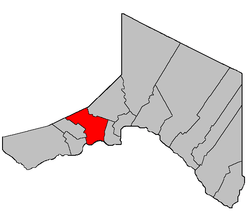 Location within Madawaska County. | |
| Coordinates: 47°21′18″N 68°33′36″W / 47.355°N 68.56°W | |
| Country |
|
| Province |
|
| County | Madawaska |
| Established | 1929 |
| Area[1] | |
| • Land | 125.69 km2 (48.53 sq mi) |
| Population (2011)[2][3] | |
| • Total | 287 |
| • Density | 2.3/km2 (6/sq mi) |
| • Pop 2006-2011 |
|
| • Dwellings | 139 |
| Time zone | AST (UTC-4) |
| • Summer (DST) | ADT (UTC-3) |
Baker Brook is a Canadian parish in Madawaska County, New Brunswick.[4]
Delineation
Baker Brook Parish is defined in the Territorial Division Act[5] as:
- Beginning at a point in the International Boundary where it is intersected by the southern prolongation of the west limit of lot No. 83 granted to Augustine Daigle thence in a northerly direction along said prolongation and said limit to its northwest angle or to the northern limit of the lots fronting on the St. John River thence in an easterly direction along the said northern limit of lots fronting on the St. John River to the southeast angle of lot No. 1 east side of Caron Brook thence northerly along the east limit of lots fronting on the east side of Caron Brook to the northeast angle of lot No. 9 granted to Louis Lavoie thence westerly along the north limit of said lot No. 9 to the northeast limit of lot No. 10 E thence northwesterly along said limit of said lot No. 10 E to the southwest angle of lot Letter “D” granted to Thomas Ouellette thence northeasterly along the southeast limit of said lot Letter “D” and lot Letter “C” to the east limit of Range Four Val-Nadeau [Settlement][lower-alpha 1] thence northwesterly along said limit of Range Four to the northeast angle of lot No. 17 in Range Four thence southwesterly along the northwest limit of lot No. 17 to the east limit of Range Five thence northwesterly along said limit of Range Five to the northeast angle of lot No. 33 in Range Five thence southwesterly along the northwest limit of said lot No. 33 to the east limit of lots fronting on the east side of Baker Lake thence northwesterly along said limit to the New Brunswick-Quebec Boundary line thence easterly along said Boundary line to the west limit of Tier Three, Rang-des-Morneault[lower-alpha 2] thence southerly along said limit to the northwest angle of lot No. 17 in said Tier Three thence easterly along the northern limit of said lot No. 17 to the east limit of Tier Three aforesaid thence southerly along said limit to the point where it is intersected by the southwest limit of lot No. 58 in Tier Six Riceville [Settlement] thence southeasterly along said limit of said lot No. 58 to the northwest limit of lot No. 51 in said Tier Six thence northeasterly along the northwest limit of lot No. 51 to the northeast limit of Tier Six thence southeasterly along said limit to the most easterly angle of lot No. 19 in Tier Six granted to Onesime Gagnon thence southwesterly along the southeast limit of said lot No. 19 in Tier Six, lot No. 18 in Tier Five, lot No. 95 in Tier Four [Ouellette Settlement] and lot No. 96 in Tier Three to the southwest limit of said Tier Three thence southeasterly along said limit to the most easterly angle of lot No. 113 in Tier Two thence southwesterly along the southeast limit of said lot No. 113 to the north limit of lots fronting on the St. John River thence southeasterly along said limit to the northeast angle of lot No. 61 granted to Firmin M. Dechene thence southwesterly along the southeast limit of said lot No. 61 and its southern prolongation to the International Boundary thence in a westerly direction along said boundary line to the place of beginning.
Communities
Parish population total does not include incorporated municipalities (in bold) and communities within their respective boundaries (in italics).
- Baker-Brook
- Michaud
- Concession-de-Baker-Brook
- Concession-des-Ouellette
- Rang-des-Morneault
- Rang-Saint-Joseph
- Val-Lambert
- Val-Nadeau
- Pinniquine
Demographics
Population
| Canada census – Baker Brook Parish, New Brunswick community profile | |||
|---|---|---|---|
| 2011 | 2006 | 2001 | |
| Population: | 287 (+62.1% from 2006) | 177 (-45.0% from 2001) | 322 (-9.8% from 1996) |
| Land area: | 125.48 km2 (48.45 sq mi) | 125.69 km2 (48.53 sq mi) | 125.48 km2 (48.45 sq mi) |
| Population density: | 2.3/km2 (6.0/sq mi) | 1.4/km2 (3.6/sq mi) | 2.6/km2 (6.7/sq mi) |
| Median age: | 44.9 (M: 45.4, F: 44.2) | 43.8 (M: 43.6, F: 45.5) | 39.5 (M: 40.6, F: 38.0) |
| Total private dwellings: | 139 | 92 | 137 |
| Median household income: | $62,671 | $.N/A | $28,398 |
| Notes: 2006 income data for this area has been suppressed for data quality or confidentiality reasons. – References: 2011[2] 2006[6] 2001[7] | |||
| Historical Census Data - Baker Brook Parish, New Brunswick[8] | ||||||||||||||||||||||||||
|---|---|---|---|---|---|---|---|---|---|---|---|---|---|---|---|---|---|---|---|---|---|---|---|---|---|---|
|
|
| ||||||||||||||||||||||||
Language
| Canada Census Mother Tongue - Baker Brook Parish, New Brunswick 2011 language data for this area has been suppressed for data quality or confidentiality reasons. [8] | ||||||||||||||||||
|---|---|---|---|---|---|---|---|---|---|---|---|---|---|---|---|---|---|---|
| Census | Total | French |
English |
French & English |
Other | |||||||||||||
| Year | Responses | Count | Trend | Pop % | Count | Trend | Pop % | Count | Trend | Pop % | Count | Trend | Pop % | |||||
| 2011 |
0 |
n/a | |
0.00% | n/a | |
0.00% | n/a | |
0.00% | n/a | |
0.00% | |||||
| 2006 |
185 |
150 | |
81.08% | 10 | |
5.41% | 10 | |
5.41% | 15 | |
8.11% | |||||
| 2001 |
315 |
315 | |
100.00% | 0 | |
0.00% | 0 | |
0.00% | 0 | |
0.00% | |||||
| 1996 |
355 |
335 | n/a | 94.37% | 0 | n/a | 0.00% | 20 | n/a | 5.63% | 0 | n/a | 0.00% | |||||
See also
Footnotes
References
- ↑ 2011 Statistics Canada Census Profile: Baker Brook Parish, New Brunswick
- 1 2 "2011 Community Profiles". Canada 2011 Census. Statistics Canada. July 5, 2013. Retrieved 2014-03-22.
- ↑ "Corrections and updates: Population and dwelling count amendments, 2011 Census". Statistics Canada. February 14, 2013. Retrieved February 15, 2013.
- ↑ New Brunswick Provincial Archives - Baker Brook Parish
- ↑ "Territorial Division Act (R.S.N.B. 1973, c. T-3)". Government of New Brunswick website. Retrieved 17 August 2016.
- ↑ "2006 Community Profiles". Canada 2006 Census. Statistics Canada. March 30, 2011. Retrieved 2014-03-22.
- ↑ "2001 Community Profiles". Canada 2001 Census. Statistics Canada. February 17, 2012. Retrieved 2014-03-22.
- 1 2 Statistics Canada: 1996, 2001, 2006, 2011 census
 |
Témiscouata Regional County Municipality |
Saint-Jacques Parish | | |
| Lac-Baker Parish | |
Saint-Hilaire Parish | ||
| ||||
| | ||||
| Clair Parish | Aroostook County, Maine |
| Subdivisions | |
|---|---|
| Cities | |
| Counties | |
| |
Coordinates: 47°21′18″N 68°33′36″W / 47.35500°N 68.56000°W
This article is issued from Wikipedia - version of the 11/14/2016. The text is available under the Creative Commons Attribution/Share Alike but additional terms may apply for the media files.