Balran
| Balran | |
|---|---|
| Village | |
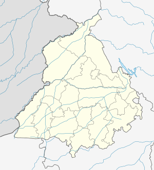 Balran Location in Punjab, India | |
| Coordinates: 29°50′35″N 75°50′50″E / 29.84303°N 75.84721°ECoordinates: 29°50′35″N 75°50′50″E / 29.84303°N 75.84721°E | |
| Country |
|
| State | Punjab |
| District | Sangrur |
| Area | |
| • Total | 20.99 km2 (8.10 sq mi) |
| Elevation | 227 m (745 ft) |
| Population (2001) | |
| • Total | 6,566 |
| • Density | 310/km2 (810/sq mi) |
| Languages | |
| • Official | Punjabi |
| Time zone | IST (UTC+5:30) |
| Telephone code | +911676 |
| Vehicle registration | PB 64 |
Balran is a Village of Sub division Moonak in Sangrur district in the state of Punjab, India. It is 54 km to the south of District headquarters Sangrur 14 km from Lehragaga, 157 km from State capital Chandigarh. This place is at the border of the Sangrur district and Fatehabad district in state of Haryana.
Geography
Balran is located at 29°50′N 75°51′E / 29.84°N 75.85°E in Punjab border with Haryana state, India.[1] It has an average elevation of 227 metres.
Demographics
As of 2001 India census,[2] Balran had a population of 6,566 Males 3,542 and females 3,022. There were 1,111 households.
References
This article is issued from Wikipedia - version of the 3/16/2014. The text is available under the Creative Commons Attribution/Share Alike but additional terms may apply for the media files.