Baltimore
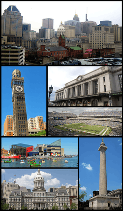

Baltimore (/ˈbɔːltᵻˌmɔːr/, locally: [ˈbɔɫ.mɔɻ]) is the largest city in the U.S. state of Maryland, and the 29th-most populous city in the country. It was established by the Constitution of Maryland[9] and is not part of any county; thus, it is the largest independent city in the United States. Baltimore has more public monuments per capita than any other city in the country and is home to some of the earliest National Register historic districts in the nation, including Fell's Point (1969), Federal Hill (1970) and Mount Vernon Place (1971). More than 65,000 properties, or roughly one in three buildings in the city, are listed on the National Register, more than any other city in the nation.[10][11]
Founded in 1729, Baltimore is the second largest seaport in the Mid-Atlantic.[12] Baltimore's Inner Harbor was once the second leading port of entry for immigrants to the United States and a major manufacturing center.[13] After a decline in major manufacturing, industrialization and rail transportation, Baltimore shifted to a service-oriented economy, with the Johns Hopkins Hospital (founded 1889), and Johns Hopkins University (founded 1876), now the city's top two employers.[14]
Baltimore had a population of 621,849 in 2015; in 2010, that of Baltimore Metropolitan Area was 2.7 million, the 21st largest in the country.[15][16]
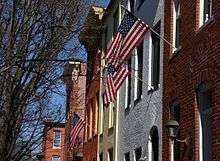
With hundreds of identified districts, Baltimore has been dubbed "a city of neighborhoods". Famous residents have included the writers Edgar Allan Poe, Edith Hamilton, Frederick Douglass, and H.L. Mencken; jazz musician James "Eubie" Blake; singer Billie Holiday; actor and filmmaker John Waters; and baseball player Babe Ruth. In the War of 1812, Francis Scott Key wrote The Star-Spangled Banner, later the American national anthem, in the city.[17]
History
The city has 289 properties listed on the National Register of Historic Places.
The historical records of the government of Baltimore are located at the Baltimore City Archives.
Etymology
The city is named after Cecil Calvert, second Lord Baltimore,[18] (1605–1675),[19] of the Irish House of Lords and founding proprietor of the Province of Maryland.[20][21] Baltimore Manor was the name of the estate in County Longford on which the Calvert family lived in Ireland.[21][22] Baltimore is an anglicization of the Irish name Baile an Tí Mhóir, meaning "town of the big house."[21]
17th century
In 1608, Captain John Smith traveled 210 miles from Jamestown to the uppermost Chesapeake Bay, leading the first European expedition to the Patapsco River [23] The name "Patapsco" is derived from pota-psk-ut, which translates to "backwater" or "tide covered with froth" in Algonquian dialect.[24] A quarter century after John Smith's voyage, English colonists began to settle in Maryland. The area constituting the modern City of Baltimore and its metropolitan area was first settled by David Jones in 1661. He claimed the area known today as Harbor East on the east bank of the Jones Falls stream, which flows south into Baltimore's Inner Harbor.[25]
In the early 1600s, the immediate Baltimore vicinity was sparsely populated, if at all, by Native Americans. The Baltimore County area northward was used as hunting grounds by the Susquehannocks living in the lower Susquehanna River valley who "controlled all of the upper tributaries of the Chesapeake" but "refrained from much contact with Powhatan in the Potomac region." [26] Pressured by the Susquehannocks, the Piscataway tribe of Algonquians stayed well south of the Baltimore area and inhabited primarily the north bank of the Potomac River in what is now Charles and southern Prince George's south of the Fall Line.[27][28][29] The Baltimore area had been inhabited by Native Americans since at least the 10th millennium BC, when Paleo-Indians first settled in the region. One Paleo-Indian site and several Archaic period and Woodland period archaeological sites have been identified in Baltimore, including four from the Late Woodland period.[30] During the Late Woodland period, the archaeological culture that is called the "Potomac Creek complex" resided in the area from Baltimore to the Rappahannock River in Virginia.[31]
The current Baltimore on the Patapsco River was established in 1729, but an earlier Baltimore existed on the Bush River as early as 1674, The first county seat of Baltimore County is known today as "Old Baltimore". It was located on the Bush River on land that in 1773 became part of Harford County. In 1674, the General Assembly passed "An Act for erecting [sic] a Court-house and Prison in each County within this Province." The site of the court house and jail for Baltimore County was evidently "Old Baltimore" near the Bush River. We know this because in 1683, the General Assembly passed "An Act for Advancement of Trade" to "establish towns, ports, and places of trade, within the province." One of the towns established by the act in Baltimore County was "on Bush River, on Town Land, near the Court-House." The court house on the Bush River referenced in the 1683 Act was in all likelihood the one created by the 1674 Act. "Old Baltimore" was in existence as early as 1674, but we don't know with certainty what if anything happened on the site prior to that year. The exact location of Old Baltimore was lost for years. It was certain that the location was somewhere on the site of the present-day Aberdeen Proving Grounds (APG), a U.S. Army testing facility. APG’s Cultural Resource Management Program took up the task of finding Old Baltimore. The firm of R. Christopher Goodwin & Associates (Goodwin) was contracted for the project. After Goodwin first performed historical and archival work, they coordinated their work with existing landscape features to locate the site of Old Baltimore. APG’s Explosive Ordnance Disposal personnel went in with Goodwin to defuse any unexploded ordnance. The field team worked from fall 1997 through winter 1998. The team dug 420 test pits, and they uncovered several artifacts...." [32] [33] [34]
18th and 19th centuries
The colonial General Assembly of Maryland created the Port of Baltimore at old Whetstone Point (now Locust Point) in 1706 for the tobacco trade. The Town of Baltimore was founded and laid out shortly thereafter on July 30, 1729, and is named after Lord Baltimore (Cecilius Calvert), who was the first Proprietary Governor of the Province of Maryland. Cecilius Calvert was the oldest son of Sir George Calvert, (1579–1632), who became the First Lord Baltimore of County Longford, Ireland in 1625. Previously, he had been a loyal agent of King Charles I of England (1600–1649) as his Secretary of State until declaring himself a follower of Roman Catholicism. Regardless, the King still gave his heir Cecil the 1632 grant for the Maryland colony. The colony was a followup to his earlier settlement in Newfoundland, known as "Acadia" or "Avalon", (future Canada), which he found too cold and difficult for habitation.[35]
Baltimore grew swiftly in the 18th Century as a granary for sugar-producing colonies in the Caribbean. The profit from sugar encouraged the cultivation of cane and the importation of food.[36] It was also during this time when Baltimore saw the establishment of its public market system in 1763.[37] Lexington Market, founded in 1782, continues to be known as one of the oldest continuously operating public markets in the United States today.[38] Other firsts include: the first Post Office System in the United States (inaugurated in 1774)[39] and the first water company chartered in the United States (Baltimore Water Company, 1792).[40][41]
Baltimore played a key part in events leading to and including the American Revolution. City leaders such as Jonathan Plowman Jr. moved the city to join the resistance to British taxes, and merchants signed agreements to not trade with Britain.[42] The Second Continental Congress met in the Henry Fite House from December 1776 to February 1777, effectively making the city the capital of the United States during this period.[43] After the Revolutionary war, the Town of Baltimore, nearby Jonestown, and an area known as Fells Point were incorporated as the City of Baltimore in 1796–1797. The city remained a part of surrounding Baltimore County, where it had also served as the "county seat" since 1768, until 1851 when it was made an independent city, with the same status in state government as the other 23 counties of Maryland.[44]
The city was the site of the Battle of Baltimore during the War of 1812. After burning Washington, D.C., the British attacked Baltimore outside the eastern outskirts of town on the "Patapsco Neck" on September 12, at the Battle of North Point, then on the night of September 13–14, 1814. United States forces from Fort McHenry successfully defended the city's harbor from the British. Francis Scott Key, (1779–1843), a Maryland lawyer from Georgetown and Frederick, was aboard a British ship where he had been negotiating for the release of an American prisoner, Dr. William Beanes.
Key witnessed the bombardment from this ship and after seeing the huge American flag on the morning of September 14, 1814, he wrote "The Star-Spangled Banner", a poem recounting the attack. Key's poem was set to a 1780 tune by British composer John Stafford Smith, and "The Star-Spangled Banner" became the official national anthem of the United States in 1931.
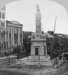
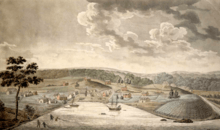
Following the Battle of Baltimore, the city's population grew rapidly and was the first American city to illuminate its streets with hydrogen gas in 1816. The construction of the federally funded National Road (which later became part of U.S. Route 40) and the private Baltimore and Ohio Railroad (B. & O.) made Baltimore a major shipping and manufacturing center by linking the city with major markets in the Midwest. A distinctive local culture started to take shape, and a unique skyline peppered with churches and monuments developed. Baltimore acquired its moniker "The Monumental City" after an 1827 visit to Baltimore by President John Quincy Adams. At an evening function Adams gave the following toast: "Baltimore: the Monumental City—May the days of her safety be as prosperous and happy, as the days of her dangers have been trying and triumphant."[46] Baltimore suffered one of the worst riots of the antebellum South in 1835, when bad investments led to the Baltimore bank riot.[47] Soon after the city pioneered in creating the world's first dental college the Baltimore College of Dental Surgery in 1840, and sharing Samuel Morse's invention of the world's first telegraph line between Baltimore and Washington DC in 1844.
Maryland remained part of the Union during the American Civil War despite being a slave state, in addition to popular support for secession in its southern and eastern regions, along with Baltimore, all of which benefited greatly from both the tobacco and slave trades.[48][49] When Union soldiers from the Sixth Massachusetts state militia and some unarmed Pennsylvania state militia known as the "Washington Brigade" from Philadelphia with their band marched through the city at the start of the war, Confederate sympathizers attacked the troops, which led to the first bloodshed in the Civil War during the Baltimore riot of 1861. Four soldiers and twelve civilians were killed during the riot, which caused Union troops to later occupy Baltimore in May under Gen. Benjamin F. Butler of Massachusetts. Maryland came under direct federal administration—in part, to prevent the state from seceding—until the end of the war in April 1865.
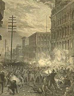
In the midst of the Long Depression, which followed the Panic of 1873, the Baltimore & Ohio Railroad company attempted to lower its workers' wages, leading to strikes and riots in Baltimore, as part of the Great Railroad Strike of 1877. On July 20, 1877, Maryland Governor John Lee Carroll called up the 5th and 6th Regiments of the National Guard to end the strikes, which had disrupted train service at Cumberland in western Maryland. Citizens sympathetic to the railroad workers attacked the National Guard troops as they marched from their armories in Baltimore to Camden Station. Soldiers from the 6th Regiment fired on the crowd, killing 10 and wounding 25. Rioters then damaged B&O trains and burned portions of the rail station. Order was restored in the city on July 21–22 when federal troops arrived to protect railroad property and end the strike.[50]
20th century
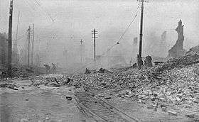
On February 7, 1904, the Great Baltimore Fire destroyed over 1,500 buildings in 30 hours, leaving more than 70 blocks of the downtown area burned to the ground. Damages were estimated at $150 million—in 1904 dollars.[51] As the city rebuilt during the next two years, lessons learned from the fire led to improvements in firefighting equipment standards.[52]
The city grew in area by annexing new suburbs from the surrounding counties, the last being in 1918, when the city acquired portions of Baltimore County and Anne Arundel County.[53] A state constitutional amendment, approved in 1948, required a special vote of the citizens in any proposed annexation area, effectively preventing any future expansion of the city's boundaries.[54]
The relative size of the city's black population grew from 23.8% in 1950 to 46.4% in 1970.[55] The Baltimore riot of 1968 occurred following the assassination of Martin Luther King, Jr. in Memphis, Tennessee, on April 4, 1968. Coinciding with riots in other cities, public order was not restored until April 12, 1968. The Baltimore riot cost the city of Baltimore an estimated $10 million (US$ 68 million in 2016). A total of 11,000 Maryland National Guard and federal troops were ordered into the city.[56]
Lasting effects of the riot can be seen on the streets of North Avenue, Howard Street, Gay Street, and Pennsylvania Avenue, where long stretches of the streets remain barren.[57] The city experienced challenges again in 1974 when teachers, municipal workers, and police officers conducted strikes.[58]
By the beginning of the 1970s, Baltimore's downtown area known as the Inner Harbor had been neglected and was occupied by a collection of abandoned warehouses. The nickname "Charm City" came from a 1975 meeting of advertisers seeking to improve the city's reputation.[59][60] Efforts to redevelop the area started with the construction of the Maryland Science Center, which opened in 1976, the Baltimore World Trade Center (1977), and the Baltimore Convention Center (1979). Harborplace, an urban retail and restaurant complex, opened on the waterfront in 1980, followed by the National Aquarium, Maryland's largest tourist destination, and the Baltimore Museum of Industry in 1981. During the epidemic of HIV/AIDS in the United States, Baltimore City Health Department official Robert Mehl persuaded the city's mayor to form a committee to address food problems; the Baltimore-based charity Moveable Feast grew out of this initiative in 1990.[61][62][63] By 2010, the organization's region of service had expanded from merely Baltimore to include all of the Eastern Shore of Maryland.[64] In 1992, the Baltimore Orioles baseball team moved from Memorial Stadium to Oriole Park at Camden Yards, located downtown near the harbor. Pope John Paul II held an open-air mass at Camden Yards during his papal visit to the United States in October 1995. Three years later the Baltimore Ravens football team moved into M&T Bank Stadium next to Camden Yards.[65]
21st century
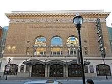
In January 2004, the historic Hippodrome Theatre reopened after significant renovation as part of the France-Merrick Performing Arts Center.[66] The Reginald F. Lewis Museum of Maryland African American History & Culture opened in 2005 on the northeast corner of President Street and East Pratt Street, and the National Slavic Museum in Fell's Point was established in 2012. On April 12, 2012, Johns Hopkins held a dedication ceremony to mark the completion of one of the United States' largest medical complexes – the Johns Hopkins Hospital in Baltimore – which features the Sheikh Zayed Cardiovascular and Critical Care Tower and The Charlotte R. Bloomberg Children's Center. The event, held at the entrance to the $1.1 billion 1.6 million-square-foot-facility, honored the many donors including Sheikh Khalifa bin Zayed Al Nahyan, first president of the United Arab Emirates, and Michael Bloomberg.[67][68]
Maryland's Star-Spangled 200 celebration, launched as the "Star-Spangled Sailabration" and crescendo "Star-Spangled Spectacular" festivals, was a three-year commemoration of the 200th anniversary of the War of 1812 and the penning of The Star-Spangled Banner. The Star-Spangled Sailabration festival brought a total of 45 tall ships, naval vessels and others from the US, United Kingdom, Canada, Colombia, Brazil, Ecuador, and Mexico to Baltimore's Harbor. The event, held June 13–19, 2012, was the week encompassing Flag Day and the 200th anniversary of the Declaration of War.[69][70] The Star-Spangled Spectacular was a 10-day free festival that celebrated the 200th anniversary of the United States National Anthem from September 6–16, 2014. More than 30 naval vessels and tall ships from the United States, United Kingdom, Canada, Norway, Germany, Spain and Turkey berthed at the Inner Harbor, Fell's Point and North Locust Point. An air show from the Navy's Flight Demonstration Team, the Blue Angels performed during both festivals. Special guests such as President Barack Obama, Vice President Joe Biden, and Secretary of the Navy Ray Mabus, were in attendance at Fort McHenry National Monument and Historic Shrine.[71] During the course of the Star-Spangled 200 celebration the city was showcased on three separate live television broadcasts. Visit Baltimore CEO, Tom Noonan, was quoted in the Baltimore Sun as calling the Spectacular, "the largest tourism event in our city's history." Over a million people visited Baltimore during both festivals.[72]
Following the Death of Freddie Gray in April 2015, the city experienced major protests and international media attention, which resulted in a temporary curfew being enforced, as well as a drastic rise in murders.[73] On September 19, 2016 the Baltimore City Council approved a $660 million bond deal for the $5.5 billion Port Covington redevelopment project championed by Under Armour founder Kevin Plank and his real estate company Sagamore Development. Port Covington surpassed the Harbor Point development as the largest tax-increment financing deal in Baltimore’s history and it's among the largest urban redevelopment projects in the country.[74] The waterfront development that includes the new headquarters for Under Armour, as well as shops, housing, offices, and manufacturing spaces is projected to create 26,500 permanent jobs with a $4.3 billion annual economic impact.[75] In an open letter Plank refers to the turbulent history in Baltimore's economic development and civic life as "forks in the road." He concludes by saying "we saw one of those great forks in the road, and chose the best course" with Port Covington.[76] Mayor Stephanie Rawlings-Blake led the signing of three bills that commit the city to the sale of bonds over the next 15 to 20 years to fund the infrastructure for the Port Covington development on September 28, 2016.[77]
Geography
Baltimore is in north-central Maryland on the Patapsco River close to where it empties into the Chesapeake Bay. The city is also located on the fall line between the Piedmont Plateau and the Atlantic Coastal Plain, which divides Baltimore into "lower city" and "upper city". The city's elevation ranges from sea level at the harbor to 480 feet (150 m) in the northwest corner near Pimlico.[5]
According to the 2010 Census, the city has a total area of 92.1 square miles (239 km2), of which 80.9 sq mi (210 km2) is land and 11.1 sq mi (29 km2) is water.[4] The total area is 12.1 percent water.
Baltimore is almost completely surrounded by Baltimore County, but is politically independent of it. It is bordered by Anne Arundel County to the south.
Cityscape
Architecture
Baltimore exhibits examples from each period of architecture over more than two centuries, and work from many famous architects such as Benjamin Latrobe, George A. Frederick, John Russell Pope, Mies van der Rohe and I. M. Pei.
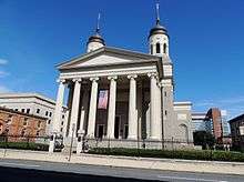
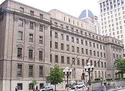
The city is rich in architecturally significant buildings in a variety of styles. The Baltimore Basilica (1806–1821) is a neoclassical design by Benjamin Latrobe, and also the oldest Catholic cathedral in the United States. In 1813 Robert Cary Long, Sr., built for Rembrandt Peale the first substantial structure in the United States designed expressly as a museum. Restored, it is now the Municipal Museum of Baltimore, or popularly the Peale Museum.
The McKim Free School was founded and endowed by John McKim, although the building was erected by his son Isaac in 1822 after a design by William Howard and William Small. It reflects the popular interest in Greece when the nation was securing its independence, as well as a scholarly interest in recently published drawings of Athenian antiquities.
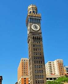
The Phoenix Shot Tower (1828), at 234.25 feet (71.40 m) tall, was the tallest building in the United States until the time of the Civil War. It was constructed without the use of exterior scaffolding. The Sun Iron Building, designed by R.C. Hatfield in 1851, was the city's first iron-front building and was a model for a whole generation of downtown buildings. Brown Memorial Presbyterian Church, built in 1870 in memory of financier George Brown, has stained glass windows by Louis Comfort Tiffany and has been called "one of the most significant buildings in this city, a treasure of art and architecture" by Baltimore Magazine.[78][79]
The 1845 Greek Revival-style Lloyd Street Synagogue is one of the oldest synagogues in the United States. The Johns Hopkins Hospital, designed by Lt. Col. John S. Billings in 1876, was a considerable achievement for its day in functional arrangement and fireproofing.
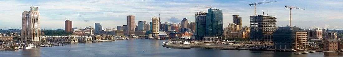
I.M. Pei's World Trade Center (1977) is the tallest equilateral pentagonal building in the world at 405 feet (123 m) tall.
The Inner Harbor East area has seen the addition of two new towers which have completed construction: a 24-floor tower that is the new world headquarters of Legg Mason, and a 21-floor Four Seasons Hotel complex.
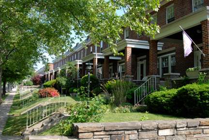
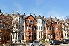
The streets of Baltimore are organized in a grid pattern, lined with tens of thousands of brick and formstone-faced rowhouses. In The Baltimore Rowhouse, Mary Ellen Hayward and Charles Belfoure considered the rowhouse as the architectural form defining Baltimore as "perhaps no other American city."[80] In the mid-1790s, developers began building entire neighborhoods of the British-style rowhouses, which became the dominant house type of the city early in the 19th century.[81]
Formstone facings, now a common feature on Baltimore rowhouses, were an addition patented in 1937 by Albert Knight. John Waters characterized formstone as "the polyester of brick" in a 30-minute documentary film, Little Castles: A Formstone Phenomenon.[82]
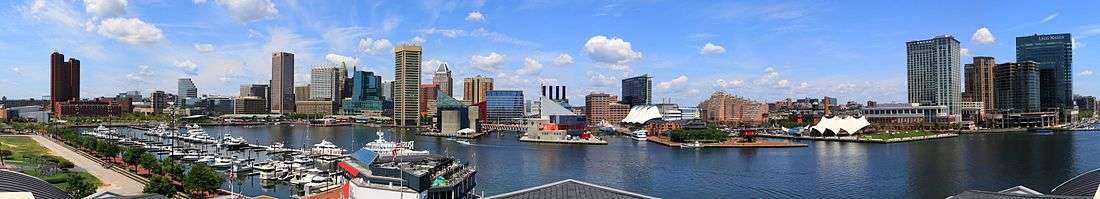
Oriole Park at Camden Yards is considered by many to be the most beautiful baseball park in Major League Baseball, and has inspired many other cities to build their own versions of this retro style ballpark. Camden Yards along with the National Aquarium have helped revive the Inner Harbor from what once was an industrial district full of dilapidated warehouses into a bustling commercial district full of bars, restaurants and retail establishments. Today, the Inner Harbor boasts the highest, most desirable real estate in the Mid-Atlantic.[83]
Baltimore's newly rehabilitated Everyman Theatre was honored by the Baltimore Heritage at the 2013 Preservation Awards Celebration in 2013. Everyman Theatre will receive an Adaptive Reuse and Compatible Design Award as part of Baltimore Heritage's 2013 historic preservation awards ceremony. Baltimore Heritage is Baltimore's nonprofit historic and architectural preservation organization, which works to preserve and promote Baltimore's historic buildings and neighborhoods.[84]
Tallest buildings
| Rank | Building | Height | Floors | Built | |
|---|---|---|---|---|---|
| 1 | Transamerica Tower (formerly the Legg Mason Building, originally built as the U.S. Fidelity and Guarantee Co. Building)[85] | 529 feet (161 m) | 40 | 1971–73 | [86] |
| 2 | Bank of America Building (originally built as Baltimore Trust Building, later Sullivan, Mathieson, Md. Nat. Bank, NationsBank Bldgs.) | 509 feet (155 m) | 37 | 1924–29 | [87] |
| 3 | William Donald Schaefer Tower (originally built as the Merritt S. & L. Tower) | 493 feet (150 m) | 37 | 1992 | [88] |
| 4 | Commerce Place (Alex. Brown & Sons/Deutsche Bank Tower) | 454 feet (138 m) | 31 | 1992 | [89] |
| 5 | 100 East Pratt Street (originally built as the I.B.M. Building) | 418 feet (127 m) | 28 | 1975/1992 | [90] |
| 6 | Baltimore World Trade Center | 405 feet (123 m) | 28 | 1977 | [91] |
| 7 | Tremont Plaza Hotel | 395 feet (120 m) | 37 | 1967 | [92] |
| 8 | Charles Towers South | 385 feet (117 m) | 30 | 1969 | [93] |
| 9 | Blaustein Building | 360 feet (110 m) | 30 | 1962 | [94] |
| 10 | 250 West Pratt Street | 360 feet (110 m) | 24 | 1986 | [95] |
Neighborhoods
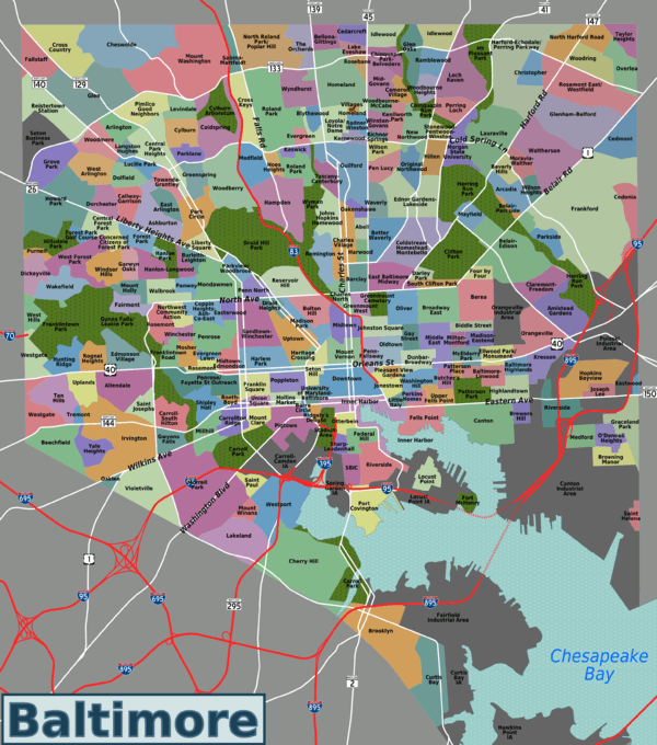
Baltimore is officially divided into nine geographical regions: North, Northeast, East, Southeast, South, Southwest, West, Northwest, and Central, with each district patrolled by a respective Baltimore Police Department. Interstate 83 and Charles Street down to Hanover Street and Ritchie Highway serve as the east-west dividing line and Eastern Avenue to Route 40 as the north-south dividing line. However, Baltimore Street is north-south dividing line for the U.S. Postal Service.[96] It is not uncommon for locals to divide the city simply by East or West Baltimore, using Charles Street or I-83 as a dividing line or into North and South using Baltimore Street as a dividing line.
Central Baltimore
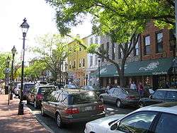
Central Baltimore, originally called the Middle District,[97] stretches north of the Inner Harbor up to the edge of Druid Hill Park. Downtown Baltimore has mainly served as a commercial district with limited residential opportunities. However, between 2000 and 2010, the downtown population grew 130 percent as old commercial properties have been replaced by residential property.[98] Still the city's main commercial area and business district, it includes Baltimore's sports complexes: Oriole Park at Camden Yards, M&T Bank Stadium, and the Baltimore Arena; and the shops and attractions in the Inner Harbor: Harborplace, the Baltimore Convention Center, the National Aquarium, Maryland Science Center, Pier Six Pavilion, and Power Plant Live.[96]
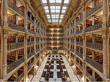
The University of Maryland, Baltimore, the University of Maryland Medical Center, and Lexington Market are also in the central district, as well as the Hippodrome and many nightclubs, bars, restaurants, shopping centers and various other attractions.[96][97] The northern portion of Central Baltimore, between downtown and the Druid Hill Park, is home to many of the city's cultural opportunities. Maryland Institute College of Art, the Peabody Institute (music conservatory), George Peabody Library, Enoch Pratt Free Library – Central Library, the Lyric Opera House, the Joseph Meyerhoff Symphony Hall, the Walters Art Museum, the Maryland Historical Society and its Enoch Pratt Mansion, and several galleries are located in this region.[99]
North Baltimore

North Baltimore lies directly north of Central Baltimore and is bounded on the east by The Alameda and on the west by Pimlico Road. Loyola University Maryland, Johns Hopkins University Homewood Campus, St. Mary's Seminary and University and Notre Dame of Maryland University are located in this district. Baltimore Polytechnic Institutehigh school for mathematics, science and engineering, and adjacent Western High School, the oldest remaining public girls secondary school in America, share a joint campus at West Cold Spring Lane and Falls Road.
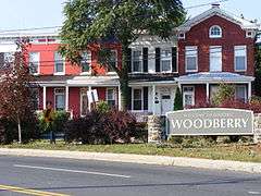
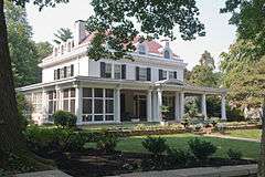
Several historic and notable neighborhoods are in this district: Roland Park (1891), Guilford (1913), Homeland (1924), Hampden, Woodberry, Old Goucher, and Jones Falls. Along the York Road corridor going north are the large neighborhoods of Charles Village, Waverly, and Mount Washington. The Station North Arts and Entertainment District is also located in North Baltimore.[100]
South Baltimore
South Baltimore, a mixed industrial and residential area, consists of the "Old South Baltimore" peninsula below the Inner Harbor and east of the old B&O Railroad's Camden line tracks and Russell Street downtown. It is a culturally, ethnically, and socioeconomically diverse waterfront area with neighborhoods such as Locust Point and Riverside around a large park of the same name.[101] Just south of the Inner Harbor, the historic Federal Hill neighborhood, is home to many working professionals, pubs and restaurants. At the end of the peninsula is historic Fort McHenry, a National Park since the end of World War I, when the old U.S. Army Hospital surrounding the 1798 star-shaped battlements was torn down.[102]
The area south of the Vietnam Veterans (Hanover Street) Bridge and the Patapsco River was annexed to the city in 1919 from being independent towns in Anne Arundel County. Across the Hanover Street Bridge are residential areas such as Cherry Hill,[103] Brooklyn, and Curtis Bay, with Fort Armistead bordering the city's south side from Anne Arundel County.
Northeast Baltimore
Northeast is primarily a residential neighborhood, home to Morgan State University, bounded by the city line of 1919 on its northern and eastern boundaries, Sinclair Lane, Erdman Avenue, and Pulaski Highway to the south and The Alameda on to the west. Also in this wedge of the city on 33rd Street is Baltimore City College high school, third oldest active public secondary school in the United States, founded downtown in 1839.[104] Across Loch Raven Boulevard is the former site of the old Memorial Stadium for the Baltimore Colts and Baltimore Orioles, now replaced by an YMCA athletic and housing complex.[105][106] Lake Montebello is in Northeast Baltimore.[97]
East Baltimore
Located below Sinclair Lane and Erdman Avenue, above Orleans Street, East Baltimore is mainly made up of residential neighborhoods. This section of East Baltimore is home to Johns Hopkins Hospital and Johns Hopkins University School of Medicine on Broadway. Notable neighborhoods include: Armistead Gardens, Broadway East, Barclay, Ellwood Park, Greenmount, and McElderry Park.[97]
This area was the on-site film location for Homicide: Life on the Street, The Corner and The Wire.[107]
Southeast Baltimore
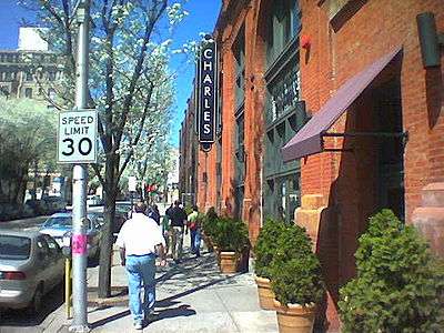
Southeast Baltimore, located below Fayette Street, bordering the Inner Harbor and the Northwest Branch of the Patapsco River to the west, the city line of 1919 on its eastern boundaries and the Patapsco River to the south, is a mixed industrial and residential area. Patterson Park, the "Best Backyard in Baltimore,"[108] as well as the Highlandtown Arts District, and Johns Hopkins Bayview Medical Center are located in Southeast Baltimore. The Shops at Canton Crossing opened in 2013.[109] The Canton neighborhood, is located along Baltimore's prime waterfront. Other historic neighborhoods include: Fells Point, Patterson Park, Butchers Hill, Highlandtown, Greektown, Harbor East, Little Italy, and Upper Fells Point.[97]
Northwest Baltimore
Northwestern is bounded by the county line to the north and west, Gwynns Falls Parkway on the south and Pimlico Road on the east, is home to Pimlico Race Course and Sinai Hospital. Its neighborhoods are mostly residential and are dissected by Northern Parkway. The area was the center of Baltimore's Jewish community after World War II. Notable neighborhoods include: Pimlico, Mount Washington, and Cheswolde, and Park Heights.[110]
West Baltimore
West Baltimore is located west of downtown and the Martin Luther King, Jr. Boulevard and is bounded by Gwynns Falls Parkway, Fremont Avenue, and West Baltimore Street. The Old West Baltimore Historic District includes the neighborhoods of Harlem Park, Sandtown-Winchester, Druid Heights, Madison Park, and Upton.[111][112] Originally a predominantly German neighborhood, by the last half of the 1800s, Old West Baltimore was home to a substantial section of the city's African American population. It became the largest neighborhood for the city's black community and its cultural, political, and economic center.[111] Coppin State University, Mondawmin Mall, and Edmondson Village are located in this district. The area's crime problems have provided subject material for television series, such as The Wire.[113] Local organizations, such as the Sandtown Habitat for Humanity and the Upton Planning Committee, have been steadily transforming parts of formerly blighted areas of West Baltimore into clean, safe communities.[114][115]
Southwest Baltimore
Southwest Baltimore is bounded by the Baltimore County line to the west, West Baltimore Street to the north, and Martin Luther King Jr. Boulevard and Russell Street/Baltimore-Washington Parkway (Maryland Route 295) to the east. Notable neighborhoods in Southwest Baltimore include: Pigtown, Carrolton Ridge, Ridgely's Delight, Leakin Park, Violetville, Lakeland, and Morrell Park.[97]
St. Agnes Hospital on Wilkens and Caton[97] avenues is located in this district with the neighboring Cardinal Gibbons High School, which is the former site of Babe Ruth's alma mater, St. Mary's Industrial School. Also through this segment of Baltimore ran the beginnings of the historic National Road, which was constructed beginning in 1806 along Old Frederick Road and continuing into the county on Frederick Road into Ellicott City, Maryland. Other sides in this district are: Carroll Park, one of the city's largest parks, the colonial Mount Clare Mansion, and Washington Boulevard, which dates to pre-Revolutionary War days as the prime route out of the city to Alexandria, Virginia, and Georgetown on the Potomac River.

Adjacent communities
The City of Baltimore is bordered by the following communities, all unincorporated census-designated places.
Climate
Under the Köppen classification, Baltimore lies within the humid subtropical climate zone (Cfa), with four distinct seasons, and is part of USDA plant hardiness zones 7b and 8a.[116] Winters are chilly but variable, with sporadic snowfall: January has a daily average of 35.8 °F (2.1 °C),[117] though temperatures reach 50 °F (10 °C) rather often and drop below 20 °F (−7 °C) when Arctic air masses affect the area.[117]
The average seasonal snowfall is 20.1 inches (51 cm),[118] but it varies greatly depending on the winter, with some seasons seeing minimal snow while others see several major Nor'easters. [lower-alpha 1] Due to lessened urban heat island (UHI) as compared to the city proper and distance from the moderating Chesapeake Bay, the outlying and inland parts of the Baltimore metro area are usually cooler, especially at night, than the city proper and the coastal towns. Thus, in the northern and western suburbs, winter snowfall is more significant, and some areas average more than 30 in (76 cm) of snow per winter.[120] It is by no means uncommon for the rain-snow line to set up in the metro area.[121] Freezing rain and sleet occurs a few times each winter in the area, as warm air overrides cold air at the low to mid-levels of the atmosphere. When the wind blows from the east, the cold air gets dammed against the mountains to the west and the result is freezing rain or sleet.
Spring and autumn are warm, with spring being the wettest season in terms of the number of precipitation days. Summers are hot and humid with a daily average in July of 80.7 °F (27.1 °C),[117] and the combination of heat and humidity leads to rather frequent thunderstorms. A southeasterly bay breeze off the Chesapeake often occurs on summer afternoons when hot air rises over inland areas; prevailing winds from the southwest interacting with this breeze as well as the city proper's UHI can seriously exacerbate air quality.[122][123] In late summer and early autumn the track of hurricanes or their remnants may cause flooding in downtown Baltimore, despite the city being far removed from the typical coastal storm surge areas.[124]
Extreme temperatures range from −7 °F (−22 °C) on February 9, 1934, and February 10, 1899,[lower-alpha 2] up to 108 °F (42 °C) on July 22, 2011.[125][126] On average, 100 °F (38 °C)+ temperatures occur on 0.9 days annually, 90 °F (32 °C)+ on 37 days, and there are 10 days where the high fails to breach the freezing mark.[117]
| Climate data for Baltimore (1981−2010 normals)[lower-alpha 3] | |||||||||||||
|---|---|---|---|---|---|---|---|---|---|---|---|---|---|
| Month | Jan | Feb | Mar | Apr | May | Jun | Jul | Aug | Sep | Oct | Nov | Dec | Year |
| Average high °F (°C) | 42.4 (5.8) |
45.7 (7.6) |
53.9 (12.2) |
65.5 (18.6) |
75.2 (24) |
85.0 (29.4) |
89.0 (31.7) |
87.0 (30.6) |
80.3 (26.8) |
68.4 (20.2) |
57.7 (14.3) |
46.1 (7.8) |
66.4 (19.1) |
| Average low °F (°C) | 29.2 (−1.6) |
31.4 (−0.3) |
38.8 (3.8) |
47.6 (8.7) |
56.9 (13.8) |
67.1 (19.5) |
72.5 (22.5) |
70.9 (21.6) |
63.8 (17.7) |
51.8 (11) |
42.9 (6.1) |
32.8 (0.4) |
50.5 (10.3) |
| Average precipitation inches (mm) | 2.92 (74.2) |
2.60 (66) |
3.86 (98) |
3.22 (81.8) |
3.49 (88.6) |
3.27 (83.1) |
4.62 (117.3) |
3.39 (86.1) |
4.09 (103.9) |
3.05 (77.5) |
2.97 (75.4) |
3.41 (86.6) |
40.89 (1,038.5) |
| Average snowfall inches (cm) | 6.8 (17.3) |
8.0 (20.3) |
1.9 (4.8) |
trace | 0 (0) |
0 (0) |
0 (0) |
0 (0) |
0 (0) |
0 (0) |
0.4 (1) |
3.0 (7.6) |
20.1 (51.1) |
| Average precipitation days (≥ 0.01 in) | 9.5 | 8.4 | 10.5 | 11.1 | 11.2 | 10.8 | 10.7 | 9.2 | 8.9 | 8.3 | 8.8 | 9.9 | 117.3 |
| Average snowy days (≥ 0.1 in) | 3.5 | 2.8 | 1.1 | 0.1 | 0 | 0 | 0 | 0 | 0 | 0 | 0.3 | 1.7 | 9.5 |
| Average relative humidity (%) | 63.2 | 61.3 | 59.2 | 58.9 | 66.1 | 68.4 | 69.1 | 71.1 | 71.3 | 69.5 | 66.5 | 65.5 | 65.8 |
| Mean monthly sunshine hours | 155.4 | 164.0 | 215.0 | 230.7 | 254.5 | 277.3 | 290.1 | 264.4 | 221.8 | 205.5 | 158.5 | 144.5 | 2,581.7 |
| Percent possible sunshine | 51 | 54 | 58 | 58 | 57 | 62 | 64 | 62 | 59 | 59 | 52 | 49 | 58 |
| Source: NOAA (relative humidity and sun 1961–1990)[117][118][127][128][129] | |||||||||||||
Demographics
| Historical population | |||
|---|---|---|---|
| Census | Pop. | %± | |
| 1790 | 13,503 | — | |
| 1800 | 26,514 | 96.4% | |
| 1810 | 46,555 | 75.6% | |
| 1820 | 62,738 | 34.8% | |
| 1830 | 80,620 | 28.5% | |
| 1840 | 102,313 | 26.9% | |
| 1850 | 169,054 | 65.2% | |
| 1860 | 212,418 | 25.7% | |
| 1870 | 267,354 | 25.9% | |
| 1880 | 332,313 | 24.3% | |
| 1890 | 434,439 | 30.7% | |
| 1900 | 508,957 | 17.2% | |
| 1910 | 558,485 | 9.7% | |
| 1920 | 733,826 | 31.4% | |
| 1930 | 804,874 | 9.7% | |
| 1940 | 859,100 | 6.7% | |
| 1950 | 949,708 | 10.5% | |
| 1960 | 939,024 | −1.1% | |
| 1970 | 905,787 | −3.5% | |
| 1980 | 786,741 | −13.1% | |
| 1990 | 736,014 | −6.4% | |
| 2000 | 651,154 | −11.5% | |
| 2010 | 620,961 | −4.6% | |
| Est. 2015 | 621,849 | [130] | 0.1% |
| U.S. Decennial Census[131] 1790–1960[132] 1900–1990[133] 1990–2000[134] 2010–2015[135] | |||
At the 2010 Census, there were 620,961 people residing in Baltimore, a decrease of 4.6% since 2000; a substantially more significant decline of 23% happened among school age children (ages 5 to 17).[136] The 2012 Census estimate has the population of Baltimore at 621,342 as of July 2012, an increase of 1,100 residents over the previous year and the first increase in population since its peak in 1950.[137] After decades of decline, downtown Baltimore and its surrounding neighborhoods are seeing a resurgence of young professionals and immigrants, mirroring major cities across the country. The increase, attributed to growing international migration and fewer people abandoning the city, is the second census estimate since Mayor Stephanie Rawlings-Blake announced at her inauguration in December 2011 that her main goal is to increase the city's population by "10,000 families" within a decade.[136] Gentrification of the surrounding 401 District has grown significantly over the past 10 years in Central and eastern portions of the city.[138]
| Racial composition | 2010 |
|---|---|
| White | 29.6% |
| —Non-Hispanic White | 28% |
| Black or African-American | 63.7% |
| Hispanic or Latino (of any race) | 4.2% |
| Asian | 2.3% |
| Native American or Alaskan Native | 0.4% |
| Other | 1.8% |
| Two or more races | 4.2% |
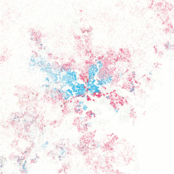
According to the 2010 Census, 63.7% of the population was Black, 29.6% White, 0.4% American Indian and Alaska Native, 2.3% Asian, 1.8% from some other race and 2.1% of two or more races. 4.2% of Baltimore's population was of Hispanic, Latino, or Spanish origin (they may be of any race). Non-Hispanic Whites were 28% of the population.[139]
After New York City, Baltimore was the second city in the United States to reach a population of 100,000.[140][141] From the 1830 through 1850 U.S. censuses, Baltimore was the second most-populous city,[141][142] before being surpassed by Philadelphia in 1860.[143] It was among the top 10 cities in population in the United States in every census up to the 1980 census,[144] and after World War II had a population of nearly a million.
Although Baltimore's population has continued to decline since 1950, the number of families living downtown has increased significantly in recent years, according to the Downtown Partnership of Baltimore, Inc. Downtown Baltimore's core area experienced a population increase of 130% since 2000. The area in a one-mile radius of downtown between Pratt and Light streets grew 13.6% during that time as well. New construction and the conversion of obsolete commercial buildings into residences has been a primary factor for growth in the central city. The average household income in downtown increased 39.7% from $45,895 to $64,128.[98] Despite the increase in the number of families, Baltimore's downtown still lost about 10,000 total residents since the 2000 Census, a decline of about 6%.[145]
According to the U.S. Census Bureau, Baltimore's population lived in a total of 294,579 housing units in 2009. Age ranges were 22.4% under 18 years old, 11.8% at age 65 or older, and 65.8% from 18 to 64 years old. Baltimore's population was 53.4% female.[146] The median age is 35 years old.
A statistical abstract prepared by the U.S. Census Bureau estimated the median income for a household in the city during 2008 at $30,078, and the median income for a family at $48,216. The same abstract also listed a per capita income of $22,885 for the city in 2008, with 15.4% of families and 19.3% of the population below the poverty line.[147]
Housing in Baltimore is relatively inexpensive for large, coastal cities of its size. The median sale price for homes in Baltimore in 2012 was $95,000.[148] Despite the housing collapse, and along with the national trends, Baltimore residents still face slowly increasing rent (up 3% in the summer of 2010).[149]
The homeless population in Baltimore is steadily increasing; it exceeded 4,000 people in 2011. The increase in the number of young homeless people was particularly severe.[150] The Baltimore—Towson metropolitan area is home to a self-identifying gay and bisexual community estimated at 100,031 individuals, the 18th largest in the United States.[151] In 2012, voters statewide approved the legalization of same-sex marriage in Maryland and authorized them to take place beginning January 1, 2013.[152]
| | ||
| Race | Population | % of Total |
|---|---|---|
| Total | 620,961 | 100 |
| African American | 395,781 | 63 |
| White | 183,830 | 29 |
| Asian | 14,548 | 2 |
| Two or More Races | 12,955 | 2 |
| Other | 11,303 | 1 |
| American Indian | 2,270 | < 1% |
| Three or more races | 1,402 | < 1% |
| Native Hawaiian Pacific Islander | 274 | < 1% |
| [153] | ||
Religion
47.33% of the people in Baltimore, Maryland are religious, meaning they affiliate with a religion. 11.85% are Catholic, 0.30% are LDS, and 11.42% are another Christian faith. This includes the next largest affiliation the Baptist Church, which makes up about 7% of the population. The Jewish population of the city is much higher than the average city. About 4.3% of the population is Jewish, compared to the average city, which is only about 0.7% Jewish; 0.10% are an eastern faith; 0.55% affiliates with Islam.[154][155]
Languages
As of 2010, 90.92% (526,705) of Baltimore residents aged five and older spoke only English at home. In addition, 3.74% (21,661) spoke Spanish, 0.77% (4,442) African languages, 0.70% (4,078) French, and 0.56% (3,237) spoke Chinese.[156]
Crime
Crime in Baltimore, generally concentrated in areas high in poverty and drug activity, has been above the national average for many years. Baltimore ended 2015, with 344 homicides. [157] continuing a higher per capita homicide rate (52.5 per 100,000 people) than the record set in 1993.[158][159]
In 2011, Baltimore police reported 196 homicides, the lowest number of slayings in the city since a count of 197 homicides in 1978 and far lower than the peak homicide count of 353 slayings in 1993. City leaders credit a sustained focus on repeat violent offenders and increased community engagement for the continued drop, reflecting a nationwide decline in crime.[160][161]
On August 8, 2014, Baltimore's new youth curfew law went into effect. It prohibits unaccompanied children under age 14 from being on the streets after 9 p.m. and those aged 14–16 from being out after 10 p.m. during the week and 11 p.m. on weekends and during the summer. The goal is to keep children out of dangerous places and reduce crime.[162]
Crime in Baltimore reached another peak in 2015 when the year's tally of 344 homicides was second only to the record 353 in 1993, when Baltimore had about 100,000 more residents. The killings in 2015 were on pace with recent years in the early months of 2015 but skyrocketed after the unrest and rioting of late April. In five of the next eight months, killings topped 30 or 40 a month. Nearly 90 percent of 2015's homicides were the result of shootings, renewing calls for new gun laws. Counting nonfatal shootings, gun violence was up more than 75 percent compared to 2014, with more than 900 people shot.
Economy
Once a predominantly industrial town, with an economic base focused on steel processing, shipping, auto manufacturing (General Motors Baltimore Assembly), and transportation, the city experienced deindustrialization which cost residents tens of thousands of low-skill, high-wage jobs.[163] The city now relies on a low-wage service economy, which accounts for 31% of jobs in the city.[164][165] Around the turn of the century, Baltimore was the leading US manufacturer of rye whiskey and straw hats. It also led in refining of crude oil, brought to the city by pipeline from Pennsylvania.[166]
As of March 2015 the U.S. Bureau of Labor Statistics calculates Baltimore's unemployment rate at 8.1%[167] while one quarter of Baltimore residents (and 37% of Baltimore children) live in poverty.[168] The 2012 closure of a major steel plant at Sparrows Point is expected to have a further impact on employment and the local economy.[169] The Census Bureau reported in 2013 that 207,000 workers commute into Baltimore city each day.[170] Downtown Baltimore is the primary economic asset within Baltimore City and the region with 29.1 million square feet of office space. The tech sector is rapidly growing as the Baltimore metro ranks 8th in the CBRE Tech Talent Report among 50 U.S. metro areas for high growth rate and number of tech professionals.[171] Forbes ranked Baltimore fourth among America's "new tech hot spots".[172]
The city is home to the Johns Hopkins Hospital. Other large companies in Baltimore include Under Armour,[173] Cordish Company,[174] Legg Mason, McCormick & Company, T. Rowe Price, and Royal Farms.[175] A sugar refinery owned by American Sugar Refining is one of Baltimore's cultural icons. Nonprofits based in Baltimore include Lutheran Services in America and Catholic Relief Services.
Almost a quarter of the jobs in the Baltimore region were in science, technology, engineering and math as of mid 2013, in part attributed to the city's extensive undergraduate and graduate schools; maintenance and repair experts were included in this count.[176]
Port
The center of international commerce for the region is the World Trade Center Baltimore. It houses the Maryland Port Administration and U.S. headquarters for major shipping lines. Baltimore is ranked 9th for total dollar value of cargo and 13th for cargo tonnage for all U.S. ports. In 2014, total cargo moving through the port totaled 29.5 million tons, down from 30.3 million tons in 2013. The value of cargo traveling through the port in 2014 came to $52.5 billion, down from $52.6 billion in 2013. The Port of Baltimore generates $3 billion in annual wages and salary, as well as supporting 14,630 direct jobs and 108,000 jobs connected to port work. In 2014, the port also generated more than $300 million in taxes. It serves over 50 ocean carriers making nearly 1,800 annual visits. Among all U.S. ports, Baltimore is first in handling automobiles, light trucks, farm and construction machinery; and imported forest products, aluminum, and sugar. The port is second in coal exports. The Port of Baltimore's cruise industry, which offers year-round trips on several lines supports over 500 jobs and brings in over $90 million to Maryland's economy annually. Growth at the port continues with the Maryland Port Administration plans to turn the southern tip of the former steel mill into a marine terminal, primarily for car and truck shipments, but also for anticipated new business coming to Baltimore after the completion of the Panama Canal expansion project.[177]
Tourism
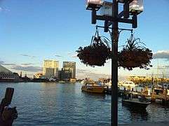
Baltimore's history and attractions have allowed the city to become a strong tourist destination on the East Coast. In 2014, the city hosted 24.5 million visitors, who spent $5.2 billion.[178] The Baltimore Visitor Center, which is operated by Visit Baltimore, is located on Light Street in the Inner Harbor. Much of the city's tourism centers around the Inner Harbor, with the National Aquarium being Maryland's top tourist destination. Baltimore Harbor's restoration has made it "a city of boats", with several historic ships and other attractions on display and open for the public to visit. The USS Constellation, the last Civil War-era vessel afloat, is docked at the head of the Inner Harbor; the USS Torsk, a submarine that holds the Navy's record for dives (more than 10,000); and the Coast Guard cutter Taney, the last surviving U.S. warship that was in Pearl Harbor during the Japanese attack on December 7, 1941, and which engaged Japanese Zero aircraft during the battle.[179]
Also docked is the lightship Chesapeake, which for decades marked the entrance to Chesapeake Bay; and the Seven Foot Knoll Lighthouse, the oldest surviving screw-pile lighthouse on Chesapeake Bay, which once marked the mouth of the Patapsco River and the entrance to Baltimore. All of these attractions are owned and maintained by the Historic Ships in Baltimore organization. The Inner Harbor also is the home port of Pride of Baltimore II, the state of Maryland's "goodwill ambassador" ship, a reconstruction of a famous Baltimore Clipper ship.[179]
Other popular tourist destinations throughout the city include Oriole Park at Camden Yards, Fort McHenry, the Mount Vernon and Fells Point neighborhoods, and museums such as the Walters Art Museum, the Baltimore Museum of Industry, and the B&O Railroad Museum.
-

Baltimore Visitor Center in Inner Harbor
-
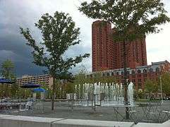
Fountain near visitor center in Inner Harbor
-
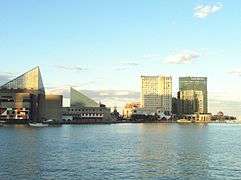
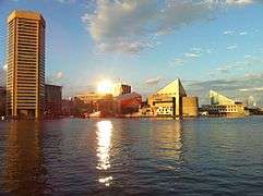
Sunset views from Baltimore's Inner Harbor
-
-
-
-
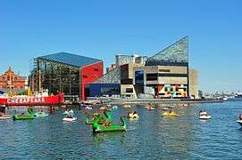
Baltimore is the home of the National Aquarium, one of the world's largest.
Culture
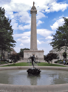
Historically a working-class port town, Baltimore has sometimes been dubbed a "city of neighborhoods", with 72 designated historic districts[180] traditionally occupied by distinct ethnic groups. Most notable today are three downtown areas along the port: the Inner Harbor, frequented by tourists due to its hotels, shops, and museums; Fells Point, once a favorite entertainment spot for sailors but now refurbished and gentrified (and featured in the movie Sleepless in Seattle); and Little Italy, located between the other two, where Baltimore's Italian-American community is based – and where former U.S. House Speaker Nancy Pelosi grew up. Further inland, Mount Vernon is the traditional center of cultural and artistic life of the city; it is home to a distinctive Washington Monument, set atop a hill in a 19th-century urban square, that predates the more well-known monument in Washington, D.C. by several decades. Baltimore also has a significant German American population,[181] and was the second largest port of immigration to the United States, behind Ellis Island in New York and New Jersey. Between 1820 and 1989, almost 2 million who were German, Polish, English, Irish, Russian, Lithuanian, French, Ukrainian, Czech, Greek and Italian came to Baltimore, most between the years 1861 to 1930. By 1913, when Baltimore was averaging forty thousand immigrants per year, World War I closed off the flow of immigrants. By 1970, Baltimore's heyday as an immigration center was a distant memory. There also was a Chinatown dating back to at least the 1880s which consisted of no more than 400 Chinese residents. A local Chinese-American association remains based there, but only one Chinese restaurant as of 2009.
Baltimore has quite a history when it comes to making beer, an art that thrived in Baltimore from the 1800s to the 1950s with over 100 old breweries in the city's past.[182] The best remaining example of that history is the old American Brewery Building on North Gay Street and the National Brewing Company building in the Brewer's Hill neighborhood. In the 1940s the National Brewing Company introduced the nation's first six-pack. National's two most prominent brands, were National Bohemian Beer colloquially "Natty Boh" and Colt 45. Listed on the Pabst website as a "Fun Fact", Colt 45 was named after running back #45 Jerry Hill of the 1963 Baltimore Colts and not the .45 caliber handgun ammunition round. Both brands are still made today and served all around the Baltimore area at bars, Oriole and Ravens games. The Natty Boh logo appears on all cans, bottles, and packaging; and merchandise featuring him can still easily be found in shops in Maryland, including several in Fells Point.
Each year the Artscape takes place in the city in the Bolton Hill neighborhood, due to its proximity to Maryland Institute College of Art. Artscape styles itself as the "largest free arts festival in America".[183] Each May, the Maryland Film Festival takes place in Baltimore, using all five screens of the historic Charles Theatre as its anchor venue. Many movies and television shows have been filmed in Baltimore. The Wire was set and filmed in Baltimore. House of Cards is set in Washington, D.C. but filmed in Baltimore.[184]
Baltimore has cultural museums in many areas of study. The Baltimore Museum of Art, and the Walters Art Museum are internationally renowned for its collection of art. The Baltimore Museum of Art has the largest holding of works by Henri Matisse in the world.[185] The National Great Blacks in Wax Museum is the first African American wax museum in the country, featuring more than 150 life-size and lifelike wax figures.[40]
Cuisine
Baltimore is known for its Maryland blue crabs, crab cake, Old Bay Seasoning, pit beef, and the "chicken box." The city has many restaurants in or around the Inner Harbor. The Little Italy neighborhood's biggest draw is the food. Fells Point also is a foodie neighborhood for tourists and locals and is where the oldest continuously running tavern in the country, "The Horse You Came In On Saloon," is located.[186] Many of the city's upscale restaurants can be found in Harbor East. Five public markets are located across the city. The Baltimore Public Market System is the oldest continuously operating public market system in the United States.[187] Lexington Market is one of the longest-running markets in the world and longest running in the country, having been around since 1782. The market continues to stand at its original site. Baltimore is the last place in America where one can still find arabbers, vendors who sell fresh fruits and vegetables from a horse-drawn cart that goes up and down neighborhood streets.[188] Food- and drink-rating site Zagat ranked Baltimore second in a list of the 17 best food cities in the country in 2015.[189]
Local dialect
One thing visitors quickly notice is that some locals refer to their city as "Balmer", dropping the "t". The traditional local accent, particular to some working-class areas of the city, has long been noted and celebrated as "Baltimorese" or "Bawlmorese". While in other parts of the city, locals refer to their city as "Baldamore". Baltimore's dialect is a member of the Atlantic midland English dialect group, and shares many characteristics with Philadelphia's, such as the addition of an "eh" sound before a long "o". Its influence distinguishes Baltimore, especially with words containing "oi" flattened into an "aw" sound.[190] The Baltimore accent, however is noted for sounding more southern than Philadelphia's. Glide deletion in the accent is present, with the long "i" sound being flattened to "ah" among certain speakers before voiced, liquid and nasal consonants. Due to its combination of rhoticity and glide deletion, the word "iron" is pronounced somewhat like "arn" and the word "fire" like "far".
Baltimore native John Waters parodies the city and its dialect extensively in his films. Most of them are filmed and/or set in Baltimore, including the 1972 cult classic Pink Flamingos, as well as Hairspray and its Broadway musical remake.
Performing arts
Baltimore has three state-designated arts and entertainment (A & E) districts. The Station North Arts and Entertainment District, Highlandtown Arts District, and the Bromo Arts & Entertainment District. The Baltimore Office of Promotion & The Arts, a non-profit organization, produces events and arts programs as well as manages several facilities. It is the official Baltimore City Arts Council. BOPA coordinates Baltimore's major events including New Year's Eve and July 4 celebrations at the Inner Harbor, Artscape which is America's largest free arts festival, Baltimore Book Festival, Baltimore Farmers' Market & Bazaar, School 33 Art Center's Open Studio Tour and the Dr. Martin Luther King, Jr. Parade.[191]
The Baltimore Symphony Orchestra is an internationally renowned orchestra, founded in 1916 as a publicly funded municipal organization. The current Music Director is Marin Alsop, a protégé of Leonard Bernstein. Centerstage is the premier theater company in the city and a regionally well-respected group. The Lyric Opera House is the home of Lyric Opera Baltimore, which operates there as part of the Patricia and Arthur Modell Performing Arts Center. The Baltimore Consort has been a leading early music ensemble for over twenty-five years. The France-Merrick Performing Arts Center, home of the restored Thomas W. Lamb-designed Hippodrome Theatre, has afforded Baltimore the opportunity to become a major regional player in the area of touring Broadway and other performing arts presentations. Renovating Baltimore's historic theatres have become widespread throughout the city such as the Everyman, Centre, Senator and most recent Parkway theatre. Other buildings have been reused such as the former Mercantile Deposit and Trust Company bank building. It is now the Chesapeake Shakespeare Company Theater.
Baltimore also boasts a wide array of professional (non-touring) and community theater groups. Aside from Center Stage, resident troupes in the city include Everyman Theatre, Single Carrot Theatre, and Baltimore Theatre Festival. Community theaters in the city include Fells Point Community Theatre and the Arena Players Inc., which is the nation's oldest continuously operating African American community theater.[192] In 2009, the Baltimore Rock Opera Society, an all-volunteer theatrical company, launched its first production.[193]
Baltimore is home to the Pride of Baltimore Chorus, a three-time international silver medalist women's chorus, affiliated with Sweet Adelines International. The Maryland State Boychoir is located in the northeastern Baltimore neighborhood of Mayfield.
Baltimore is the home of non-profit chamber music organization Vivre Musicale. VM won a 2011–2012 award for Adventurous Programming from the American Society of Composers, Authors and Publishers and Chamber Music America.[194]
The Peabody Institute, located in the Mount Vernon neighborhood, is the oldest conservatory of music in the United States.[195] Established in 1857, it is one of the most prestigious in the world,[195] along with Juilliard, Eastman, and the Curtis Institute. The Morgan State University Choir is also one of the nation's most prestigious university choral ensembles.[196] The city is home to the Baltimore School for the Arts, a public high school in the Mount Vernon neighborhood of Baltimore. The institution is nationally recognized for its success in preparation for students entering music (vocal/instrumental), theatre (acting/theater production), dance, and visual arts.
Sports
Football
Prior to an NFL team moving to Baltimore, there had been several attempts at a professional football team prior to the 1950s. Most were minor league or semi-professional teams. The first major league to base a team in Baltimore was the All-America Football Conference (AAFC), which had a team named the Baltimore Colts. The AAFC Colts played for three seasons in the AAFC (1947, 1948, and 1949), and when the AAFC folded following the 1949 season, moved to the NFL for a single year (1950) before going bankrupt. Three years later, the NFL's Dallas Texans would itself fold, and its assets and player contracts purchased by an ownership team headed by Baltimore businessman Carroll Rosenbloom, who moved the team to Baltimore, establishing a new team also named the Baltimore Colts. During the 1950s and 1960s, the Colts were one of the NFLs more successful franchises, led by NFL Hall of Fame quarterback Johnny Unitas who set a then-record of 47 consecutive games with a touchdown pass. The Colts advanced to the NFL Championship twice (1958 & 1959) and Super Bowl twice (1969 & 1971), winning all except Super Bowl III in 1969. After the 1983 season, the team left Baltimore for Indianapolis in 1984, where it became the Indianapolis Colts.
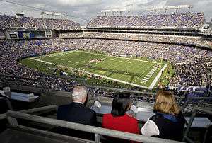
The NFL returned to Baltimore when the former Cleveland Browns moved to Baltimore to become the Baltimore Ravens in 1996. Since then, the Ravens won a Super Bowl championship in 2000 and 2012, four AFC North division championships (2003, 2006, 2011 and 2012), and appeared in four AFC Championship Games (2000, 2008, 2011 and 2012).
Baseball
Baltimore has a long and storied baseball history, including its distinction as the birthplace of Babe Ruth in 1895. The original 19th century Baltimore Orioles were one of the most successful early franchises, featuring numerous hall of famers during its years from 1882 to 1899. As one of the eight inaugural American League franchises, the Baltimore Orioles played in the AL during the 1901 and 1902 seasons. The team moved to New York City before the 1903 season and was renamed the New York Highlanders, which later became the New York Yankees. Ruth played for the minor league Baltimore Orioles team, which was active from 1903 to 1914. After playing one season in 1915 as the Richmond Climbers, the team returned the following year to Baltimore, where it played as the Orioles until 1953.[197]
The team currently known as the Baltimore Orioles has represented Major League Baseball locally since 1954 when the St. Louis Browns moved to the city of Baltimore. The Orioles advanced to the World Series in 1966, 1969, 1970, 1971, 1979 and 1983, winning three times (1966, 1970 and 1983), while making the playoffs all but one year (1972) from 1969 through 1974.
In 1995, local player (and later Hall of Famer) Cal Ripken, Jr. broke Lou Gehrig's streak of 2,130 consecutive games played, for which Ripken was named Sportsman of the Year by Sports Illustrated magazine. Six former Orioles players, including Ripken (2007), and two of the team's managers have been inducted into the Baseball Hall of Fame.
Other teams and events
The first professional sports organization in the United States, The Maryland Jockey Club, was formed in Baltimore in 1743. Preakness Stakes, the second race in the United States Triple Crown of Thoroughbred Racing, has been held every May at Pimlico Race Course in Baltimore since 1873.
College lacrosse is a popular sport in the spring, as the Johns Hopkins Blue Jays men's lacrosse team has won 44 national championships, the most of any program in history. In addition, Loyola University won its first men's NCAA lacrosse championship in 2012.
The Baltimore Blues are a semi-professional rugby league club which began competition in the USA Rugby League in 2012.[198] The Baltimore Bohemians are an American soccer club. They compete in the USL Premier Development League, the fourth tier of the American Soccer Pyramid. Their inaugural season started in the spring of 2012.
The Baltimore Grand Prix debuted along the streets of the Inner Harbor section of the city's downtown on September 2–4, 2011. The event played host to the American Le Mans Series on Saturday and the IndyCar Series on Sunday. Support races from smaller series were also held, including Indy Lights. After three consecutive years, on September 13, 2013, it was announced that the event would not be held in 2014 or 2015 due to scheduling conflicts.[199]
The athletic equipment company, Under Armour is also based out of Baltimore. Founded in 1996 by Kevin Plank, a University of Maryland alumnus, the company's headquarters are located in Tide Point, adjacent to Fort McHenry and the Domino Sugar factory. The Baltimore Marathon is the flagship race of several races. The marathon begins at the Camden Yards sports complex and travels through many diverse neighborhoods of Baltimore, including the scenic Inner Harbor waterfront area, historic Federal Hill, Fells Point, and Canton, Baltimore. The race then proceeds to other important focal points of the city such as Patterson Park, Clifton Park, Lake Montebello, the Charles Village neighborhood and the western edge of downtown. After winding through 42.195 kilometres (26.219 mi) of Baltimore, the race ends at virtually the same point at which it starts.
Parks and recreation
The City of Baltimore boasts over 4,900 acres (1,983 ha) of parkland.[200] The Baltimore City Department of Recreation and Parks manages the majority of parks and recreational facilities in the city including Patterson Park, Federal Hill Park, and Druid Hill Park.[201] The city is also home to Fort McHenry National Monument and Historic Shrine, a coastal star-shaped fort best known for its role in the War of 1812. As of 2015, The Trust for Public Land, a national land conservation organization, ranks Baltimore 40th among the 75 largest U.S. cities.[200]
Government
Baltimore is an independent city, and not part of any county. For most governmental purposes under Maryland law, Baltimore City is treated as a county-level entity. The United States Census Bureau uses counties as the basic unit for presentation of statistical information in the United States, and treats Baltimore as a county equivalent for those purposes.
Baltimore has been a Democratic stronghold for over 150 years, with Democrats dominating every level of government. In virtually all elections, the Democratic primary is the real contest.[202] The city hosted the first six Democratic National Conventions, from 1832 through 1852, and hosted the DNC again in 1860, 1872, and 1912.[203][204]
City government
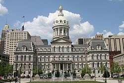
Mayor
- For a full list of mayors, see List of Baltimore Mayors.
Sheila Dixon became the first female mayor of Baltimore on January 17, 2007. As the former City Council President, she assumed the office of Mayor when former Mayor Martin O'Malley took office as Governor of Maryland.[205] On November 6, 2007, Dixon won the Baltimore mayoral election. Mayor Dixon's administration ended less than three years after her election, the result of a criminal investigation that began in 2006 while she was still City Council President. She was convicted on a single misdemeanor charge of embezzlement on December 1, 2009. A month later, Dixon made an Alford plea to a perjury charge and agreed to resign from office; Maryland, like most states, does not allow convicted felons to hold office.[206][207]
Stephanie Rawlings-Blake, who was City Council President at that time, assumed the office of Mayor on February 4, 2010, when Dixon's resignation became effective.[208] She was elected to a full term in 2011, receiving 84% of the vote.[209]
Baltimore City Council
Grassroots pressure for reform, voiced as Question P, restructured the city council in November 2002, against the will of the mayor, the council president, and the majority of the council. A coalition of union and community groups, organized by the Association of Community Organizations for Reform Now (ACORN), backed the effort.[210]
The Baltimore City Council is now made up of 14 single-member districts and one elected at-large council president. Bernard C. "Jack" Young has been the council president since February 2010, when he was unanimously elected by the other council members to replace Stephanie Rawlings-Blake, who had become mayor.[211] Edward Reisinger, the 10th district representative, is the council's current vice president.[212]
Law enforcement
The Baltimore City Police Department, founded 1784 as a "Night City Watch" and day Constables system and later reorganized as a City Department in 1853, with a following reorganization under State of Maryland supervision in 1859, with appointments made by the Governor of Maryland after a disturbing period of civic and elections violence with riots in the later part of the decade, is the current primary law enforcement agency serving the citizens of the City of Baltimore. Campus and building security for the city's public schools is provided by the Baltimore City Public Schools Police, established in the 1970s.
The Maryland Transportation Authority Police under the Maryland Department of Transportation, (originally established as the Baltimore Harbor Tunnel Police" when opened in 1957) is the primary law enforcement agency on the Fort McHenry Tunnel Thruway (Interstate 95), the Baltimore Harbor Tunnel Thruway (Interstate 895), which go under the Northwest Branch of the Patapsco River, and Interstate 395, which has three ramp bridges crossing the Middle Branch of the Patapsco River which are under MdTA jurisdiction, the Baltimore-Washington International Airport, (BWI) and have limited concurrent jurisdiction with the Baltimore City Police Department under a "memorandum of understanding".
Law enforcement on the fleet of transit buses and transit rail systems serving Baltimore is the responsibility of the Maryland Transit Administration Police, which is part of the Maryland Transit Administration of the state Department of Transportation. The MTA Police also share jurisdiction authority with the Baltimore City Police, governed by a memorandum of understanding.[213]
As the enforcement arm of the Baltimore circuit and district court system, the Baltimore City Sheriff's Office, created by state constitutional amendment in 1844, is responsible for the security of city courthouses and property, service of court-ordered writs, protective and peace orders, warrants, tax levies, prisoner transportation and traffic enforcement. Deputy Sheriffs are sworn law enforcement officials, with full arrest authority granted by the constitution of Maryland, the Maryland Police and Correctional Training Commission and the Sheriff of the City of Baltimore.[214]
The United States Coast Guard, operating out of their shipyard and facility (since 1899) at Arundel Cove on Curtis Creek, (off Pennington Avenue extending to Hawkins Point Road/Fort Smallwood Road) in the Curtis Bay section of southern Baltimore City and adjacent northern Anne Arundel County. The U.S.C.G. also operates and maintains a presence on Baltimore and Maryland waterways in the Patapsco River and Chesapeake Bay. "Sector Baltimore" is responsible for commanding law enforcement and search & rescue units as well as aids to navigation.
Baltimore City Fire Department
The city of Baltimore is protected by the over 1,800 professional firefighters of the Baltimore City Fire Department (BCFD), which was founded in December 1858 and began operating the following year. Replacing several warring independent volunteer companies since the 1770s and the confusion resulting from a riot involving the "Know-Nothing" political party two years before, the establishment of a unified professional fire fighting force was a major advance in urban governance. The BCFD operates out of 37 fire stations located throughout the city and has a long history and sets of traditions in its various houses and divisions.
State government
Since the legislative redistricting in 2002, Baltimore has had six legislative districts located entirely within its boundaries, giving the city six seats in the 47-member Maryland Senate and 18 in the 141-member Maryland House of Delegates.[215][216] During the previous 10-year period, Baltimore had four legislative districts within the city limits, but four others overlapped the Baltimore County line.[217] As of January 2011, all of Baltimore's state senators and delegates were Democrats.[215] Approval of the next redistricting plan is expected to become effective in time for Maryland's 2012 congressional primary election on February 14, 2012.[218]
State agencies
Federal government
Three of the state's eight congressional districts include portions of Baltimore: the 2nd, represented by Dutch Ruppersberger; the 3rd, represented by John Sarbanes; and the 7th, represented by Elijah Cummings. All three are Democrats; a Republican has not represented a significant portion of Baltimore in Congress since John Boynton Philip Clayton Hill represented the 3rd District in 1927, and has not represented any of Baltimore since the Eastern Shore-based 1st District lost its share of Baltimore after the 2000 census; it was represented by Republican Wayne Gilchrest at the time.
Both of Maryland's senators, Ben Cardin and Barbara Mikulski, are from Baltimore. The last three people to represent Maryland in the Senate represented the 3rd District before being elected to the Senate. Paul Sarbanes represented the 3rd from 1971 until 1977, when he was elected to the first of five terms in the Senate. Sarbanes was succeeded by Mikulski, who represented the 3rd from 1977 to 1987. Mikulski was succeeded by Cardin, who held the seat until handing it to John Sarbanes upon his election to the Senate in 2007.[219]
The Postal Service's Baltimore Main Post Office is located at 900 East Fayette Street in the Jonestown area.[220]
The national headquarters for the United States Social Security Administration is located in Woodlawn, just outside of Baltimore.
Education
Colleges and universities
Baltimore is the home of numerous places of higher learning, both public and private. 100,000 college students from around the country attend Baltimore City's 12 accredited two-year or four-year colleges and universities.[221][222] Among them are:
Private
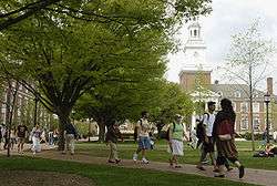
- The Johns Hopkins University
- Baltimore International College
- Loyola University Maryland
- Maryland Institute College of Art
- St. Mary's Seminary and University
- Notre Dame of Maryland University
- The Peabody Institute of Johns Hopkins University
- Sojourner–Douglass College
- Stratford University (Baltimore campus)
Public
- Baltimore City Community College
- Coppin State University
- Morgan State University
- University of Baltimore
- University of Maryland, Baltimore
Primary and secondary schools
The city's public schools are managed by Baltimore City Public Schools and include schools that have been well known in the area: Carver Vocational-Technical High School, the first African American vocational high school and center that was established in the state of Maryland; Digital Harbor High School, one of the secondary schools that emphasizes information technology; Lake Clifton Eastern High School, which is the largest school campus in Baltimore City of physical size; the historic Frederick Douglass High School, which is the second oldest African American high school in the United States;[224] Baltimore City College, the third oldest public high school in the country;[225] and Western High School, the oldest public all-girls school in the nation.[226] Baltimore City College (also known as "City") and Baltimore Polytechnic Institute (also known as "Poly") share the nation's second-oldest high school football rivalry.[227]
Transportation
Roads and highways
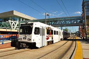
The Interstate highways serving Baltimore are I-70, I-83 (the Jones Falls Expressway), I-95 (the John F. Kennedy Memorial Highway north of the city), I-395, I-695 (the Baltimore Beltway), I-795 (the Northwest Expressway), I-895 (the Harbor Tunnel Thruway), and I-97. The city's mainline Interstate highways—I-95, I-83, and I-70—do not directly connect to each other, and in the case of I-70 end at a park and ride lot just inside the city limits, because of freeway revolts in Baltimore. These revolts were led primarily by Barbara Mikulski, now a United States senator, which resulted in the abandonment of the original plan. There are two tunnels traversing Baltimore Harbor within the city limits: the four-bore Fort McHenry Tunnel (serving I-95) and the two-bore Harbor Tunnel (serving I-895). The Baltimore Beltway crosses south of Baltimore Harbor over the Francis Scott Key Bridge.
The only U.S. Highways in the city are US 1, which bypasses downtown, and US 40, which crosses downtown from east to west. Both run along major surface streets; however, US 40 utilizes a small section of a freeway cancelled in the 1970s in the west side of the city originally intended for Interstate 170. State routes in the city also travel along surface streets, with the exception of Maryland Route 295, which carries the Baltimore–Washington Parkway.
The Baltimore City Department of Transportation (BCDOT) is responsible for several functions of the road transportation system in Baltimore, including repairing roads, sidewalks, and alleys; road signs; street lights; and managing the flow of transportation systems.[228] In addition, the agency is in charge of vehicle towing and traffic cameras.[229][230] BCDOT maintains all streets within the city of Baltimore. These include all streets that are marked as state and U.S. highways as well as the portions of I-83 and I-70 within the city limits. The only highways within the city that are not maintained by BCDOT are I-95, I-395, I-695, and I-895; those four highways are maintained by the Maryland Transportation Authority.[231]
Transit systems
Public transit
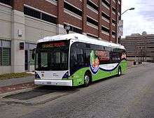
Public transit in Baltimore is mostly provided by the Maryland Transit Administration (abbreviated "MTA Maryland") and Charm City Circulator. MTA Maryland operates a comprehensive bus network, including many local, express, and commuter buses, a light rail network connecting Hunt Valley in the north to BWI Airport and Cromwell (Glen Burnie) in the south, and a subway line between Owings Mills and Johns Hopkins Hospital.[232] A proposed rail line, known as the Red Line, which would link the Social Security Administration to Johns Hopkins Bayview Medical Center and perhaps the Canton and Dundalk communities, was cancelled as of June 2015 by Governor Larry Hogan; a proposal to extend Baltimore's existing subway line to Morgan State University, known as the Green Line, is in the planning stages.[233]
The Charm City Circulator (CCC), a shuttle bus service operated by Veolia Transportation for the Baltimore Department of Transportation, began operating in the downtown area in January 2010. Funded partly by a 16 percent increase in the city's parking fees, the circulator provides free bus service seven days a week, picking up passengers every 15 minutes at designated stops during service hours.[234][235]
The CCC's first bus line, the Orange route, travels between Hollins Market and Harbor East. Its Purple route, launched June 7, 2010, operates between Penn Station and Federal Hill. The Green route runs between Johns Hopkins and City Hall.[235][236] The Charm City Circulator operates a fleet of diesel and hybrid vehicles built by DesignLine, Orion, and Van Hool.[234]
Intercity rail
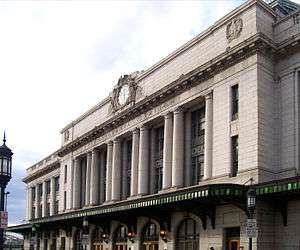
Baltimore is a top destination for Amtrak along the Northeast Corridor. Baltimore's Penn Station is one of the busiest in the country. In FY 2014, Penn Station was ranked the seventh-busiest rail station in the United States by number of passengers served each year.[237] The building sits on a raised "island" of sorts between two open trenches, one for the Jones Falls Expressway and the other for the tracks of the Northeast Corridor (NEC). The NEC approaches from the south through the two-track, 7,660-foot Baltimore and Potomac Tunnel, which opened in 1873 and whose 30 mph limit, sharp curves, and steep grades make it one of the NEC's worst bottlenecks. The NEC's northern approach is the 1873 Union Tunnel, which has one single-track bore and one double-track bore.
Just outside the city, Baltimore/Washington International (BWI) Thurgood Marshall Airport Rail Station is another popular stop. Amtrak's Acela Express, Palmetto, Carolinian, Silver Star, Silver Meteor, Vermonter, Crescent, and Northeast Regional trains are the scheduled passenger train services that stop in the city. Additionally, MARC commuter rail service connects the city's two main intercity rail stations, Camden Station and Penn Station, with Washington, D.C.'s Union Station as well as stops in between. The MARC consists of 3 lines; the Brunswick, Camden and Penn. On December 7, 2013 the Penn Line began weekend service.[238]
Airports
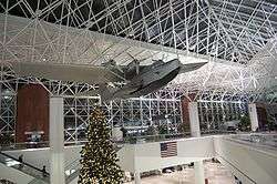
Baltimore is served by two airports, both operated by the Maryland Aviation Administration, which is part of the Maryland Department of Transportation.[239] Baltimore–Washington International Thurgood Marshall Airport, generally known as "BWI," lies about 10 miles (16 km) to the south of Baltimore in neighboring Anne Arundel County. The airport is named after Thurgood Marshall, a Baltimore native who was the first African American to serve on the Supreme Court of the United States. In terms of passenger traffic, BWI is the 22nd busiest airport in the United States.[240] As of calendar year 2014, BWI is the largest, by passenger count, of three major airports serving the Baltimore–Washington Metropolitan Area. It is accessible by I-95 and the Baltimore–Washington Parkway via Interstate 195, the Baltimore Light Rail, and Amtrak and MARC Train at BWI Rail Station.
Baltimore is also served by Martin State Airport, a general aviation facility, to the northeast in Baltimore County. Martin State Airport is linked to downtown Baltimore by Maryland Route 150 (Eastern Avenue) and by MARC Train at its own station.
Pedestrians and bicycles
Baltimore has a comprehensive system of bicycle routes in the city. These routes are not numbered, but are typically denoted with green signs sporting a silhouette of a bicycle upon an outline of the city's border, and denote the distance to destinations, much like bicycle routes in the rest of the state. The roads carrying bicycle routes are also labelled with either bike lanes, sharrows, or Share the Road signs. Many of these routes pass through the downtown area. The network of bicycle lanes in the city continues to expand, with over 140 miles added between 2006 and 2014.[241] Alongside bike lanes, Baltimore has also built bike boulevards, starting with Guilford Avenue in 2012.
Baltimore currently has three major trail systems within the city. The Gwynns Falls Trail runs from the Inner Harbor to the I-70 Park and Ride, passing through Gwynns Falls Park and possessing numerous branches. There are also many pedestrian hiking trails traversing the park. The Jones Falls Trail currently runs from the Inner Harbor to the Cylburn Arboretum; however, it is currently undergoing expansion. Long term plans call for it to extend to the Mount Washington Light Rail Stop, and possibly as far north as the Falls Road stop to connect to the Robert E. Lee boardwalk north of the city. It will also incorporate a spur alongside Western Run. The two aforementioned trails carry sections of the East Coast Greenway through the city. There is also the Herring Run Trail, which runs from Harford Road east to its end beyond Sinclair Lane, utilizing Herring Run Park; long term plans also call for its extension to Morgan State University and north to points beyond. Other major bicycle projects include a protected cycle track installed on both Maryland Avenue and Mount Royal Avenue, expected to become the backbone of a downtown bicycle network. Installation for the cycletracks is expected in 2014 and 2016, respectively.
In addition to the bicycle trails and cycletracks, Baltimore has the Stony Run Trail, a walking path that will eventually connect from the Jones Falls north to Northern Parkway, utilizing much of the old Ma and Pa Railroad corridor inside the city. In 2011, the city undertook a campaign to reconstruct many sidewalk ramps in the city, coinciding with mass resurfacing of the city's streets. A 2011 study by Walk Score ranked Baltimore the 14th most walkable of fifty largest U.S. cities.[242]
Port of Baltimore
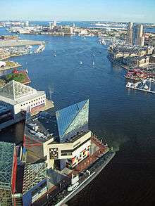
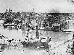
.jpg)
The port was founded in 1706, preceding the founding of Baltimore. The Maryland colonial legislature made the area near Locust Point as the port of entry for the tobacco trade with England. Fells Point, the deepest point in the natural harbor, soon became the colony's main ship building center, later on becoming leader in the construction of clipper ships.[243]
After Baltimore's founding, mills were built behind the wharves. The California Gold Rush led to many orders for fast vessels; many overland pioneers also relied upon canned goods from Baltimore. After the Civil War, a coffee ship was designed here for trade with Brazil. At the end of the nineteenth century, European ship lines had terminals for immigrants. The Baltimore and Ohio Railroad made the port a major transshipment point.[244]:17,75 Currently the port has major roll-on/roll-off facilities, as well as bulk facilities, especially steel handling.[245]
Water taxis also operate in the Inner Harbor. Governor Ehrlich participated in naming the port after Helen Delich Bentley during the 300th anniversary of the port.[246]
In 2007, Duke Realty Corporation began a new development near the Port of Baltimore, named the Chesapeake Commerce Center. This new industrial park is located on the site of a former General Motors plant. The total project comprises 184 acres (0.74 km2) in eastern Baltimore City, and the site will yield 2,800,000 square feet (260,000 m2) of warehouse/distribution and office space. Chesapeake Commerce Center has direct access to two major Interstate highways (I-95 and I-895) and is located adjacent to two of the major Port of Baltimore terminals. The Port of Baltimore is one of two seaports on the U.S. East Coast with a 50-foot (15 m) dredge to accommodate the largest shipping vessels.[247]
Along with cargo terminals, the port also has a passenger cruise terminal, which offers year-round trips on several lines, including Royal Caribbean's Grandeur of the Seas and Carnival's Pride. Overall five cruise lines have operated out of the port to the Bahamas and the Caribbean, while some ships traveled to New England and Canada. The terminal has become a popular embarkation point where passengers have the rare opportunity to park and board next to the ship visible from Interstate 95.[248] Passengers from Pennsylvania, New York and New Jersey make up a third of the volume, with travelers from Maryland, Virginia, the District and even Ohio and the Carolinas making up the rest.[249]
Environment
Water pollution control
Baltimore's Inner Harbor, known for its skyline waterscape and its tourist friendly-areas, was horribly polluted. The waterway was often filled with garbage after heavy rainstorms, failing its 2014 water quality report card. The Waterfront Partnership of Baltimore took steps to remediate the waterways, in hopes that the harbor would be fishable and swimmable once again. Installed in May 2014, the Water Wheel, known as Mr. Trash Wheel, sits at the mouth of the Jones Falls River in Baltimore's Inner Harbor. A February 2015 agreement with a local waste-to-energy plant, is believed to make Baltimore the first city to use reclaimed waterway debris to generate electricity.[250]
Mr. Trash Wheel is the world's first permanent water wheel trash interceptor to clean up the city's polluted Inner Harbor.[251] The Jones Falls river watershed drains fifty-eight square miles of land outside of Baltimore and is a significant source of trash that enters the harbor. Garbage collected by Mr. Trash Wheel could come from anywhere in the Jones Falls Watershed area.[252] The wheel moves continuously, removing garbage and dumping it into an attached dumpster using only hydro and solar renewable power to keep its wheel turning. It has the capability to collect 50,000 pounds of trash per day, and has removed more than 350 tons of litter from Baltimore's landmark and tourist attraction in its first 18 months, estimated as consisting of approximately 200,000 bottles, 173,000 potato chip bags and 6.7 million cigarettes butts.[253][254] The Water Wheel has been very successful at trash removal, visibly decreasing the amount of garbage that collects in the harbor, especially after a rainfall.
The Waterfront Partnership is raising money to build a second Water Wheel at the end of Harris Creek, an entirely piped stream that flows beneath Baltimore's Canton neighborhood and empties into the Baltimore Harbor. Harris Creek is known to carry tons of trash every year.[255][256] The planned new Water Wheel will capture that trash and keep it out of the Harbor, Chesapeake Bay, and Atlantic Ocean. A number of projects are going on in Baltimore City and County that should result in better water quality scores. These projects include the Blue Alleys project, the Water Wheel, expanded street sweeping, and stream restoration.[251]
In August 2010, the National Aquarium assembled, planted, and launched a floating wetland island designed by Biohabitats in Baltimore's Inner Harbor.[257] Hundreds of years ago Baltimore's harbor shoreline would have been lined with tidal wetlands. Floating wetlands provide many environmental benefits to water quality and habitat enhancement, which is why the Waterfront Partnership of Baltimore has included them in their Healthy Harbor Initiative pilot projects.[258] Biohabitats also developed a concept to transform a dilapidated wharf into a living pier that cleans Harbor water, provides habitat and is an aesthetic attraction. Currently under design, the top of the pier will become a constructed tidal wetland.[259] The city also has a fleet of trash skimmer operators to clean the harbor, which together accumulate a total of 200,000 tons of trash each year.[260]
Media
Baltimore's main newspaper is The Baltimore Sun. It was sold by its Baltimore owners in 1986 to the Times Mirror Company,[261] which was bought by the Tribune Company in 2000.[262] The Baltimore News-American, another long-running paper that competed with the Sun, ceased publication in 1986.[263]
The city is home to the Baltimore Afro-American, an influential African American newspaper founded in 1892.[264][265]
In 2006, The Baltimore Examiner was launched to compete with The Sun. It was part of a national chain that includes The San Francisco Examiner and The Washington Examiner. In contrast to the paid subscription Sun, The Examiner was a free newspaper funded solely by advertisements. Unable to turn a profit and facing a deep recession, The Baltimore Examiner ceased publication on February 15, 2009.
Despite being located 40 miles northeast of Washington, D.C., Baltimore is a major media market in its own right, with all major English language television networks represented in the city. WJZ-TV is a CBS owned and operated station, and WBFF is the flagship of Sinclair Broadcast Group, the largest station owner in the country.
Nielsen ranked Baltimore as the 26th-largest television market for the 2008–2009 viewing season and the 27th-largest for 2009–2010.[266] Arbitron's Fall 2010 rankings identified Baltimore as the 22nd largest radio market.[267]
Notable people
Sister cities
Baltimore has ten sister cities, as designated by Sister Cities International: [268][269]
See also
- Baltimore Development Corporation
- Baltimore in fiction
- Bluegrass in Baltimore: The Hard Drivin' Sound and its Legacy (Book on the history of the Appalachian migrants move into the city in the 20th Century)
- Cemeteries in Baltimore, Maryland
- History of the Germans in Baltimore, Maryland
- Moveable Feast
Notes
- ↑ Officially, seasonal snowfall accumulation has ranged from 0.7 in (1.8 cm) in 1949–50 to 77.0 in (196 cm) in 2009–10. See North American blizzard of 2009#Snowfall (December 19–20, 2009), First North American blizzard of 2010#Snowfall (February 5–6, 2010), and Second North American blizzard of 2010#Impact (February 9–10, 2010). The February storms contributed to a monthly accumulation of 50.0 in (127 cm), the most for any month.[118] If no snow fell outside of February that winter, 2009–10 would still rank as 5th snowiest.[119]
- ↑ Since 1950, when the National Weather Service switched to using the suburban and generally much cooler BWI Airport as the official Baltimore climatology station, this extreme has repeated three times: January 29, 1963, January 17, 1982, and January 22, 1984.
- ↑ Temperature, precipitation normals are recorded at Maryland Science Center in downtown; the National Weather Service does not yet record snowfall at this location, so the snow normals for BWI Airport, at an elevation of 156 ft (47.5 m) about 10 mi (16 km) south of downtown, are shown. Likewise humidity and sun duration normals were recorded at BWI Airport.
References
- 1 2 3 Donovan, Doug (May 20, 2006). "Baltimore's New Bait: The City is About to Unveil a New Slogan, 'Get In On It,' Meant to Intrigue Visitors". The Baltimore Sun. Retrieved November 28, 2008.
- ↑ Kane, Gregory (June 15, 2009). "Dispatch from Bodymore, Murderland". Washington Examiner.
- ↑ Jeffrey Gettleman (September 2, 2003). "In Baltimore, Slogan Collides with Reality". The New York Times.
- 1 2 "2010 Census Gazetteer Files". United States Census Bureau. August 22, 2012. Retrieved September 14, 2014.
- 1 2 "Highest and Lowest Elevations in Maryland's Counties". Maryland Geological Survey. Archived from the original on October 5, 2007. Retrieved November 14, 2007.
- ↑ "American FactFinder". United States Census Bureau. Retrieved October 13, 2014.
- ↑ "Population Estimates". United States Census Bureau. Retrieved May 20, 2016.
- ↑ "Zip Code Lookup". USPS. Archived from the original on November 23, 2010. Retrieved October 13, 2014.
- ↑ The form and type of government of the city is described by Article XI of the State Constitution.
- ↑ Sherman, Natalie (March 14, 2015). "Historic districts proliferate as city considers changes". Baltimore Sun. Retrieved February 6, 2016.
- ↑ Gibbons, Mike (October 21, 2011). "Monumental City Welcomes Number Five". Babe Ruth Birthplace Foundation. Retrieved February 6, 2016.
- ↑ Hughes, Joseph R. "Inland port gives Baltimore strategic shipping advantages". Washington Examiner. Retrieved June 23, 2011.
- ↑ "Baltimore Heritage Area". Maryland Historical Trust. February 11, 2011. Retrieved December 30, 2011.
- ↑ "Major Employers | Baltimore Development Corporation". Baltimoredevelopment.com. Archived from the original on July 25, 2010. Retrieved July 8, 2013.
- ↑ "Metro Area Factsheet: Baltimore, Maryland PMSA". FAIR US. Retrieved December 31, 2011.
- ↑ "Metropolitan and Micropolitan Statistical Areas". U.S. Census Bureau. Retrieved October 13, 2014.
- ↑ "About Baltimore". Baltimore.org. Retrieved July 8, 2013.
- ↑ Baltimore City, Maryland: Historical Chronology, Maryland State Archives, 29 Feb 2016, retrieved 11 Apr 2016
- ↑ Calvert Family Tree (PDF), University Libraries, University of Maryland, retrieved 11 Apr 2016
- ↑ Maryland History Timeline, Maryland Office of Tourism, retrieved 11 Apr 2016
- 1 2 3 Egan, Casey (23 Nov 2015), "The surprising Irish origins of Baltimore, Maryland", IrishCentral, retrieved 11 Apr 2016
- ↑ Brugger, Robert J. (1988). Maryland: A Middle Temperament, 1634–1980. Baltimore: Johns Hopkins Press. p. 4. ISBN 0-8018-3399-X.
- ↑ A Point of Natural Origin and Locust Point – Celebrating 300 Years of a Historic Community, Scott Sheads, Mylocustpoint.
- ↑ "Ghosts of industrial heyday still haunt Baltimore's harbor, creeks". Chesapeake Bay Journal. Retrieved September 8, 2012.
- ↑ "Carroll Museums: Making History Yours". carrollmuseums.org. Retrieved August 4, 2015.
- ↑ Adam Youssi (2006). "The Susquehannocks' Prosperity & Early European Contact". Historical Society of Baltimore County. Retrieved April 28, 2015.
- ↑ Alex J. Flick; et al. (2012). "A Place Now Known Unto Them: The Search for Zekiah Fort" (PDF). St. Mary's College of Maryland. p. 11. Retrieved April 28, 2015.
- ↑ Murphree, Daniel Scott (2012). Native America: A State-by-State Historical Encyclopedia. Santa Barbara, California: ABC-CLIO. pp. 489, 494. ISBN 978-0-313-38126-3. Retrieved April 28, 2015.
- ↑ As depicted on a map of the Piscataway lands in Kenneth Bryson, Images of America: Accokeek (Arcadia Publishing, 2013) pp. 10–11, derived from Alice and Henry Ferguson, The Piscataway Indians of Southern Maryland (Alice Ferguson Foundation, 1960) pp. 8 (map) and p. 11: "By the beginning of Maryland (English) settlement, pressure from the Susquehannocks had reduced..the Piscataway 'empire'...to a belt bordering the Potomac south of the falls and extending up the principle tributaries. Roughly, the 'empire' covered the southern half of present Prince Georges County and all, or nearly all, of Charles County."
- ↑ Akerson, Louise A. (1988). American Indians in the Baltimore area. Baltimore, Maryland: Baltimore Center for Urban Archaeology (Md.). p. 15. OCLC 18473413.
- ↑ Potter, Stephen R. (1993). Commoners, Tribute, and Chiefs: The Development of Algonquian Culture in the Potomac Valley. Charlottesville, Virginia: University of Virginia Press. p. 119. ISBN 0-8139-1422-1. Retrieved January 5, 2013.
- ↑ https://www.nps.gov/CRMJournal/CRM/v22n5.pdf
- ↑ http://msa.maryland.gov/…/…/000001/000075/html/am75--61.html
- ↑ https://core.tdar.org/…/artifact-inventory-old-baltimore-ab…
- ↑ Krugler, John D (2004). English and Catholic: the Lords Baltimore in the Seventeenth Century. Baltimore: Johns Hopkins University Press. p. 74. ISBN 0-8018-7963-9.
- ↑ Kent Mountford (July 1, 2003). "History behind sugar trade, Chesapeake not always sweet". Bay Journal.
- ↑ Mallika Sharan. "History". bpmarkets.com. Retrieved August 4, 2015.
- ↑ Mallika Sharan. "World Famous Lexington Market". lexingtonmarket.com. Retrieved August 4, 2015.
- ↑ Thielking, Megan (November 10, 2015). "25 Things You Should Know About Baltimore". Mental Floss. Retrieved December 19, 2015.
In 1774, the first post office in the United States was inaugurated in the city.
- 1 2 "Baltimore: A City of Firsts". Visit Baltimore. Retrieved February 6, 2016.
- ↑ "Baltimore City, Maryland Historical Chronology". Maryland State Archives. December 7, 2015. Retrieved January 20, 2015.
- ↑ Hezekiah Niles (1876). Principles and Acts of the Revolution in America. New York: A. S. Barnes & Co. pp. 257–258.
- ↑ "Henry Fite's House, Baltimore". U.S. Department of State, Office of the Historian. Archived from the original on March 26, 2011. Retrieved March 23, 2011.
- ↑ "Baltimore, Maryland—Government". Maryland Manual On-Line: A Guide to Maryland Government. Maryland State Archives. October 23, 2008. Archived from the original on September 19, 2008. Retrieved October 27, 2008.
- ↑ "The Great Strike". Catskill Archive. Timothy J. Mallery. Archived from the original on September 29, 2008. Retrieved October 26, 2008.
- ↑ "Baltimore, October 17". Salem Gazette. Salem, Massachusetts. October 23, 1827. p. 2. Retrieved October 27, 2008.
- ↑ "The Baltimore Bank Riot". University of Illinois Press. Retrieved January 5, 2010.
- ↑ Clayton, Ralph (July 12, 2000). "A bitter Inner Harbor legacy: the slave trade". The Baltimore Sun. Retrieved July 8, 2013.
- ↑ McPherson, James M. (December 11, 2003). Battle Cry of Freedom. USA: Oxford University Press. p. 225. ISBN 019516895X.
- ↑ Scharf, J. Thomas (1967). History of Maryland From the Earliest Period to the Present Day. 3 (2nd ed.). Hatboro, PA: Tradition Press. pp. 733–42.
- ↑ "A Howling Inferno: The Great Baltimore Fire". Virtually Live@Hopkins. Johns Hopkins University. January 12, 2004. Retrieved March 17, 2011.
- ↑ Peter B. Petersen (2009). "Legacy of the Fire". Fire Museum of Maryland. Retrieved March 18, 2011.
- ↑ George P. Bagby, editor (1918). The annotated code of the public civil laws of Maryland, Volume 4. King Bros., Printers and Publishers. p. 769.
- ↑ Duffy, James (December 2007). "Baltimore seals its borders". Baltimore Magazine. pp. 124–27.
- ↑ Alabaster cities: urban U.S. since 1950. John R. Short (2006). Syracuse University Press. p.142. ISBN 0-8156-3105-7
- ↑ "Baltimore '68 Events Timeline". Baltimore 68: riots and Rebirth. University of Baltimore Archives. Retrieved January 19, 2011.
- ↑ "Recalling Baltimore's 1968 riots". The Baltimore Sun. April 3, 1998. Retrieved January 19, 2011.
- ↑ Police Chief Donald Pomerleau said, "We're in a semi-riot mode, similar to the 1968 riots." See: "Cops storm jail rebels; Baltimore in semi-riot state". Chicago Tribune. UPI. July 14, 1974. Retrieved August 5, 2012.
- ↑ Sandler, Gilbert (July 18, 1995). "How the city's nickname came to be". Baltimore Sun. Retrieved August 1, 2012.
- ↑ Sandler, Gil (August 18, 1998). "Where did city get its charming nickname? Baltimore Glimpses". Baltimore Sun. Retrieved August 1, 2012.
- ↑ Fuller, Nicole (February 28, 2007). "Moveable Feast, which gives food to HIV/AIDS, terminally ill patients, might turn away clients". The Baltimore Sun. Retrieved October 26, 2015 – via HighBeam Research. (subscription required (help)).
- ↑ Hill, Retha (June 9, 1990). "Meals a Godsend To AIDS Patients;Md. Program Helps Ease Burden for Homebound". The Washington Post. Retrieved October 26, 2015 – via HighBeam Research. (subscription required (help)).
- ↑ "History of Moveable Feast". About Us. Moveable Feast. 2015. Archived from the original on September 18, 2015. Retrieved October 26, 2015.
- ↑ "Gay Pride events to return to University of Baltimore, June 17–18". US Fed News Service. May 27, 2010. Retrieved October 26, 2015 – via HighBeam Research. (subscription required (help)).
- ↑ "Who We Are". Maryland Stadium Authority. Archived from the original on October 18, 2008. Retrieved October 26, 2008.
- ↑ Rousuck, J. Wynn; Gunts, Edward (January 25, 2005). "Hippodrome's first hurrahs". The Baltimore Sun. Retrieved April 30, 2015.
- ↑ "UAE royal family honoured at opening of new Johns Hopkins Hospital". Middle East Health. May 2012. Retrieved January 30, 2016.
- ↑ Gantz, Sarah (April 13, 2012). "Photos: Johns Hopkins dedicates $1.1 billion patient towers". Baltimore Business Journal. Retrieved January 30, 2016.
- ↑ "Star-Spangled Sailabration". Sail Baltimore. Retrieved January 30, 2016.
- ↑ "Baltimore's Star-Spangled Sailabration". The Washington Post. June 14, 2012. Retrieved January 30, 2016.
- ↑ Kirk, Amy (September 15, 2014). "Military Members Wrap-up Baltimore Star Spangled Spectacular". United States Navy. Retrieved January 30, 2016.
- ↑ "Star-Spangled Spectacular Shines the Limelight on Baltimore". Observation Baltimore. September 10, 2014. Retrieved January 30, 2016.
- ↑ Sanburn, Josh (June 2, 2015). "What's Behind Baltimore's Record-Setting Rise In Homicides". Time. Time Magazine. Retrieved December 16, 2015.
- ↑ http://www.baltimoresun.com/news/opinion/editorial/bs-ed-sagamore-20160324-story.html
- ↑ http://archpaper.com/2016/09/baltimore-council-660-million-build-port-covington/
- ↑ http://buildportcovington.com/2016/09/07/open-letter-kevin-plank/
- ↑ http://www.wbaltv.com/news/baltimore-mayor-signs-port-covington-public-financing-legislation/41863502#comments
- ↑ Evitts, Elizabeth (April 2003). "Window to the Future" (PDF). Baltimore Magazine. Retrieved May 6, 2009.
- ↑ Bishop, Tricia (April 7, 2003). "Illuminated by a jewel". The Baltimore Sun. Retrieved May 6, 2009.
- ↑ Mary Ellen Hayward and Charles Belfoure (1999). The Baltimore Rowhouse. Princeton Architectural Press. p. back cover. ISBN 1-56898-283-6. Retrieved March 21, 2011.
- ↑ Hayward and Belfoure, pp 17–18, 22.
- ↑ Paul K. Williams (September 23, 2009). "The Story of Formstone". Welcome to Baltimore, Hon!. Retrieved March 21, 2011.
- ↑ "Waterfront Mansion Overlooking Inner Harbor Priced At $8.5M « CBS Baltimore". Baltimore.cbslocal.com. March 11, 2013. Retrieved July 8, 2013.
- ↑ "Everyman Theatre Honored with 'Baltimore Heritage Historic Preservation Award'". Retrieved July 8, 2013.
- ↑ Hopkins, Jamie Smith (October 31, 2011). "Transamerica workers begin move to downtown skyscraper". The Baltimore Sun. Retrieved November 16, 2011.
- ↑ "Legg Mason Building". Emporis Corporation. Retrieved November 1, 2007.
- ↑ "Bank of America Building". Emporis Corporation. Retrieved November 1, 2007.
- ↑ "William Donald Schaefer Tower". Emporis Corporation. Retrieved November 1, 2007.
- ↑ "Commerce Place". Emporis Corporation. Retrieved November 1, 2007.
- ↑ "100 East Pratt Street". Emporis Corporation. Retrieved November 1, 2007.
- ↑ "Trade Center". Emporis Corporation. Retrieved November 1, 2007.
- ↑ "Tremont Plaza Hotel". Emporis Corporation. Retrieved November 1, 2007.
- ↑ "Charles Towers South Apartments". Emporis Corporation. Retrieved November 1, 2007.
- ↑ "Blaustein Building". Emporis Corporation. Retrieved November 1, 2007.
- ↑ "250 West Pratt Street". Emporis Corporation. Retrieved November 1, 2007.
- 1 2 3 Mary K. Tilghman (2008). Insiders' Guide to Baltimore. Morris Book Publishing LLC. p. 2. ISBN 978-0-7627-4553-1.
- 1 2 3 4 5 6 7 "Central District", Baltimore City Police History, retrieved 12 Apr 2016
- 1 2 Rachel Bernstein (May 17, 2011). "Families increasing in downtown Baltimore". The Daily Record. Retrieved January 8, 2012.
- ↑ "Baltimore". Visit Baltimore. Retrieved May 1, 2016.
- ↑ "Northern District Area Guide", Baltiore Police Department, retrieved 12 Apr 2016
- ↑ Scott Sheads. "Locust Point – Celebrating 300 Years of a Historic Community". Locust Point Civic Association. Retrieved April 1, 2011.
- ↑ "Discover Federal Hill". Historic Federal Hill. Retrieved April 1, 2011.
- ↑ "History of Cherry Hill" (PDF). Cherry Hill Master Plan. Baltimore City Department of Planning. July 10, 2008. p. 10. Retrieved April 1, 2011.
- ↑ Anft, Michael. "Contrasting studies". The Baltimore Sun. Archived from the original on September 9, 2005. Retrieved July 29, 2007.
- ↑ "Profile of General Demographic Characteristics (2000): Hillen" (PDF). Baltimore City Planning Department. Retrieved March 29, 2011.
- ↑ "Profile of General Demographic Characteristics (2000): Stonewood-Pentwood-Winston" (PDF). Baltimore City Planning Department. Retrieved March 29, 2011.
- ↑ Gadi Dechter (May 24, 2006). "A Guided Tour of "The Wire's" East Baltimore". Baltimore City Paper. Retrieved April 1, 2011.
- ↑ Collins, Dan (18 Dec 2008), "Patterson Park: Best backyard in Baltimore", Washington Examiner, retrieved 30 Mar 2016
- ↑ "The Shops at Canton Crossing is Officially Open for Business". CBS Baltimore. 8 Oct 2013. Retrieved 12 Apr 2016.
- ↑ "Park Heights". Live in Baltimore. Retrieved April 4, 2011.
- 1 2 HRG Consultants, Inc & AB Associates (Sep 2001), "Baltimore City Heritage Area: Management Action Plan" (PDF), nps.gov, National Park Service, retrieved May 15, 2016
- ↑ "Registration form: Old West Baltimore Historic District" (PDF), mht.maryland.gov, National Register of Historic Places, November 9, 2004, retrieved May 15, 2016
- ↑ Capital News Service (May 3, 2016), "Part 3 Unhealthy Baltimore: Distrust in the hospital room", The Baltimore Sun, retrieved May 15, 2016
- ↑ Wheeler, Timothy B (December 11, 2011), "Habitat group rehabs 300th home in Sandtown", The Baltimore Sun, retrieved May 15, 2016
- ↑ "Upton". LiveBaltimore.com. Live in Baltimore. nd. Retrieved May 15, 2016.
- ↑ "USDA Zone Map Lookup: Baltimore, MD". The Arbor Day Foundation. Retrieved July 8, 2013.
- 1 2 3 4 5 "Station Name: MD MD SCI CTR BALTIMORE". National Oceanic and Atmospheric Administration. Retrieved February 27, 2013.
- 1 2 3 "NowData – NOAA Online Weather Data". National Oceanic and Atmospheric Administration. Retrieved July 8, 2013.
- ↑ "Baltimore Snowfall". NWS Baltimore/Washington. Retrieved June 15, 2014.
- ↑ "Maryland Average Annual Snowfall Map". National Oceanic and Atmospheric Administration.
- ↑ "NWS Sterling, VA – Snowfall and Cold". National Oceanic and Atmospheric Administration. Archived from the original on April 18, 2012. Retrieved June 30, 2012.
- ↑ Sanderson, Katharine. "Why it's hot in the city: Heat wave in Baltimore made worse by hot air from Washington DC.". Nature (Journal). Retrieved May 31, 2014.
- ↑ Roylance, Frank D. (January 8, 2010). "D.C. heat stagnates Baltimore's air". Baltimore Sun. Retrieved May 31, 2014.
- ↑ Mogil, H. Michael; Seaman, Kristen L. "The Climate and Weather of Delaware, Maryland, and Washington, D.C.". Weatherwise (July–August 2009). Retrieved May 31, 2014.
- ↑ "heat index » Maryland Weather". marylandwx.com. Retrieved August 4, 2015.
- ↑ "Past Monthly Weather Data for Baltimore July 1999 – 2014". Weather Warehouse. Retrieved August 17, 2014.
- ↑ "Baltimore Weather – Accuweather Forecast for MD 21201". Accuweather. Retrieved July 8, 2013.
- ↑ "Station Name: BALTIMORE WASH INTL AP". National Oceanic and Atmospheric Administration. Retrieved 2014-03-13.
- ↑ "WMO Climate Normals for BALTIMORE/BALTO-WASH, MD 1961–1990". National Oceanic and Atmospheric Administration. Retrieved March 11, 2014.
- ↑ "Annual Estimates of the Resident Population for Incorporated Places: April 1, 2010 to July 1, 2015". Retrieved July 2, 2016.
- ↑ "U.S. Decennial Census". United States Census Bureau. Archived from the original on May 11, 2015. Retrieved September 14, 2014.
- ↑ "Historical Census Browser". University of Virginia Library. Retrieved September 14, 2014.
- ↑ "Population of Counties by Decennial Census: 1900 to 1990". United States Census Bureau. Retrieved September 14, 2014.
- ↑ "Census 2000 PHC-T-4. Ranking Tables for Counties: 1990 and 2000" (PDF). United States Census Bureau. Retrieved September 14, 2014.
- ↑ "State & County QuickFacts". United States Census Bureau. Retrieved September 14, 2014.
- 1 2 Sherman, Natalie (April 17, 2015). "City hopes to get more families to stay". The Baltimore Sun. Retrieved April 19, 2015.
- ↑ Kilar, Steve (March 14, 2013). "Baltimore's population up, following decades of loss". The Baltimore Sun. Retrieved July 8, 2013.
- ↑ Litten, Kevin (March 9, 2015). "This map shows the gentrification of Baltimore's neighborhoods over 20 years". Baltimore Business Journal. Retrieved April 19, 2015.
- ↑ "Baltimore (city), Maryland". State & County QuickFacts. U.S. Census Bureau. Retrieved April 23, 2012.
- ↑ "1840 Fast Facts: 10 Largest Urban Places". U.S. Census Bureau. Retrieved March 29, 2011.
- 1 2 "1850 Fast Facts: 10 Largest Urban Places". U.S. Census Bureau. Retrieved March 29, 2011.
- ↑ "1830 Fast Facts: 10 Largest Urban Places". U.S. Census Bureau. Retrieved March 29, 2011.
- ↑ "1860 Fast Facts: 10 Largest Urban Places". U.S. Census Bureau. Retrieved March 29, 2011.
- ↑ "1980 Fast Facts: 10 Largest Urban Places". U.S. Census Bureau. Retrieved March 29, 2011.
- ↑ Uliano, Dick (October 1, 2012). "Downtown neighborhoods enjoying resurgence". WTOP. Retrieved July 8, 2013.
- ↑ Baltimore city, Maryland: People QuickFacts. U.S. Census Bureau. Retrieved March 18, 2011
- ↑ Statistical Abstract of the United States: Income, Expenditures, Poverty, and Wealth. U.S. Census Bureau (2011). Retrieved March 22, 2011.
- ↑ "Additional Statistics for Single Family Homes and Condos in Baltimore, MD". Baltimore Real Estate Market. RealEstate.com. Retrieved February 5, 2013.
- ↑ Jamie Smith Hopkins (October 27, 2010). "A smaller rent increase for a wider swath of Baltimore apartments". The Baltimore Sun-news. Retrieved March 18, 2011.
- ↑ Smith, Van (October 19, 2011). "Census shows striking growth in Baltimore homelessness Population swells nearly 20 percent in two years; ranks of homeless young people increase 50 percent". CityPaper. Retrieved August 9, 2012.
The biennial homeless censuses, which are required under federal law and are conducted on a single day—this year, Jan. 25—have trended upward since the first one in 2003 counted 2,681 homeless people in Baltimore, compared to 4,088 this year, according to the report by Morgan State's School of Architecture and Planning. Called a "point-in-time" survey, the census effort looks for homeless people living on the streets as well as those checking into shelters and hospital emergency rooms and receiving other homeless services. The count of Baltimore's young homeless people, which is evaluated separately by the Center for Adolescent Health at the Johns Hopkins Bloomberg School of Public Health and is undertaken over a period of weeks instead of one day, has risen 135 percent since 2007, from 272 to 640. Rather than canvassing the streets for homeless youngsters, the effort relies on data provided by cooperating service providers, including the city public-schools system.
- ↑ Gary J. Gates, PhD. "Same-sex Couples and the Gay, Lesbian, Bisexual Population: New Estimates from the American Community Survey" (PDF). The Williams Institute on Sexual Orientation. Retrieved January 22, 2014.
- ↑ Alana Semuels (November 7, 2012). "Voters OK gay marriage in Maine, Maryland". The Los Angeles Times. Retrieved January 22, 2014.
- ↑ "Baltimore Maryland Population Statistics". US Census Bureau. Retrieved March 15, 2013.
- ↑ "Baltimore Population 2013". World Population Statistics. September 2, 2013. Retrieved February 6, 2016.
- ↑ "Baltimore, Maryland: Religion". Sperling's Best Places. Retrieved February 6, 2016.
- ↑ "Baltimore (city) County, Maryland". Modern Language Association. Retrieved August 10, 2013.
- ↑ "Baltimore Homicides". The Baltimore Sun. Retrieved December 14, 2015.
- ↑ Rector, Kevin; Fenton, Justin (November 17, 2015). "Per capita, Baltimore reaches its highest ever homicide rate". The Baltimore Sun. Retrieved December 3, 2015.
- ↑ James, Michael (November 11, 1994). "46 slayings in 41 days push homicide rate up". The Baltimore Sun. Retrieved December 3, 2015.
1993, the city's most murderous year ever with 353 killings
- ↑ Justin Fenton (January 1, 2012). "Baltimore has fewer than 200 killings for first time in decades". The Baltimore Sun.
- ↑ Mark Reutter (November 25, 2012). "As Baltimore's homicide total climbs, D.C. murders plummet". Baltimore Brew.
- ↑ Honan, Edith. "Go home kids: Baltimore launches strict evening curfew for youth". www.washingtonpost.com. The Washington Post. Retrieved August 10, 2014.
- ↑ Vicino, Thomas J. (2008). Transforming Race and Class in Suburbia: Decline in Metropolitan Baltimore. New York: Palgrave Macmillan. ISBN 9780230605459.
- ↑ "Occupational Employment and Wages in Baltimore-Towson – May 2015 : Mid–Atlantic Information Office : U.S. Bureau of Labor Statistics". www.bls.gov. Retrieved 2016-11-22.
- ↑ Hopkins, Jamie Smith (April 26, 2012). "'Next economy' envisioned for Baltimore region: Brookings study calls on leaders to reshape economy, reverse low-wage trend". Baltimore Sun. Retrieved October 7, 2012.
- ↑ "Baltimore's Key Industries". baltimore.org. Retrieved August 4, 2015.
- ↑ "Unemployment in the U.S. - Google Public Data Explorer". google.com. Retrieved August 4, 2015.
- ↑ Kilar, Steve (September 20, 2012). "Baltimore's poverty rate unchanged at 1 in 4 residents: More young Marylanders insured following healthcare overhaul". Baltimore Sun. Retrieved October 7, 2012.
- ↑ Shen, Fern (August 20, 2012). "Baltimore steelworkers brace for unemployment: "It's rough out there" Men and women schooled in steelmaking reflect on their future.". Baltimore Brew. Retrieved October 7, 2012.
- ↑ "Census Bureau Reports 207,000 Workers Commute into Baltimore city, Md., Each Day". U.S. Census Bureau. March 5, 2013. Retrieved May 23, 2015.
- ↑ "Demand for Tech Workers Driving Office Market Momentum, says new CBRE Report Ranking Top 50 U.S. 'Tech Talent' Markets". CBRE. April 13, 2015. Retrieved May 23, 2015.
- ↑ "America's New Tech Hot Spots". Forbes. January 10, 2013. Retrieved May 23, 2015.
- ↑ Mirabella, Lorraine (October 14, 2011). "Under Armour's growth worries some neighbors: Company plans to double size of Baltimore headquarters". Baltimore Sun. Retrieved October 5, 2012.
- ↑ "Company Overview of The Cordish Company, Inc.". Real Estate Management and Development. Business Week. Retrieved October 5, 2012.
- ↑ "Best Convenience-Store Dining: Royal Farms". CityPaper. September 19, 2001. Retrieved October 5, 2012.
- ↑ "STEM jobs account for 23% of Baltimore-area workforce, Brookings says". Retrieved July 8, 2013.
- ↑ "Port of Baltimore, Maryland". Msa.maryland.gov. Retrieved October 13, 2015.
- ↑ "Baltimore attracted record visits, spending in 2014 | Baltimore, MD | U.S. News Hub - 8/19/2015". Maryland.newshub.us. August 19, 2015. Retrieved October 13, 2015.
- 1 2 Stephen Blakely (November 1, 2010). "The best of Baltimore Begins at the deck of your boat". Soundings.
- ↑ "Baltimore City Residents". City of Baltimore, Maryland. Archived from the original on June 21, 2009. Retrieved June 5, 2009.
- ↑ "Germans to America – Lists of Passengers Arriving at U.S. Ports 1850–1897". German Roots. Retrieved July 8, 2013.
- ↑ Thomas Paul. "Old Baltimore Breweries". kilduffs.com. Retrieved August 4, 2015.
- ↑ Mike Unger. "Artscape 2010 in Baltimore". About.com Baltimore. Retrieved March 15, 2011.
- ↑ David Zurawik (February 1, 2013). "Spacey, Fincher build a winning 'House of Cards' for Netflix". The Baltimore Sun. Retrieved September 17, 2014.
- ↑ "About The Baltimore Museum of Art". The Baltimore Museum of Art. Retrieved February 6, 2016.
- ↑ Math Teacher (July 31, 2008). "Edgar Allen Poe Lives @ The Horse You Came in On". Groundspeak. Retrieved February 6, 2016.
- ↑ "History". Baltimore Public Markets Corporation. Retrieved February 6, 2016.
- ↑ "Baltimore and Chesapeake Bay Travel Guide". Bizarre Foods with Andrew Zimmern. The Travel Channel. Retrieved February 6, 2016.
- ↑ Loudenback, Tanza (December 30, 2015). "The 17 best US cities for people who really like to eat". Business Insider. Retrieved February 6, 2016.
- ↑ "The Mid-Atlantic Dialects". Evolution Publishing. Retrieved March 29, 2011.
- ↑ "About Us". Baltimore Office of Promotion and The Arts. Retrieved February 6, 2016.
- ↑ "Baltimore's African American Heritage and Attractions Guide: Visual and Performing Arts". Visit Baltimore (affiliated with the Baltimore Convention & Tourism Board). Retrieved January 5, 2010.
- ↑ Michael Byrne (September 30, 2009). "Tales of Brotopia: The Baltimore Rock Opera Society drops Gründlehämmer". Baltimore City Paper. Retrieved July 7, 2011.
- ↑ "Presenters and Ensembles Honored for Adventurous Programming of Contemporary Music" (PDF) (Press release). Chamber Music America. December 13, 2011. Retrieved February 15, 2012.
- 1 2 "The Peabody Institute at the Johns Hopkins University – The John F. Kennedy Center for the Performing Arts". Kennedy-center.org. Retrieved July 8, 2013.
- ↑ Schudel, Matt (July 27, 2004). "Morgan State Choir Director Nathan M. Carter Dies at 68". The Washington Post. Retrieved January 22, 2016.
led the Morgan State University Choir in performances all over the world while building it into one of the premier vocal groups in the nation
- ↑ "Baltimore Orioles (minors)". Baseball-Reference.com. Sports Reference, LLC. Retrieved April 5, 2011.
- ↑ "USARL | USA Rugby League | American Rugby League « Uncategorized « USARL welcome the Blues!". USA Rugby League. December 12, 2011. Retrieved January 8, 2012.
- ↑ Scott Dance (September 13, 2013). "Grand Prix of Baltimore canceled through 2015, and likely beyond". The Baltimore Sun.
- 1 2 "City Profiles: Baltimore" The Trust for Public Land. Retrieved on July 5, 2013
- ↑ "Baltimore: Parks and Trails" City of Baltimore: Department of Recreation and Parks. Retrieved on July 5, 2013.
- ↑ Clayton Coleman Hall, editor (1912). Baltimore: its history and its people, Volume 1—History. Lewis Historical Publishing Co., New York. pp. 372–273. Retrieved March 31, 2011.
- ↑ Kelly, Martin. "Democratic National Conventions: List of Democratic National Conventions Since 1832". American History. About.com. Retrieved October 5, 2012.
- ↑ Rasmussen, Frederick N. (August 2, 2012). "Baltimore has been site of many national political conventions". Baltimore Sun. Retrieved October 5, 2012.
- ↑ Fritze, John (January 19, 2007). "Dixon Takes Oath". The Baltimore Sun. Retrieved July 8, 2013.
- ↑ Bykowicz, Julie (January 7, 2010). "Dixon Resigns". The Baltimore Sun. Retrieved December 21, 2010.
- ↑ Bykowicz, Julie; Annie Linskey (December 1, 2009). "Dixon convicted of embezzlement". Baltimore Sun.
- ↑ Nuckols, Ben (February 4, 2010). "Rawlings-Blake sworn in as mayor". Baltimore Sun.
- ↑ Scharper, Julie (September 14, 2011). "Rawlings-Blake: 'We have a unique opportunity'". Baltimore Sun. Retrieved November 8, 2011.
- ↑ Laura Vozzella (November 6, 2002). "Voters OK reshaping of City Council". The Baltimore Sun. Archived from the original on September 27, 2007. Retrieved March 31, 2011.
- ↑ Sharper, Julie (February 9, 2010). "Young unanimously elected Baltimore City Council president". The Baltimore Sun. Retrieved February 10, 2010.
- ↑ "District 10: Edward Reisinger, Council Vice-President". Baltimore City Council. Retrieved March 31, 2011.
- ↑ "MTA Police Force". Maryland Transit Administration. Retrieved April 5, 2011.
- ↑ "Baltimore CIty Sheriff's Office". City of Baltimore. Retrieved January 5, 2010.
- 1 2 "General Assembly Members by County: Baltimore City". Maryland Manual On-Line. Maryland State Archives. January 27, 2011. Archived from the original on March 31, 2011. Retrieved March 30, 2011.
- ↑ "2002 Legislative District Plan" (PDF). Maryland Department of Planning. Retrieved March 30, 2011.
- ↑ "Legislative Election Districts 1992–2000". Maryland Manual On-Line. Maryland State Archives. June 17, 2004. Archived from the original on March 31, 2011. Retrieved March 31, 2011.
- ↑ "Congressional and Legislative Redistricting". Maryland Department of Planning. Retrieved March 31, 2011.
- ↑ "Official 2006 Gubernatorial General Election results for U.S. Senator". Maryland State Board of Elections. Retrieved January 5, 2010.
- ↑ "Post Office Location—BALTIMORE". United States Postal Service / WhitePages Inc. Retrieved May 5, 2009.
- ↑ "Economic Profile". baltimoredevelopment.com. Retrieved August 4, 2015.
- ↑ "About Baltimore". Maryland Institute College of Art. Retrieved February 6, 2016.
- ↑ "The Most Beautiful Libraries in the World". Books. ShortList. Retrieved December 22, 2015.
- ↑ "Film shows Baltimore school struggling despite No Child Left Behind law". Associated Press. June 21, 2008. Retrieved January 24, 2009.
- ↑ Katz-Stone, Adam (January 28, 2000). "School boundaries". Baltimore Business Journal. Retrieved January 24, 2009.
- ↑ "WHS Flyer" (PDF). Western High School. Archived (PDF) from the original on February 5, 2009. Retrieved January 24, 2009.
- ↑ Patterson, Ted (2000). Football in Baltimore: History and Memorabilia. Baltimore: Johns Hopkins University Press. p. 7. ISBN 978-0-8018-6424-7.
- ↑ "Home". Baltimore City Department of Transportation. Retrieved January 21, 2011.
- ↑ "Vehicle Towing". Baltimore City Department of Transportation. Retrieved January 21, 2011.
- ↑ "Traffic Cameras". Baltimore City Department of Transportation. Archived from the original on January 27, 2011. Retrieved January 21, 2011.
- ↑ "Highway Location Reference: Baltimore City" (PDF). Maryland State Highway Administration. 2005. Archived from the original (PDF) on July 14, 2011. Retrieved July 8, 2013.
- ↑ "Maryland Transit Administration". Maryland Transit Administration. Archived from the original on April 5, 2007. Retrieved April 5, 2007.
- ↑ "Baltimore Region Rail System Plan". Maryland Transit Administration. Archived from the original on April 10, 2007. Retrieved April 5, 2007.
- 1 2 "What is the Charm City Circulator All About?". Charm City Circulator. Retrieved March 31, 2011.
- 1 2 John Barry (July 7, 2010). "The Charm City Circulator is more than a cool free bus". Baltimore City Paper. Retrieved March 31, 2011.
- ↑ Daniel J. Sernovitz (August 26, 2010). "For the Charm City Circulator, "growing pains are inevitable"". Baltimore Business Journal. Retrieved March 31, 2011.
- ↑ "Amtrak Fact Sheet, FY2014, Maryland" (PDF). Amtrak Government Affairs. November 2014. Retrieved May 6, 2015.
- ↑ Wagner, John; Hedgpeth, Dana (September 5, 2013). "Maryland Politics". The Washington Post.
- ↑ "Maryland Aviation Administration". Maryland Aviation Administration. Archived from the original on April 5, 2007. Retrieved April 5, 2007.
- ↑ "General Passenger Statistics". Baltimore/Washington International Airport. Retrieved October 26, 2016.
- ↑ Andrew Zaleski (January 22, 2014). "Wheels of Change: Baltimore's bike crusade". The Baltimore Sun. Retrieved September 2, 2014.
- ↑ "2011 City and Neighborhood Rankings". Walk Score. 2011. Retrieved August 28, 2011.
- ↑ Christopher T. George. "Fells Point: The Port of Early Baltimore". Baltimore A Link To The City. Retrieved March 16, 2011.
- ↑ Stover, John F. (1987). History of the Baltimore and Ohio Railroad. West Lafayette, IN: Purdue University Press. ISBN 0-911198-81-4.
- ↑ "Types of Cargo". Maryland Port Administration. Retrieved January 19, 2011.
- ↑ "Governor Ehrlich Names Port Of Baltimore After Helen Delich Bentley". Tesla Memorial Society of New York. Archived from the original on January 4, 2010. Retrieved January 5, 2010.
- ↑ "Safe Passage". Maryland Port Administration. Retrieved January 19, 2011.
- ↑ "Baltimore Port to Open Year-Round for Cruise Traffic". Washingtonpost.com. October 4, 2009. Retrieved October 13, 2015.
- ↑ "Baltimore Port to Open Year-Round for Cruise Traffic". Washingtonpost.com. Retrieved October 13, 2015.
- ↑ "Inner Harbor's Amazing Trash Wheel Just Got Better". Baltimore Magazine. February 11, 2015. Retrieved December 22, 2015.
- 1 2 Chow, Lorraine (December 17, 2015). "Solar-Powered Water Wheel Removes 350 Tons of Trash From Baltimore Harbor". EcoWatch. Retrieved January 24, 2016.
- ↑ "Mr. Trash Wheel: Using the Power of Nature to Keep Our Harbor Clean". Waterfront Partnership of Baltimore. Retrieved January 24, 2016.
- ↑ Baker, Brandon (June 25, 2014). "How a Solar-Powered Water Wheel Can Clean 50,000 Pounds of Trash Per Day From Baltimore's Inner Harbor". EcoWatch. Retrieved January 24, 2016.
- ↑ Clemens, Danny (April 22, 2015). "'Mr. Trash Wheel' Removes 6,700,000 Cigarettes from Baltimore Harbor". Discovery. Retrieved January 24, 2016.
- ↑ "Canton Water Wheel". Retrieved January 24, 2016.
- ↑ Hodgkins, Kelly (October 15, 2015). "This Autonomous Trash-Collecting Boat Is Making Baltimore Harbor Less Disgusting". Digital Trends. Retrieved January 24, 2016.
- ↑ "Floating Wetland Island". National Aquarium. Retrieved February 6, 2016.
- ↑ Kellett, Pamela Tenner (March 13, 2015). "The Floating Wetlands of Baltimore's Inner Harbor". SpinSheet. Retrieved February 6, 2016.
- ↑ "Baltimore Healthy Harbor Initiative Pilot Projects". Biohabitats. Retrieved February 6, 2016.
- ↑ Madren, Carrie (June 8, 2013). "Baltimore Preparing a TMDL to Clean Up Trash in Its Water". Bay Journal. Retrieved January 24, 2016.
- ↑ "The Times Mirror Company—Company History". fundinguniverse.com. Funding Universe. Archived from the original on October 10, 2008. Retrieved September 25, 2008.
- ↑ Smith, Terence (March 21, 2000). "Tribune Buys Times Mirror". pbs.org. MacNeil/Lehrer Productions. Archived from the original on September 7, 2008. Retrieved September 25, 2008.
- ↑ "The Baltimore News American Photograph Collection". University of Maryland: Libraries. December 18, 2009. Retrieved December 31, 2009.
- ↑ "Newspapers: Baltimore Afro-American". The Black Press: Soldiers Without Swords. PBS. Retrieved October 5, 2012.
- ↑ McEwen, Lauren (August 28, 2012). "The Baltimore Afro-American celebrates 120 years in print". Washington Post. Retrieved October 5, 2012.
- ↑ "Local Television Market Universe Estimates" (PDF). nielsen. Archived (PDF) from the original on March 17, 2011. Retrieved March 16, 2011.
- ↑ "Arbitron Radio Market Rankings: Fall 2010". Arbitron. Archived from the original on April 14, 2011. Retrieved March 16, 2011.
- ↑ "Baltimore, Maryland: Sister Cities". Archived from the original on September 9, 2013. Retrieved January 29, 2015.
- ↑ "Sister City Committee". Baltimore-Luxor-Alexandria Sister City Committee. Retrieved March 30, 2011.
External links
- City of Baltimore
- Baltimore City Council
- Visit Baltimore – official Destination Marketing Organization
- Baltimore City Public Schools
- Baltimore Development Corporation
- Baltimore City Maps, historic maps at the Sheridan Libraries.
| Preceded by Philadelphia |
Capitol of the United States of America 1776–1777 |
Succeeded by Philadelphia |
| Articles Relating to the City of Baltimore | ||||||||||||||||||||||||||||||||||||||||||||||||||||||||||||||||||||||||||||
|---|---|---|---|---|---|---|---|---|---|---|---|---|---|---|---|---|---|---|---|---|---|---|---|---|---|---|---|---|---|---|---|---|---|---|---|---|---|---|---|---|---|---|---|---|---|---|---|---|---|---|---|---|---|---|---|---|---|---|---|---|---|---|---|---|---|---|---|---|---|---|---|---|---|---|---|---|
| ||||||||||||||||||||||||||||||||||||||||||||||||||||||||||||||||||||||||||||
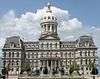