Ban Muang District
| Ban Muang บ้านม่วง | |
|---|---|
| Amphoe | |
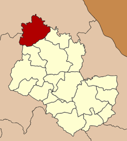 Amphoe location in Sakon Nakhon Province | |
| Coordinates: 17°51′4″N 103°34′12″E / 17.85111°N 103.57000°ECoordinates: 17°51′4″N 103°34′12″E / 17.85111°N 103.57000°E | |
| Country |
|
| Province | Sakon Nakhon |
| Seat | Muang |
| Area | |
| • Total | 850.0 km2 (328.2 sq mi) |
| Population (2005) | |
| • Total | 67,196 |
| • Density | 79.1/km2 (205/sq mi) |
| Time zone | THA (UTC+7) |
| Postal code | 47140 |
| Geocode | 4710 |
Ban Muang (Thai: บ้านม่วง) is a district (Amphoe) of Sakon Nakhon Province, northeast Thailand.
Geography
Neighboring districts are (from the west clockwise) Ban Dung of Udon Thani Province, Fao Rai of Nong Khai Province, So Phisai and Phon Charoen of Bueng Kan Province, Kham Ta Kla, Wanon Niwat and Charoen Sin of Sakon Nakhon Province.
The Songkhram River marks the boundary of the district to the west.
History
The minor district (King Amphoe) was created on March 20, 1968, when the three tambon Mai, Muang and Dong Mo Thong were split off from Wanon Niwat district.[1] It was upgraded to a full district on November 16, 1971.[2]
Administration
The district is subdivided into 9 subdistricts (tambon), which are further subdivided into 92 villages (muban). The subistrict municipality (thesaban tambon) Ban Muang covers parts of the tambon Muang. There are further 9 Tambon administrative organizations (TAO).
| No. | Name | Thai name | Villages | Inh. | |
|---|---|---|---|---|---|
| 1. | Muang | ม่วง | 11 | 8,205 | |
| 2. | Mai | มาย | 9 | 5,974 | |
| 3. | Dong Mo Thong | ดงหม้อทอง | 11 | 7,083 | |
| 4. | Dong Nuea | ดงเหนือ | 12 | 7,125 | |
| 5. | Dong Mo Thong Tai | ดงหม้อทองใต้ | 9 | 8,174 | |
| 6. | Huai Lua | ห้วยหลัว | 9 | 7,192 | |
| 7. | Non Sa-at | โนนสะอาด | 9 | 5,321 | |
| 8. | Nong Kwang | หนองกวั่ง | 11 | 9,118 | |
| 9. | Bo Kaeo | บ่อแก้ว | 11 | 9,004 |
References
- ↑ ประกาศกระทรวงมหาดไทย เรื่อง แบ่งท้องที่ตั้งเป็นกิ่งอำเภอ (PDF). Royal Gazette (in Thai). 85 (25 ง): 836. 1968-03-19.
- ↑ พระราชกฤษฎีกาตั้งอำเภอปลาปาก อำเภอเชียงกลาง อำเภอปากชม อำเภอบ้านม่วง อำเภอพังโคน อำเภอดอนสัก อำเภอพนม อำเภอเวียงสระ อำเภอสังคม และอำเภอหัวตะพาน พ.ศ. ๒๕๑๔ (PDF). Royal Gazette (in Thai). 88 (123 ก): 745–748. November 16, 1971.