Bang Pakong District
| Bang Pakong บางปะกง | |
|---|---|
| Amphoe | |
 Amphoe location in Chachoengsao Province | |
| Coordinates: 13°32′34″N 100°59′38″E / 13.54278°N 100.99389°ECoordinates: 13°32′34″N 100°59′38″E / 13.54278°N 100.99389°E | |
| Country | Thailand |
| Province | Chachoengsao |
| Seat | Tha Sa-an |
| Area | |
| • Total | 257.893 km2 (99.573 sq mi) |
| Population (2015) | |
| • Total | 89,109 |
| • Density | 345.52/km2 (894.9/sq mi) |
| Time zone | ICT (UTC+7) |
| Postal code | 24130 |
| Geocode | 2404 |
Bang Pakong (Thai: บางปะกง) is a district (amphoe) in the western part of Chachoengsao Province in central Thailand.
Bang Pakong District's name comes from the Bang Pakong River. The area has many industrial estates, including the huge gas- and oil-fired Bang Pakong Power Station.
History
Bang Pakong District was established in 1907. The first temporary district office was a building within the Wat Bon Khongkharam. In 1908 the government moved the office to the bank of the Bang Pakong River in Tambon Tha Sa-an, which is still the location today.[1]
Geography
Neighboring districts are (from the north clockwise) Ban Pho of Chachoengsao Province, Phan Thong, Mueang Chon Buri of Chon Buri Province, the Bay of Bangkok and Samut Prakan Province.
The important water resource is the Bang Pakong River, which empties into the Bay of Bangkok within the district. Bang Na-Trat highway runs through the district.
Administration
Central administration
The district Bang Pakong is divided into 12 sub-districts (tambon), which are further subdivided into 99 administrative villages (Muban).
| No. | Name | Thai | Villages | Pop.[2] |
|---|---|---|---|---|
| 1. | Bang Pakong | บางปะกง | 10 | 14,732 |
| 2. | Tha Sa-an | ท่าสะอ้าน | 8 | 7,334 |
| 3. | Bang Wua | บางวัว | 14 | 12,959 |
| 4. | Bang Samak | บางสมัคร | 9 | 13,891 |
| 5. | Bang Phueng | บางผึ้ง | 7 | 2,185 |
| 6. | Bang Kluea | บางเกลือ | 7 | 4,322 |
| 7. | Song Khlong | สองคลอง | 10 | 9,261 |
| 8. | Nong Chok | หนองจอก | 9 | 3,649 |
| 9. | Phimpha | พิมพา | 4 | 3,339 |
| 10. | Tha Kham | ท่าข้าม | 8 | 7,789 |
| 11. | Hom Sin | หอมศีล | 6 | 5,102 |
| 12. | Khao Din | เขาดิน | 7 | 2,574 |
Local administration
There are 10 sub-district municipalities (thesaban tambon) in the district:
- Bang Pakong Phrom Thep San (Thai: เทศบาลตำบลบางปะกงพรหมเทพรังสรรค์) consisting of parts of the sub-district Bang Pakong.
- Bang Samak (Thai: เทศบาลตำบลบางสมัคร) consisting of parts of the sub-district Bang Samak.
- Bang Phueng (Thai: เทศบาลตำบลบางผึ้ง) consisting of the sub-district Bang Phueng.
- Tha Kham (Thai: เทศบาลตำบลท่าข้าม) consisting of the sub-district Tha Kham.
- Tha Sa-an (Thai: เทศบาลตำบลท่าสะอ้าน) consisting of parts of the sub-district Tha Sa-an.
- Hom Sin (Thai: เทศบาลตำบลหอมศีล) consisting of parts of the sub-district Hom Sin.
- Bang Pakong (Thai: เทศบาลตำบลบางปะกง) consisting of parts of the sub-district Bang Pakong.
- Bang Wua (Thai: เทศบาลตำบลบางวัว) consisting of parts of the sub-districts Bang Wua, Bang Samak, Bang Kluea.
- Phimpha (Thai: เทศบาลตำบลพิมพา) consisting of the sub-district Phimpha.
- Bang Wua Khana Rak (Thai: เทศบาลตำบลบางวัวคณารักษ์) consisting of parts of the sub-district Bang Wua.
There are six sub-district administrative organizations (SAO) in the district:
- Tha Sa-an (Thai: องค์การบริหารส่วนตำบลท่าสะอ้าน) consisting of parts of the sub-district Tha Sa-an.
- Bang Kluea (Thai: องค์การบริหารส่วนตำบลบางเกลือ) consisting of parts of the sub-district Bang Kluea.
- Song Khlong (Thai: องค์การบริหารส่วนตำบลสองคลอง) consisting of the sub-district Song Khlong.
- Nong Chok (Thai: องค์การบริหารส่วนตำบลหนองจอก) consisting of the sub-district Nong Chok.
- Hom Sin (Thai: องค์การบริหารส่วนตำบลหอมศีล) consisting of parts of the sub-district Hom Sin.
- Khao Din (Thai: องค์การบริหารส่วนตำบลเขาดิน) consisting of the sub-district Khao Din.
-
.jpg)
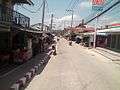
Downtown Bang Pakong
-
Bangwua Street, Bang Pakong
-
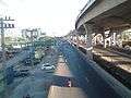
Bangna-Bangpakong Road in Bang Pakong's Ambit
References
- ↑ ประวัติความเป็นมาของหมู่บ้าน ปากคลองอ้อมใหญ่ (in Thai). Archived from the original on 2007-09-29.
- ↑ "Population statistics 2013" (in Thai). Department of Provincial Administration. Retrieved 2014-10-07.
External links
- amphoe.com (Thai)