Bangassou
| Bangassou | |
|---|---|
|
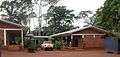
Central market in Bangassou | |
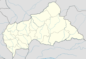 Bangassou Location in Central African Republic | |
| Coordinates: 4°44′15″N 22°49′10″E / 4.737425°N 22.819462°ECoordinates: 4°44′15″N 22°49′10″E / 4.737425°N 22.819462°E | |
| Country |
|
| Prefecture | Mbomou |
| Elevation | 457 m (1,499 ft) |
| Population (2012) | |
| • Total | 35,305 |

Bangassou is a city in the south eastern Central African Republic, lying on the north bank of the Mbomou River. It has a population of 24,447[1] (2003 census) and is the capital of the Mbomou prefecture. It is known for its wildlife, market, and nearby airport and is linked by ferry to the Democratic Republic of Congo on the south bank. The city is also home to the Roman Catholic Diocese of Bangassou.
Axmin Mining Camp and Kembe Falls are located in the area.
History
During the French colonial occupation of Congo Free State, the French military established a base at Bangassou. In 1922 the Spiritains established a Catholic mission in the town. In 1931 the société cotonnière Comouna built a cotton processing plant in the town. In 1935 the town became the capital of the Department of Mbomou. On 11 March 2013 Seleka rebels occupied the town.
Climate
| Climate data for Bangassou | |||||||||||||
|---|---|---|---|---|---|---|---|---|---|---|---|---|---|
| Month | Jan | Feb | Mar | Apr | May | Jun | Jul | Aug | Sep | Oct | Nov | Dec | Year |
| Average high °C (°F) | 34 (94) |
35 (95) |
34 (94) |
33 (92) |
33 (91) |
32 (89) |
31 (88) |
31 (88) |
32 (89) |
32 (89) |
33 (91) |
33 (91) |
33 (91) |
| Average low °C (°F) | 18 (65) |
19 (66) |
20 (68) |
21 (69) |
21 (69) |
21 (69) |
20 (68) |
19 (67) |
19 (67) |
20 (68) |
19 (67) |
18 (65) |
19 (67) |
| Average precipitation mm (inches) | 23 (0.9) |
43 (1.7) |
119 (4.7) |
137 (5.4) |
230 (9) |
183 (7.2) |
183 (7.2) |
206 (8.1) |
193 (7.6) |
264 (10.4) |
97 (3.8) |
38 (1.5) |
1,715 (67.5) |
| Source: Weatherbase [2] | |||||||||||||
Gallery
-
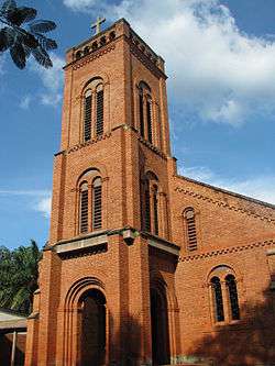
San Pedro Claver Cathedral, seat of the Roman Catholic Diocese of Bangassou
-
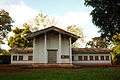
Bangassou courthouse
-
AIDS hospice, run in association with the diocese
-
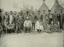
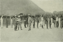
Sultan and his wives at Bangassou, 1906
-

Near Bangassou, 1906
References
- ↑ "Central African Republic: largest cities and towns and statistics of their population". World Gazetteer. Retrieved 11 May 2011.
- ↑ "Weatherbase: Historical Weather for Bangassou, Central African Republic". Weatherbase. 2011. Retrieved on November 24, 2011.
