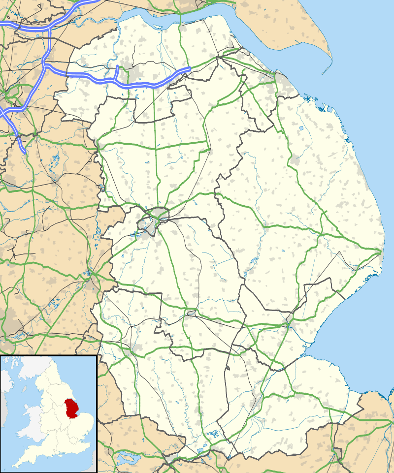
Barkston
| Barkston | |
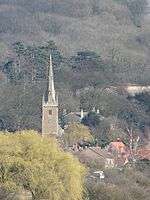 The spire of Barkston church |
|
 Barkston |
|
| Population | 497 (2001 census)[1][2] |
|---|---|
| OS grid reference | SK930415 |
| – London | 100 mi (160 km) S |
| Civil parish | Barkston |
| District | South Kesteven |
| Shire county | Lincolnshire |
| Region | East Midlands |
| Country | England |
| Sovereign state | United Kingdom |
| Post town | Grantham |
| Postcode district | NG32 |
| Dialling code | 01400 |
| Police | Lincolnshire |
| Fire | Lincolnshire |
| Ambulance | East Midlands |
| EU Parliament | East Midlands |
| UK Parliament | Sleaford and North Hykeham |
|
|
Coordinates: 52°57′46″N 0°36′54″W / 52.9628°N 0.6149°W
Barkston is a village and civil parish[3] in the South Kesteven district of Lincolnshire, England. The population of the civil parish was 497 at the 2001 census falling slightly to 493 at the 2011 census.[4] The village is situated approximately 4 miles (6 km) north from the market town of Grantham, and on the A607 road, just south of the junction with the A153 to Ancaster.
History
The village is named in the Domesday Book as "Barchestune", and the name probably means "the farmstead of a man called Barkr."
The Deserted Medieval Village of Ringsthorpe was located just to the west of Barkston, on the other side of the River Witham.SK927414 Mentioned in the Domesday Book, the latest archaeology at the site is from the Medieval period, and the last documentary mention is in the 14th century.[5]
Built in 1640 and re-built in 1839, Hickson's Almshouses provide homes for local elderly people.[6]
Barkston railway station was at the junction of the ECML and Sleaford railways, near Barkston South junction.
Military history
During the Second World War, Arthur Lowe, of Dad's Army, was stationed at Barkston with the Royal Army Ordnance Corps, which was tasked with servicing searchlights.[7]

RAF Barkston Heath has in recent years been the base of the Joint Elementary Flying Training School (RAF and Fleet Air Arm) in 1995, and the Army Air Corps joined in 1996, which became the Defence Elementary Flying Training School in 2003 when the RAF left. Now 703 Naval Air Squadron and 674 Squadron Army Air Corps are part of No.1 Elementary Flying Training School. The airfield is also used for the British Model Flying Association national championships. In June 2003, the BBMF moved to Barkston Heath for four months.[8]
Geography
The present route of the A607 through the village dates from the 1930s. The River Witham passes through the west of the village. At the 2001 census there were 229 households,[2] 100% of the population was white, and 87% declared themselves as Christian. 20% of the population are retired.[1]
To the east on top of the Jurassic limestone escarpment is RAF Barkston Heath, next to the course of the Roman Road Ermine Street.
The parish boundary crosses the A607 at the northern end of the Syston bypass. It follows to the south of Station Road, crossing the River Witham, crossing the northern side of Hambleton Hill, crossing the East Coast Main Line at Shire House, to the west. North of this point are the Barkston South and Barkston East railway junctions, situated either side of Westfield Farm, and now no longer needed since 2004. The boundary follows along the northern edge of Hurn Wood, where it meets Marston. Northwards, it crosses the Grantham Avoiding Line at the Sand Lane bridge. It crosses the ECML, follows the Viking Way eastwards and meets Hougham, and the River Witham, south of Frinkley Plantation. At Far Hill, the boundary leaves the Viking Way, passing northwards through Old Gorse Wood, to the west of the former Barkston Gorse Farm, crossing Frinkley Lane. Eastwards, it briefly meets Carlton Scroop, and at the top of a hill it meets Honington at Spellar Wood, passing along the southern edge. Passing south-west, it crosses Frinkley Lane, also the Viking Way, crosses Hough Road along the southern edge of Grove Plantations, and the Grantham-Sleaford railway line (Poacher Line). It crosses the A607 at the A153 junction, passes through Minnetts Wood, north of Heath Farm, over the top of Honington Heath, meeting Ancaster, and straight across the middle of RAF Barkston Heath.
At Ermine Street (B6403 road) it meets Wilsford and North Kesteven, and is briefly the South Kesteven boundary. At the southern edge of Barkston Heath airfield, it follows Heath Lane westwards, and meets Syston. It follows Heath Lane, at this point a track, along Barkston Heath, passing through Minnett's Wood along Minnett's Hill.
Community

The Ecclesiastical parish of Barkston is part of the Barkston and Hough Group of the Deanery of Loveden, Diocese of Lincoln. The 2013 incumbent is Rev Stuart Hadley.[9] The parish church is dedicated to Saint Nicholas.
The St Nicholas Church includes a Norman window, a 14th-century spire and 15th-century porch.[10]
Although the Methodist Chapel has closed, the Church holds services in the village hall.
The village public house is The Stag, located on Church Street. A mobile library calls once a month, a mobile fish and chip van every Thursday, and a mobile greengrocer every Friday. There is a petrol station with shop on the main road, with an adjacent hand car wash and mechanic's garage.
Barkston has a Girl Guides and Brownies troop, a mother-and-toddler group. A produce show is held every summer.
Barkston has a cricket club, an Indoor Bowls team, and a local football team. The football team play in the Grantham and District League Premier Division after finishing third in the 2007–08 season in Division One.
References
- 1 2 Parish statistics
- 1 2 "2001 census". Neighbourhood Statistics. Office for National Statistics. Retrieved 20 April 2013.
- ↑ "Civil Parish details".
- ↑ "Civil Parish population 2011". Neighbourhood Statistics. Office for National Statistics. Retrieved 21 April 2016.
- ↑ Historic England. "DMV at Ringsthorpe (326017)". PastScape. Retrieved 10 April 2010.
- ↑ Charity record for Hickson's Almshouses Archived 18 July 2011 at the Wayback Machine.
- ↑ Arthur Lowe
- ↑ BBMF in 2003
- ↑ "Ecclesiastical parish details". Archived from the original on 16 July 2011.
- ↑ Historic England. "St Nicholas church (326027)". PastScape. Retrieved 10 April 2010.
External links
 Media related to Barkston at Wikimedia Commons
- Barkston in the Domesday Book
News items
England Portal | |
| Unitary authorities | |
| Boroughs or districts | |
| Major settlements |
|
| Topics | |