Bayle Mountain
| Bayle Mountain | |
|---|---|
 | |
| Highest point | |
| Elevation | 1,853 ft (565 m) |
| Coordinates | 43°47′0″N 71°15′06″W / 43.78333°N 71.25167°WCoordinates: 43°47′0″N 71°15′06″W / 43.78333°N 71.25167°W |
| Geography | |
| Location | Ossipee, New Hampshire, U.S. |
| Parent range | Ossipee Mountains |
| Topo map | USGS Tamworth |
| Climbing | |
| Easiest route | Bayle Mountain Trail |
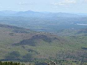
Bayle Mountain is a mountain located in Carroll County, New Hampshire, standing above Conner Pond.
See also
External links
This article is issued from Wikipedia - version of the 12/18/2015. The text is available under the Creative Commons Attribution/Share Alike but additional terms may apply for the media files.