Beit Ezra
| Beit Ezra | |
|---|---|
 Beit Ezra | |
| Coordinates: 31°44′11.75″N 34°39′20.52″E / 31.7365972°N 34.6557000°ECoordinates: 31°44′11.75″N 34°39′20.52″E / 31.7365972°N 34.6557000°E | |
| District | Southern |
| Council | Be'er Tuvia |
| Affiliation | Moshavim Movement |
| Founded | 1950 |
| Founded by | Iraqi immigrants |
| Population (2015)[1] | 1,090 |
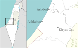
Beit Ezra (Hebrew: בֵּית עֶזְרָא, lit. House of Ezra) is a moshav in southern Israel. Located between Ashdod and Ashkelon on the Israeli coastal plain, it falls under the jurisdiction of Be'er Tuvia Regional Council. In 2015 it had a population of 1,090.
History
The moshav was founded in 1950 by immigrants from Iraq on the ruins of Hamama and was named after Ezra.[2] South of the moshav is Hill 69, which served as a military post and was the scene of fighting during the 1948 Arab–Israeli War. Also nearby is the Ad Halom bridge at which the Egyptian army was stopped during their advance towards Tel Aviv.
References
- ↑ "List of localities, in Alphabetical order" (PDF). Israel Central Bureau of Statistics. Retrieved 16 October 2016.
- ↑ Mapa's concise gazetteer of Israel (in Hebrew). Yuval Elʻazari (ed.). Tel-Aviv: Mapa Publishing. 2005. p. 75. ISBN 965-7184-34-7.
This article is issued from Wikipedia - version of the 1/19/2016. The text is available under the Creative Commons Attribution/Share Alike but additional terms may apply for the media files.