Belstone
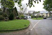

Belstone is a small village and civil parish in the West Devon District of Devon, England. Lying on the northern side of Dartmoor, the western boundary of the parish is mostly formed by the East Okement River and the eastern by the River Taw; its highest point is Belstone Tor in the south, at 1,508 feet.[1] The parish is surrounded, clockwise from the north, by the parishes of Sticklepath, South Tawton, Dartmoor Forest and Okehampton Hamlets.[2] In 2001 its population was 257, relatively unchanged from the 1901 figure of 236.[1]
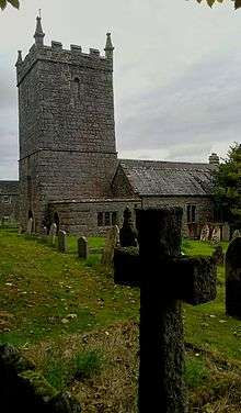
The village, recorded in the Domesday Book as Bellestam, is central in its parish and lies at around 990 feet above sea level. It is only accessible by minor roads from the A30 road, east of the town of Okehampton, which is about three miles to the north-west. The parish church, dedicated to St. Mary, dates from the 13th century and has priests recorded from 1260.[1][3]
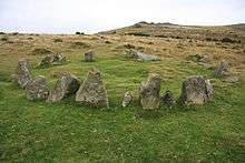
There are a number of Bronze Age remains within the parish, including the Nine Maidens stone circle, the remains of the outer wall of a burial chamber.[1]
In the 19th century, copper was worked on the moor at Taw River mine which closed in 1892, and at Greenhill in the north-east.[1]
It is possible that Fatherford, in the north west of Belstone parish, was one stage in a Roman extension of the Fosse Way road from Exeter to Launceston.[4]
Belstone in fiction
- Agatha Christie's 1931 novel The Sittaford Mystery would appear to use Belstone as the location of the fictional settlement of Sittaford.
- The story of The Ballad of the Belstone Fox (1970) by David Rook was based on the area, later made into a film The Belstone Fox in 1973.
- Michael Jecks made the village the setting for his 1999 novel Belladonna At Belstone.
References
- 1 2 3 4 5 Harris, Helen (2004). A Handbook of Devon Parishes. Tiverton: Halsgrove. p. 16. ISBN 1-84114-314-6.
- ↑ "Map of Devon Parishes" (PDF). Devon County Council. Retrieved 20 June 2013.
- ↑ Dorothea, James (1911). Belstone: Some Account of the Parish. Past and Present. Winchester: Warren and Son.
- ↑ "Belstone History". South Zeal & its Dartmoor Environment. Retrieved 12 July 2016.
- The Book of Belstone by Chris and Marion Walpole, 2002
External links
| Wikimedia Commons has media related to Belstone. |
Coordinates: 50°43′N 3°57′W / 50.717°N 3.950°W