Belton, North Lincolnshire
| Belton | |
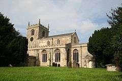 All Saints' Church, Belton |
|
 Belton |
|
| Population | 2,968 (2011) |
|---|---|
| OS grid reference | SE784069 |
| – London | 145 mi (233 km) S |
| Unitary authority | North Lincolnshire |
| Ceremonial county | Lincolnshire |
| Region | Yorkshire and the Humber |
| Country | England |
| Sovereign state | United Kingdom |
| Post town | Doncaster |
| Postcode district | DN9 |
| Dialling code | 01427 |
| Police | Humberside |
| Fire | Humberside |
| Ambulance | East Midlands |
| EU Parliament | Yorkshire and the Humber |
| UK Parliament | Brigg and Goole (UK Parliament constituency) |
|
|
Coordinates: 53°33′11″N 0°49′00″W / 53.552995°N 0.816584°W
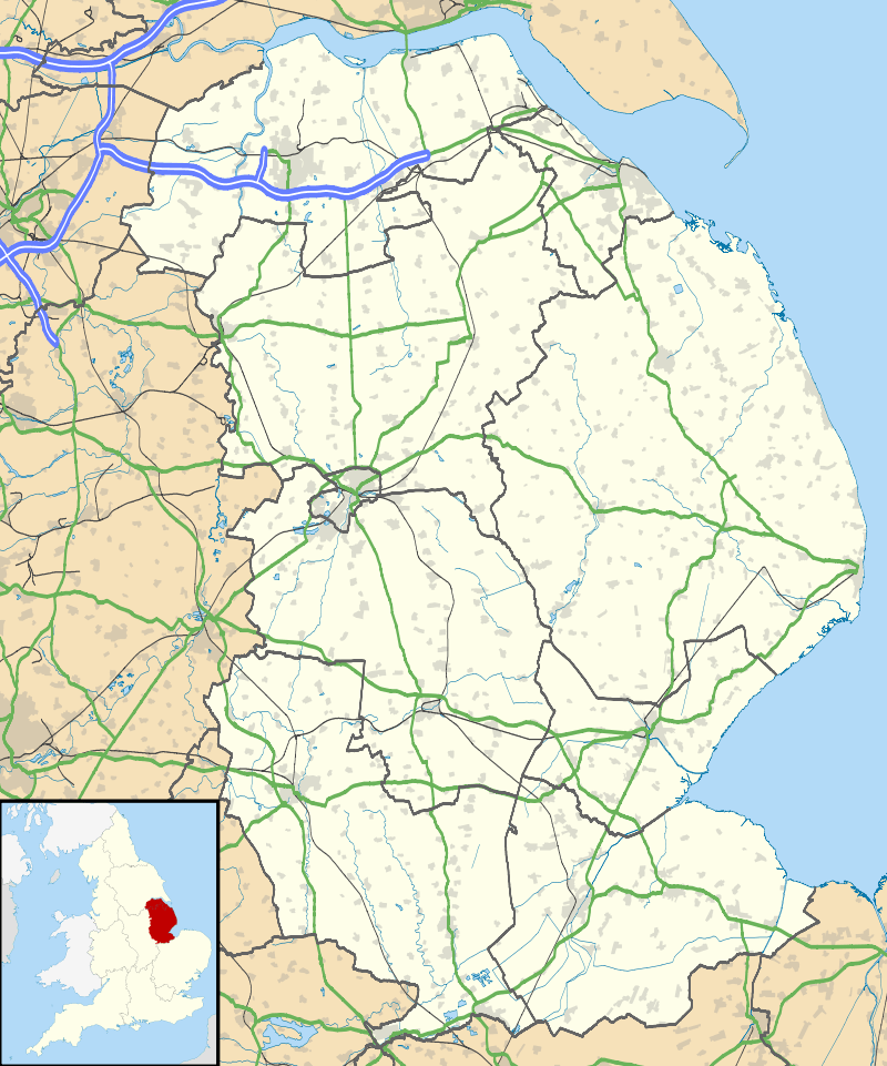
Belton is a village and civil parish in the Isle of Axholme area of North Lincolnshire, England. It is situated on the A161 road, and approximately 6 miles (10 km) east from Scunthorpe. To the north of Belton is the town of Crowle; to the south, the village of Epworth.[1]
Belton parish boundaries include the hamlets of Beltoft, Sandtoft, Churchtown, Bracon, Carrhouse, Mosswood, Grey Green and Westgate. Within the parish is the now dispersed country house estate of Temple Belwood. Hirst Priory at Sandtoft still stands.
According to the 1991 Census, Belton had a population of 2,549, increasing to 2,968 at the 2011 census.[2]
Church
Belton Grade I listed[3] Anglican church is dedicated to All Saints.[4] The church is of perpendicular style. Within its chancel chapel is a 14th-century tomb, supposed to be that of Sir Richard de Belwood.[5]
Sandtoft
Sandtoft was granted to the abbey of St Mary's York, c. 1150, by Roger de Mowbray, for the use of a single monk. By 1241, it had become a separate monastic cell, later annexed by the larger cell of St Mary Magdalene, Lincoln.[5]
RAF Sandtoft, a former RAF Bomber Command airfield, closed in 1955 and has since been converted to other use, including for Sandtoft Airfield which is home to Sandtoft Flying School. The Trolleybus Museum at Sandtoft, the largest trolleybus museum in Europe, is located on part of the site of the former air base.
Hirst and Temple Belwood
Grade II listed Hirst Priory[6] is on or near the site of a monastic cell at Hirst. In the early 12th century the lands for the cell were granted by Nigel d'Albini to the Austin canons of Nostell Priory. The cell, which was extant until the 16th century, housed a single canon to oversee the priory's property and tithes.[5] The house was built in the 18th century, with later additions in the 19th.[6]
Temple Bellwood was a large house in 200 acres (0.8 km2) of parkland north of Belton. The land once belonged to the Knights Templar of Balsall, Warwickshire.[5]
Amenities
Belton has a small primary school that has been in existence since 1869, and two public houses.
References
- ↑ OS Explorer Map 280: Isle of Axholme, Scunthorpe and Gainsborough: (1:25 000) : ISBN 0 319 46432 6
- ↑ "Civil Parish population 2011". Neighbourhood Statistics. Office for National Statistics.
- ↑ Historic England. "Church of All Saints (1083293)". National Heritage List for England. Retrieved 28 June 2011.
- ↑ "Belton", genuki.org.uk. Retrieved 28 June 2011
- 1 2 3 4 Cox, J. Charles (1916) Lincolnshire p. 59; Methuen & Co. Ltd
- 1 2 Historic England. "Hirst Priory (1083287)". National Heritage List for England. Retrieved 28 June 2011.
External links
 Media related to Belton, North Lincolnshire at Wikimedia Commons
- History of Belton
- An Isle of Axholme website
England Portal | |
| Unitary authorities | |
| Boroughs or districts | |
| Major settlements |
|
| Topics | |