Bernières-le-Patry
| Bernières-le-Patry | |
|---|---|
|
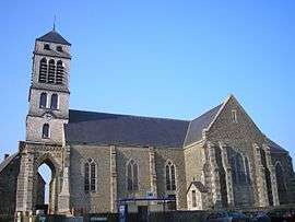
St. Gerbold | |
 Bernières-le-Patry | |
|
Location within Normandy region  Bernières-le-Patry | |
| Coordinates: 48°48′54″N 0°44′07″W / 48.815°N 0.7353°WCoordinates: 48°48′54″N 0°44′07″W / 48.815°N 0.7353°W | |
| Country | France |
| Region | Normandy |
| Department | Calvados |
| Arrondissement | Vire |
| Canton | Condé-sur-Noireau |
| Government | |
| • Mayor (2008–2014) | René Mauny |
| Area1 | 15.67 km2 (6.05 sq mi) |
| Population (2008)2 | 559 |
| • Density | 36/km2 (92/sq mi) |
| Time zone | CET (UTC+1) |
| • Summer (DST) | CEST (UTC+2) |
| INSEE/Postal code | 14065 / 14410 |
| Elevation |
152–270 m (499–886 ft) (avg. 182 m or 597 ft) |
|
1 French Land Register data, which excludes lakes, ponds, glaciers > 1 km² (0.386 sq mi or 247 acres) and river estuaries. 2 Population without double counting: residents of multiple communes (e.g., students and military personnel) only counted once. | |
Bernières-le-Patry is a former commune in the Calvados department in the Normandy region in northwestern France. On 1 January 2016, it was merged into the new commune of Valdallière.[1]
Population
| Historical population | ||
|---|---|---|
| Year | Pop. | ±% |
| 1793 | 1,464 | — |
| 1800 | 1,132 | −22.7% |
| 1806 | 1,461 | +29.1% |
| 1821 | 1,419 | −2.9% |
| 1831 | 1,423 | +0.3% |
| 1836 | 1,510 | +6.1% |
| 1841 | 1,547 | +2.5% |
| 1846 | 1,563 | +1.0% |
| 1851 | 1,568 | +0.3% |
| 1856 | 1,500 | −4.3% |
| 1861 | 1,502 | +0.1% |
| 1866 | 1,504 | +0.1% |
| 1872 | 1,344 | −10.6% |
| 1876 | 1,268 | −5.7% |
| 1881 | 1,122 | −11.5% |
| 1886 | 1,136 | +1.2% |
| 1891 | 1,075 | −5.4% |
| 1896 | 973 | −9.5% |
| 1901 | 952 | −2.2% |
| 1906 | 907 | −4.7% |
| 1911 | 870 | −4.1% |
| 1921 | 757 | −13.0% |
| 1926 | 761 | +0.5% |
| 1931 | 784 | +3.0% |
| 1936 | 737 | −6.0% |
| 1946 | 712 | −3.4% |
| 1954 | 684 | −3.9% |
| 1962 | 691 | +1.0% |
| 1968 | 658 | −4.8% |
| 1975 | 532 | −19.1% |
| 1982 | 512 | −3.8% |
| 1990 | 485 | −5.3% |
| 1999 | 502 | +3.5% |
| 2008 | 559 | +11.4% |
See also
References
- ↑ Arrêté préfectoral 13 October 2015 (French)
| Wikimedia Commons has media related to Bernières-le-Patry. |
This article is issued from Wikipedia - version of the 3/22/2016. The text is available under the Creative Commons Attribution/Share Alike but additional terms may apply for the media files.