Bernisse
| Bernisse | ||
|---|---|---|
| Former municipality | ||
|
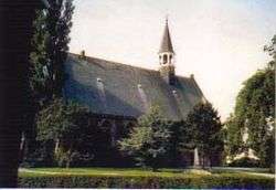
Church in Oudenhoorn | ||
| ||
.svg.png) Location in South Holland | ||
| Coordinates: 51°51′N 4°15′E / 51.850°N 4.250°ECoordinates: 51°51′N 4°15′E / 51.850°N 4.250°E | ||
| Country | Netherlands | |
| Province | South Holland | |
| Municipality | Nissewaard | |
| Area[1] | ||
| • Total | 68.46 km2 (26.43 sq mi) | |
| • Land | 57.34 km2 (22.14 sq mi) | |
| • Water | 11.12 km2 (4.29 sq mi) | |
| Elevation[2] | 0 m (0 ft) | |
| Population (May 2014)[3] | ||
| • Total | 12,384 | |
| • Density | 216/km2 (560/sq mi) | |
| Time zone | CET (UTC+1) | |
| • Summer (DST) | CEST (UTC+2) | |
| Postcode | 3211–3218, 3227 | |
| Area code | 0181 | |
| Website |
www | |
Bernisse (![]() pronunciation ) is a former municipality in the western Netherlands, in the province of South Holland. Since 2015 it has been a part of the municipality of Nissewaard.
pronunciation ) is a former municipality in the western Netherlands, in the province of South Holland. Since 2015 it has been a part of the municipality of Nissewaard.
The former municipality had a population of 12,384 in 2014, and covered an area of 68.46 km2 (26.43 sq mi) of which 11.12 km2 (4.29 sq mi) was water.
The former municipality was named after the river Bernisse, which flows right through it from the Spui to the Brielse meer and separates the estuary islands of Voorne and Putten.
The former municipality of Bernisse consisted of the following communities: Abbenbroek, Biert, Geervliet, Heenvliet, Oudenhoorn, Simonshaven, Zuidland.
The municipality of Bernisse was formed on January 1, 1980, through the amalgamation of the municipalities Abbenbroek, Oudenhoorn, Zuidland, and parts of the municipalities Geervliet (including Simonshaven) and Heenvliet.
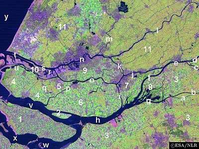
Topography

Dutch Topographic map of the former municipality of Bernisse, 2013.
References
- ↑ "Kerncijfers wijken en buurten" [Key figures for neighbourhoods]. CBS Statline (in Dutch). CBS. 2 July 2013. Retrieved 12 March 2014.
- ↑ "Postcodetool for 3216AG". Actueel Hoogtebestand Nederland (in Dutch). Het Waterschapshuis. Retrieved 14 July 2013.
- ↑ "Bevolkingsontwikkeling; regio per maand" [Population growth; regions per month]. CBS Statline (in Dutch). CBS. 26 June 2014. Retrieved 24 July 2014.
External links
| Wikimedia Commons has media related to Bernisse. |
 |
Brielle | Rotterdam Hartel Canal |
| |
| Hellevoetsluis | |
Spijkenisse | ||
| ||||
| | ||||
| Haringvliet Goeree-Overflakkee |
Spui / Korendijk |