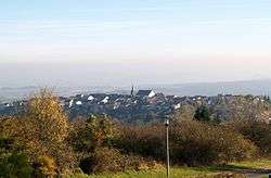
Berus
This article is about the village in Saarland. For French commune in the Sarthe department, see Bérus.
| Berus | ||
|---|---|---|
| Ortsteil of Überherrn | ||
 | ||
| ||
 Berus | ||
| Coordinates: 49°15′50″N 6°41′40″E / 49.26389°N 6.69444°ECoordinates: 49°15′50″N 6°41′40″E / 49.26389°N 6.69444°E | ||
| Country | Germany | |
| State | Saarland | |
| District | Saarlouis | |
| Municipality | Überherrn | |
| Area | ||
| • Total | 11.80 km2 (4.56 sq mi) | |
| Population (2010-12-31) | ||
| • Total | 2,053 | |
| • Density | 170/km2 (450/sq mi) | |
| Time zone | CET/CEST (UTC+1/+2) | |
| Postal codes | 66802 | |
| Dialling codes | 06836 | |
Berus is a village in the municipality of Überherrn in the district of Saarlouis, Saarland, southwestern Germany. Until December 1973, Berus was a municipality of its own.
Geographic position
The old centre of the village is situated on a spur of the Saargau overlooking the Saar valley, on the very border to Lorraine (France). The highest position is on 377 m absolute altitude. (Sauberg/Frensh broadcast station Europe 1)
This article is issued from Wikipedia - version of the 6/22/2015. The text is available under the Creative Commons Attribution/Share Alike but additional terms may apply for the media files.
