Bethlehem Airport
For the airport serving Bethlehem, Pennsylvania, see Lehigh Valley International Airport.
| Bethlehem Airport | |||||||||||||||
|---|---|---|---|---|---|---|---|---|---|---|---|---|---|---|---|
| IATA: none – ICAO: FABM | |||||||||||||||
| Summary | |||||||||||||||
| Airport type | Public | ||||||||||||||
| Operator | Municipal | ||||||||||||||
| Location | Bethlehem, Free State, South Africa | ||||||||||||||
| Elevation AMSL | 5,561 ft / 1,695 m | ||||||||||||||
| Coordinates | 28°14′55″S 028°20′10″E / 28.24861°S 28.33611°ECoordinates: 28°14′55″S 028°20′10″E / 28.24861°S 28.33611°E | ||||||||||||||
| Map | |||||||||||||||
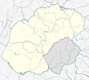 FABM Location in the Free State | |||||||||||||||
| Runways | |||||||||||||||
| |||||||||||||||
Bethlehem Airport (ICAO: FABM) is an airport serving Bethlehem,[2] a town in the Free State province in South Africa.
Facilities
The airport resides at an elevation of 5,561 feet (1,695 m) above mean sea level. It has two runways: 11/29 has an asphalt surface measuring 1,175 by 15 metres (3,855 ft × 49 ft) and 13/31 with a grass surface measuring 1,311 by 46 metres (4,301 ft × 151 ft).[1]
See also
References
- 1 2 "Aerodrome chart for BETHLEHEM - FABM" (PDF). South African Civil Aviation Authority. Effective 7 June 2007. Check date values in:
|date=(help) - 1 2 Airport information for FABM from DAFIF (effective October 2006)
External links
This article is issued from Wikipedia - version of the 9/22/2013. The text is available under the Creative Commons Attribution/Share Alike but additional terms may apply for the media files.