Bethoncourt
| Bethoncourt | ||
|---|---|---|
 | ||
| ||
 Bethoncourt | ||
|
Location within Bourgogne-Franche-Comté region  Bethoncourt | ||
| Coordinates: 47°32′07″N 6°48′17″E / 47.5353°N 6.8047°ECoordinates: 47°32′07″N 6°48′17″E / 47.5353°N 6.8047°E | ||
| Country | France | |
| Region | Bourgogne-Franche-Comté | |
| Department | Doubs | |
| Arrondissement | Montbéliard | |
| Canton | Montbéliard-Est | |
| Intercommunality | Pays de Montbéliard | |
| Government | ||
| • Mayor (2008–2014) | Thierry Bodin | |
| Area1 | 6.54 km2 (2.53 sq mi) | |
| Population (2012)2 | 5,885 | |
| • Density | 900/km2 (2,300/sq mi) | |
| Time zone | CET (UTC+1) | |
| • Summer (DST) | CEST (UTC+2) | |
| INSEE/Postal code | 25057 / 25200 | |
| Elevation | 315–410 m (1,033–1,345 ft) | |
|
1 French Land Register data, which excludes lakes, ponds, glaciers > 1 km² (0.386 sq mi or 247 acres) and river estuaries. 2 Population without double counting: residents of multiple communes (e.g., students and military personnel) only counted once. | ||

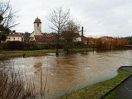
Bethoncourt is a commune in the Doubs department in the Bourgogne-Franche-Comté region in eastern France.
Geography
Bethoncourt lies north of Montbéliard, close to the border with the Haute-Saône department and the Territoire de Belfort and very near the Swiss border. The Lizaine, formerly called the Luzine, flows through it.
History
In the Franco-Prussian War, many citizens of Bethoncourt fled from the Prussians across the border to Switzerland, where many had relatives in the Swiss Jura region.
Population
In the early twentieth century, Bethoncourt grew from a small town into a thriving city of nearly 11,000 inhabitants. Since 1975, however, it has shrunk to just over half that size.
| Historical population | ||
|---|---|---|
| Year | Pop. | ±% |
| 1800 | 445 | — |
| 1896 | 891 | +100.2% |
| 1921 | 1,026 | +15.2% |
| 1962 | 6,442 | +527.9% |
| 1968 | 10,996 | +70.7% |
| 1975 | 10,592 | −3.7% |
| 1982 | 9,751 | −7.9% |
| 1990 | 7,485 | −23.2% |
| 1999 | 6,848 | −8.5% |
| 2008 | 6,057 | −11.6% |
| 2012 | 5,885 | −2.8% |
Economy
Bethoncourt possessed rich iron mines that provided ore for all the foundries in the region in such towns as Chagey and Audincourt.
Shafts from 1 to 3 meters in diameter were dug to a depth of 40 meters. These led to horizontal galleries that allowed extraction of the mineral.
The ore was brought to a washing station (still extant), a sort of lock on the Lizaine between Bethoncourt and Bussurel. There the nodules of iron were washed out of the soil matrix.
The workers, mostly peasants, were well paid for this difficult and dangerous work. The galloshes (Gollutch) they wore became the nickname for the residents of Bethoncourt.[1]
In the mid-nineteenth century, an important segment of the population consisted of highly skilled watchmakers. However, the entire Jura watchmaking industry was hit hard by the importation of cheap factory-made American watches, which were of equal or higher quality.
In the 1930s, up to 600 workers were employed in the textile mill.
Transportation
Bethoncourt lies on the Strasbourg-Lyon line of the SNCF and on departmental highway D438.
Twin towns
Bethoncourt is twinned with:
-
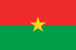 Silmiouglou, Burkina Faso
See also
References
- ↑ Association Bethoncourtoise pour la sauvegarde et la mise en valeur du patrimoine locale
| Wikimedia Commons has media related to Bethoncourt. |