Bharkhar
| Bharkhar | |
|---|---|
| village | |
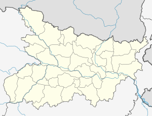 Bharkhar  Bharkhar Location in Bihar, India | |
| Coordinates: 25°11′22.85″N 83°36′59.76″E / 25.1896806°N 83.6166000°ECoordinates: 25°11′22.85″N 83°36′59.76″E / 25.1896806°N 83.6166000°E | |
| Country |
|
| State | Bihar |
| District | Kaimur |
| Population | |
| • Total | 1,683(counted in 2,009) |
| Languages | |
| • Official | Bhojpuri, Hindi |
| Time zone | IST (UTC+5:30) |
| Telephone code | code- 06189 |
| Vehicle registration | BR-24 |
| Coastline | 0 kilometres (0 mi) |
| Nearest city | kudra |
| Literacy | more than 85%% |
| Climate | as usual (Köppen) |
| Avg. summer temperature | 43 °C (109 °F) |
| Avg. winter temperature | 14 °C (57 °F) |
| Website |
wikimapia |
Bharkhar is a village near Mohania in the state of Bihar, India.[1]
It had a population of 1396 in May 2009.
The nearest railway station is Bhabua Road (2;km). India's longest highway NH-2. passes through the village.
and the It's also connected with state highway 14 "SH14", SH14 is Bihar road lines which is started from Bhabhua to Buxur. Bharkhar village is now developing in business of rice. many of people who buy rice from farmer and they supply in another location with higher price.
References
http://offerings.nic.in/directory/adminreps/viewGPmapcvills.asp?gpcode=93805&rlbtype=V
http://offerings.nic.in/directory/adminreps/viewGPmapcvills.asp?gpcode=93805
This article is issued from Wikipedia - version of the 11/1/2016. The text is available under the Creative Commons Attribution/Share Alike but additional terms may apply for the media files.