Bholahat Upazila
| Bholahat ভোলাহাট | |
|---|---|
| Upazila | |
 Bholahat Location in Bangladesh | |
| Coordinates: 24°56′45″N 88°13′40″E / 24.94583°N 88.22778°ECoordinates: 24°56′45″N 88°13′40″E / 24.94583°N 88.22778°E | |
| Country |
|
| Division | Rajshahi Division |
| District | Chapai Nawabganj District |
| Area | |
| • Total | 123.52 km2 (47.69 sq mi) |
| Population (1991) | |
| • Total | More than 2 Lac |
| Time zone | BST (UTC+6) |
| Website | Official Map of Bholahat |
Bholahat (Bengali: ভোলাহাট) is an Upazila of Nawabganj District in the Division of Rajshahi, Bangladesh.[1]
Geography
Its total area of 123.52 km². The Indian border is surrounded on 3 sides by this Upazila. The Mahananda River, Bil Vatia and Mango garden divide this Upazila from India.
Demographics
According to the 2001 Bangladesh census, Bholahat had a population of 92,149. Males constituted 50.58% of the population, and females 49.42%. There were 19,257 households.
Bholahat had an average literacy rate of 39.22%, comprising a male literacy rate of 39.71% and female literacy rate of 38.74%.
Administration
Bholahat has 4 Unions/Wards, 45 Mauzas/Mahallas and 91 villages.
See also
References
- ↑ Mazharul Islam Taru (2012), "Bholahat Upazila", in Sirajul Islam and Ahmed A. Jamal, Banglapedia: National Encyclopedia of Bangladesh (Second ed.), Asiatic Society of Bangladesh
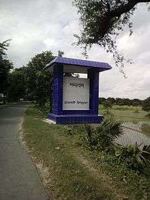
Bholahat Entrance
Weblinks
| Wikimedia Commons has media related to Bholahat Upazila. |
| Upazila/Thana: | ||
|---|---|---|
Headquarters: Rajshahi | ||
| Bogra District |  | |
| Joypurhat District | ||
| Naogaon District | ||
| Natore District | ||
| Nawabganj District | ||
| Pabna District | ||
| Rajshahi District | ||
| Sirajganj District | ||
This article is issued from Wikipedia - version of the 11/10/2016. The text is available under the Creative Commons Attribution/Share Alike but additional terms may apply for the media files.