Bhoom Tahsil
| Bhum Tahsil भूम तालुका Bhoom Tahsil | |
|---|---|
| tehsil | |
 Bhum Tahsil Location in Maharashtra, India | |
| Coordinates: 18°29′N 075°36′E / 18.483°N 75.600°ECoordinates: 18°29′N 075°36′E / 18.483°N 75.600°E | |
| Country |
|
| State | Maharashtra |
| District | Osmanabad |
| Population (2011) | |
| • Total | 137,217 |
| Languages | |
| • Official | Marathi |
| Time zone | IST (UTC+5:30) |
| PIN | 413504 |
| Vehicle registration | MH25 |
| Lok Sabha constituency | Osmanabad |
| Vidhan Sabha constituency | Paranda[1] |
Bhum Tahsil is a tahsil/taluka (subdistrict) in Osmanabad district, Maharashtra on the Deccan Plateau of India. The town of Bhum is the administrative headquarters of the tahsil. There are seventy-four panchayat villages in Bhum Tahsil. Bhoom was a under Nizam territory during the British raj in India. However it was independently ruled by the Thorat Royal family. Shrimant Raje Vijaysinh Amarsinh Thorat is the present Raja of Bhoom. He was the President of Bhoom Municipal Council from 1991 -2006.[2]
Demographics
In the 2001 Indian census, Bhum Tahsil had a population of 116,894, with 60,620 (51.9%) males and 56,274 (48.1%) females, for a gender ratio of 928 females per thousand males.[3]
In the 2011 census, Bhum Tahsil had 137,217 inhabitants[4] and a gender ratio of 905 females per thousand males.[5] The tahsil was 86.4% rural.[4] The literacy rate in 2011 was 73.08% overall in Bhum Tahsil, with a rate of 82.86% for males and 62.45% for females.[6] In 2011 in Bhum Tahsil, 11.5% of the population was 0 to 6 years of age.[4]
Economy
The primary occupation is farming, with the principle crops being millet, wheat, gram (chickpeas), sunflower seeds, and groundnuts (peanuts). Second, in terms of income, is government service.
Monuments and attractions
- In the village of Kunthalgiri, near to the town of Bhoom, there is an ancient Jain temple.[7] Kunthalgiri is also famous for "pedha", a sweet.
- In the Bhoom, there is an ancient temple called "Alam-prabhu". It is the Patron Deity of the Bhoom. "Alam-prabhu" as its name indicates is the symbol of unity between Hindu and Muslim. In the month of December there's a huge fair in the name of lord "Datta" is held, which lasts for 4–5 days.
- In the village of Jyotibachiwadi, there is temple of "Jotiba" there is come lot of people in Chaitra pornima.
Villages
Bhoom is the only town in Bhum Tahsil. Villages there include:
- Ulup ( Kanifnath Mandir Trust)
- Anjansonda
- Ambi
- Arsoli
- Bagalwadi
- Bhongiri
- Chumbli
- Mankeshwar
- Pakhrud
- songiri
- Rameshwar
- Sukta
- Padoli
- Jamb
- Patharud
- Bavi
- Matrewadi
- Golegoan
- walha
- walwad
- jyotibachiwadi
References
- ↑ "Assembly Constituencies-Post delimitation: Maharashtra: Osmanabad District" (PDF). National Informatics Centre, Government of India.
- ↑ "Reports of National Panchayat Directory: Village Panchayat Names of Bhoom, Osmanabad, Maharashtra". Ministry of Panchayati Raj, Government of India.
- ↑ "Census 2001 Population Finder: Maharashtra: Osmanabad: Bhum". Office of The Registrar General & Census Commissioner, Ministry of Home Affairs, Government of India.
- 1 2 3 "Population, Child Population in the age-group 0-6 and Literates by residence and sex, State, Districts, Tahsils 2011: Maharashtra" (PDF). Press Information Bureau, Mumbai. p. 40.
- ↑ "Sex ratio of Population and Child Population in the age-group 0-6, State, Districts, Tahsils 2011: Maharashtra" (PDF). Press Information Bureau, Mumbai. p. 8.
- ↑ "Literacy rates by residence and sex, State, Districts, Tahsils 2011: Maharashtra" (PDF). Press Information Bureau, Mumbai. p. 17.
- ↑ "Shri Digamber Jain Siddha Kshetra Kunthalgiri". Jain Teerth.
Osmanabad district topics | ||
|---|---|---|
| History | 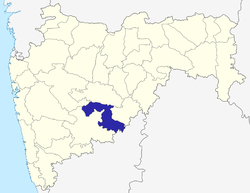 | |
| Cities and towns | ||
| Monuments | ||
| Lok Sabha constituencies | ||
| Vidhan Sabha constituencies | ||