Bin el Ouidane Dam
| Bin el Ouidane Dam | |
|---|---|
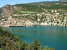 Upstream face and crest of the dam | |
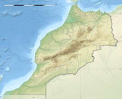 Location of Bin el Ouidane Dam in Morocco | |
| Official name | Barrage Bin el Ouidane |
| Country | Morocco |
| Location | Beni Mellal |
| Coordinates | 32°06′24″N 06°27′49″W / 32.10667°N 6.46361°WCoordinates: 32°06′24″N 06°27′49″W / 32.10667°N 6.46361°W |
| Status | Operational |
| Construction began | 1949 |
| Opening date | 1953 |
| Owner(s) | Office National de L'Electricite (ONE) |
| Dam and spillways | |
| Type of dam | Arch |
| Impounds | El Abid River |
| Height | 133 m (436 ft) |
| Length | 290 m (950 ft) |
| Dam volume | 365,000 m3 (12,900,000 cu ft) |
| Reservoir | |
| Total capacity | 1,500×106 m3 (1,200,000 acre·ft) |
| Catchment area | 6,400 km2 (2,500 sq mi) |
| Power station | |
| Commission date | 1953 |
| Turbines | 3 x 45 MW (60,000 hp) |
| Installed capacity | 135 MW (181,000 hp)[1] |
| Annual generation | 287 GWh (1,030 TJ) |
The Bin el Ouidane Dam is an arch dam located 28 kilometres (17 mi) south of Beni Mellal on the El Abid River in Azilal Province, Morocco. Designed by Coyne et Bellier and constructed between 1949 and 1953, the purpose of the dam is hydroelectric power production and irrigation. Its 135 MW (181,000 hp) power station produces an average of 287 gigawatt-hours (1,030 TJ) annually and water from the reservoir helps irrigate 69,500 hectares (172,000 acres) in the Beni Moussa and Tadla plains.[2]
See also
References
- ↑ "Bin El Ouidane Hyroelectric Power Plant Morocco". Global Energy Observatory. Retrieved 23 August 2011.
- ↑ "Bin el Ouidane" (in French). Secretariat D'etat Charge de L'eau et de L'environnement. Retrieved 23 August 2011.
External links
![]() Media related to Bin el Ouidane Dam at Wikimedia Commons
Media related to Bin el Ouidane Dam at Wikimedia Commons
This article is issued from Wikipedia - version of the 8/3/2016. The text is available under the Creative Commons Attribution/Share Alike but additional terms may apply for the media files.