Bistricë (river)
| Bistricë | |
|---|---|
_.jpg) View from the artificial lake on rivers' basin | |
| Country | Albania |
| Basin | |
| Main source | Syri i Kaltër, Vlorë County, Albania |
| River mouth |
Ionian Sea 39°50′38″N 20°1′52″E / 39.84389°N 20.03111°ECoordinates: 39°50′38″N 20°1′52″E / 39.84389°N 20.03111°E |
| Physical characteristics | |
| Length | 25 km (16 mi) |
| Discharge |
|
Bistricë (definite: Bistrica) is a river in southwestern Albania. It ends in the Ionian Sea.
Geography
Bistricë starts from Mali i Gjerë (also known as Sopot) in Finiq municipality directing initially versus south-west. The main source is near Krongj ("The Blue Eye" source), also gathering other sources from the nearby villages of Pecë, Kardhikaq, Velahovë, and other smaller brooks.[1] It passes through Mesopotam and Finiq municipalities, parallel with the Sarandë-Gjirokastër road.
Initially the river ended in Lake Butrint, which connects with the Ionian sea through the Vivar channel. In 1958, it was deviated to Çukë channel.
The river is 25 km long.
Economy and tourism
The river is not navigable. There is an artificial lake with the same name (Albanian: Liqeni i Bistricës) built on its basin, and three hydro-power stations built in the '60.[2] The river's waters are used to a certain extent as a supply for the nearby fields of Vurg area. All the stations passed through the privatization process from 2010 with plenty of controversies.[3][4]
A well known touristic place is the "Azure Eye", often referred as "Blue Eye" (Albanian: Syri i Kaltër), a spring tributary to Bistrica river near the village named Krongj, with a rich flora and fauna.
See also
Sources
- Sjöberg, Örjan. "A Contribution to the Geography of Hydro-Electric Power Generation in Albania", Osterreichische Osthefte [Vienna], 29, No. 1, 1987, 5-27. ISSN 0029-9375
- Mevlan Kabos; Eshref Pumo; Farudin Krutaj. "Gjeografia fizike e Shqipërisë : në dy vëllime", Qendra e Studimeve Gjeografike (Akademia e Shkencave e RPS të Shqipërisë), 1990–1991, 112. OCLC 38055712
References
- ↑ Vlore County - official page
- ↑ KESH - History of Energy in Albania (in Albanian) Archived January 12, 2014, at the Wayback Machine.
- ↑ Qeveria i shiti hidrocentralin e Bistricës një mashtruesi, arrestohet nga FBI në Qipro [The government sold the hydropower station to an impostor, arrested by FBI in Cyprus] (in Albanian), AMA News, 2010-08-08, retrieved 11 January 2014
- ↑ Privatizimi i HEC-ve Bistrica 1 dhe Bistrica 2, qeveria miraton ofertën e "Kurum" [Bistrica-1 and Bistrica-2 through privatization, the government accepts the offer from Kurum] (in Albanian), 9 January 2013, retrieved 12 January 2014
External links
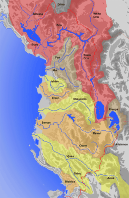
Albania's hydrographic network consists of 8 major rivers that form over 152 river streams and connecting waterways. | |