Black Lake (Sharbot Lake)
For other places with the same name, see Black Lake.
| Black Lake | |
|---|---|
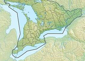 Black Lake Location in Southern Ontario | |
| Location | Frontenac County, Ontario |
| Coordinates | 44°46′35″N 76°43′14″W / 44.77639°N 76.72056°WCoordinates: 44°46′35″N 76°43′14″W / 44.77639°N 76.72056°W[1] |
| Part of | Saint Lawrence River drainage basin |
| Primary outflows | Unnamed creek |
| Basin countries | Canada |
| Max. length | 1,160 metres (3,810 ft) |
| Max. width | 600 metres (2,000 ft) |
| Surface elevation | 205 metres (673 ft)[2] |
Black Lake is a lake in the municipality of Central Frontenac, Frontenac County in Eastern Ontario, Canada.[1] It is part of the Saint Lawrence River drainage basin.
The primary outflow, at the west, is an unnamed creek that flows to Sharbot Lake, which in turn flows via the Fall River, the Mississippi River and the Ottawa River to the Saint Lawrence River.
Sharbot Lake Provincial Park envelops the northern, western and southern sides of the lake.[3] Ontario Highway 7 runs along the north side of the lake.
See also
References
- 1 2 "Black Lake". Geographical Names Data Base. Natural Resources Canada. Retrieved 2014-06-26.
- ↑ Taken from Google Earth at geographic coordinates, accessed 2014-06-26.
- ↑ Park Map (PDF) (Map). Ontario Parks. 2010. Retrieved 2014-06-26.
Other map sources:
- Map 6 (PDF) (Map). 1 : 700,000. Official road map of Ontario. Ministry of Transportation of Ontario. 2014. Retrieved 2014-06-26.
- Restructured municipalities - Ontario map #5 (Map). Restructuring Maps of Ontario. Ontario Ministry of Municipal Affairs and Housing. 2006. Retrieved 2014-06-26.
This article is issued from Wikipedia - version of the 5/20/2016. The text is available under the Creative Commons Attribution/Share Alike but additional terms may apply for the media files.